Şagu elevation
Şagu (Arad, Comuna Şagu), Romania elevation is 136 meters and Şagu elevation in feet is 446 ft above sea level [src 1]. Şagu is a seat of a second-order administrative division (feature code) with elevation that is 116 meters (381 ft) smaller than average city elevation in Romania.
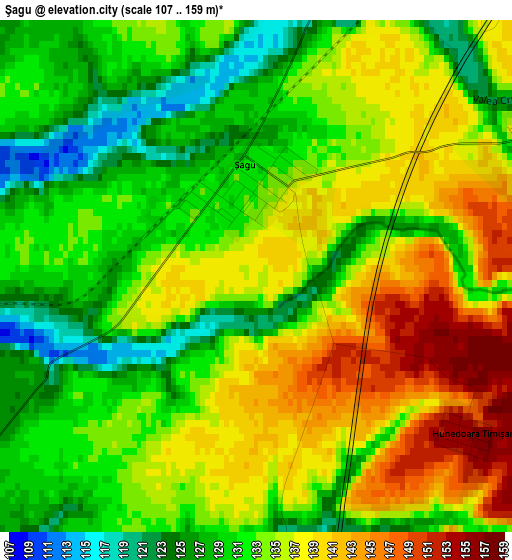
Below is the Elevation map of Şagu, which displays elevation range with different colors. Scale of the first map is from 107 to 159 m (351 to 522 ft) with average elevation of 133.7 meters (=439 ft) [note 1]
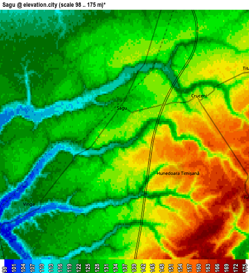
These maps also provides idea of topography and contour of this city, they are displayed at different zoom levels. More info about maps, scale and edge coordinates you can find below images.
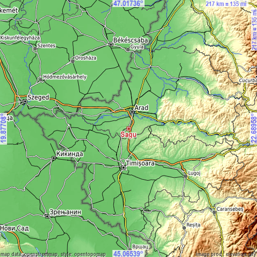
| \ | Map #1 | Map #2 | Topo.Map |
| Scale [m] | 107..159 m | 98..175 m | × |
| Scale [ft] | 351..522 ft | 322..574 ft | × |
| Average | 133.7 m = 439 ft | 134.2 m = 440 ft | × |
| Width | 6.78 km = 4.2 mi | 13.56 km = 8.4 mi | 217 km = 134.8 mi |
| Height | 6.78 km = 4.2 mi | 13.56 km = 8.4 mi | 217 km = 134.8 mi |
| ↑Max Latitude | 46.080491° | 46.110965° | 47.01736° |
| Latitude at center | 46.05° | 46.05° | 46.05° |
| ↓Min Latitude | 46.019492° | 45.988968° | 45.06539° |
| ← Min Longitude | 21.239385° | 21.195439° | 19.87708° |
| Longitude center | 21.28333° | 21.28333° | 21.28333° |
| →Max Longitude | 21.327275° | 21.371221° | 22.68958° |
Nearby cities:
Cities around Şagu sort by population:
• Arad elevation 109 m
15 km,  9°
9°
• Vladimirescu 109 m
15.8 km,  35°
35°
• Vinga 102 m
7.4 km,  240°
240°
• Fântânele 125 m
11.3 km, 43°
• Felnac 113 m
12.7 km,  305°
305°
• Orţişoara 123 m
11.6 km,  214°
214°
• Maşloc 175 m
14.1 km,  114°
114°
• Zădăreni 110 m
10.5 km,  331°
331°
• Fibiș 156 m
13.8 km,  128°
128°
• Frumușeni 140 m
14.9 km,  66°
66°
• Mănăștur 101 m
12.4 km,  248°
248°
• Mailat 118 m
13.6 km,  266°
266°
Multilingual:
 En español:
Şagu elevación 136 m.
 En France:
Şagu élévation 136 m.


Sources and notes:
- [note 1] Map square and city borders are not equal. Map elevation data is calculated only from area inside that square.
- [src 1] Elevation data from geonames database provided with same terms of usage.
- [src 2] The elevation map of Şagu is generated using elevation data from NASA's 3 arcsec (90m) resolution SRTM data.
- [src 3] Base (background) map © OpenStreetMap contributors tiles are generated by Geofabrik and OpenTopoMap.
Copyright & License:
This Şagu Elevation Map is licensed under CC BY-SA. You may reuse any part from this page, if you give a proper credit by linking to this URL:
 More info on terms of use page.