Orţişoara elevation
Orţişoara (Timiş, Comuna Orţişoara), Romania elevation is 123 meters and Orţişoara elevation in feet is 404 ft above sea level [src 1]. Orţişoara is a seat of a second-order administrative division (feature code) with elevation that is 129 meters (423 ft) smaller than average city elevation in Romania.
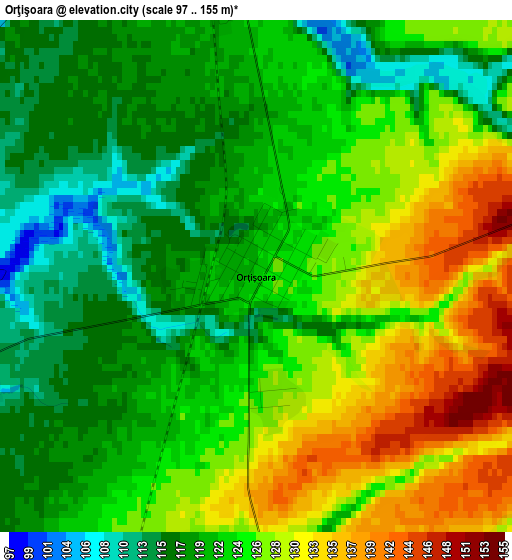
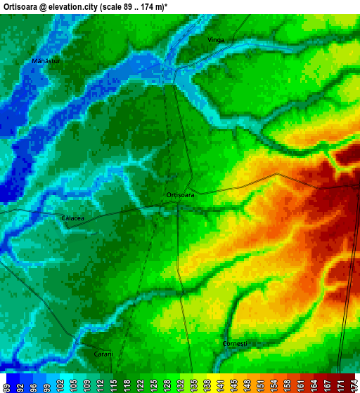
Below is the Elevation map of Orţişoara, which displays elevation range with different colors. Scale of the first map is from 97 to 155 m (318 to 509 ft) with average elevation of 123.7 meters (=406 ft) [note 1]
These maps also provides idea of topography and contour of this city, they are displayed at different zoom levels. More info about maps, scale and edge coordinates you can find below images.
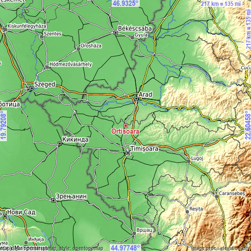
| \ | Map #1 | Map #2 | Topo.Map |
| Scale [m] | 97..155 m | 89..174 m | × |
| Scale [ft] | 318..509 ft | 292..571 ft | × |
| Average | 123.7 m = 406 ft | 123.2 m = 404 ft | × |
| Width | 6.79 km = 4.2 mi | 13.59 km = 8.4 mi | 217.4 km = 135.1 mi |
| Height | 6.79 km = 4.2 mi | 13.59 km = 8.4 mi | 217.4 km = 135.1 mi |
| ↑Max Latitude | 45.994149° | 46.02467° | 46.9325° |
| Latitude at center | 45.96361° | 45.96361° | 45.96361° |
| ↓Min Latitude | 45.933055° | 45.902482° | 44.97748° |
| ← Min Longitude | 21.154385° | 21.110439° | 19.79208° |
| Longitude center | 21.19833° | 21.19833° | 21.19833° |
| →Max Longitude | 21.242275° | 21.286221° | 22.60458° |
Nearby cities:
Cities around Orţişoara sort by population:
• Vinga elevation 102 m
5.9 km,  1°
1°
• Giarmata 110 m
16.4 km,  147°
147°
• Sânandrei 90 m
12.5 km,  190°
190°
• Satchinez 93 m
12.5 km,  256°
256°
• Şagu 136 m
11.6 km,  34°
34°
• Pişchia 107 m
12.7 km,  122°
122°
• Dudeștii Noi 88 m
15.6 km,  208°
208°
• Carani 118 m
6.7 km, 208°
• Gelu 98 m
11.7 km,  293°
293°
• Mănăștur 101 m
7.1 km,  315°
315°
• Mailat 118 m
11.2 km, 320°
• Hodoni 103 m
10.6 km,  233°
233°
Multilingual:
 En español:
Orţişoara elevación 123 m.
 En France:
Orţişoara élévation 123 m.
 Auf Deutsch:
Orţişoara höhe über dem Meeresspiegel ist 123 m.

Sources and notes:
- [note 1] Map square and city borders are not equal. Map elevation data is calculated only from area inside that square.
- [src 1] Elevation data from geonames database provided with same terms of usage.
- [src 2] The elevation map of Orţişoara is generated using elevation data from NASA's 3 arcsec (90m) resolution SRTM data.
- [src 3] Base (background) map © OpenStreetMap contributors tiles are generated by Geofabrik and OpenTopoMap.
Copyright & License:
This Orţişoara Elevation Map is licensed under CC BY-SA. You may reuse any part from this page, if you give a proper credit by linking to this URL:
 More info on terms of use page.