Fântânele elevation
Fântânele (Arad, Comuna Fântânele), Romania elevation is 125 meters and Fântânele elevation in feet is 410 ft above sea level [src 1]. Fântânele is a seat of a second-order administrative division (feature code) with elevation that is 127 meters (417 ft) smaller than average city elevation in Romania.
Below is the Elevation map of Fântânele, which displays elevation range with different colors. Scale of the first map is from 99 to 144 m (325 to 472 ft) with average elevation of 121.3 meters (=398 ft) [note 1]
These maps also provides idea of topography and contour of this city, they are displayed at different zoom levels. More info about maps, scale and edge coordinates you can find below images.
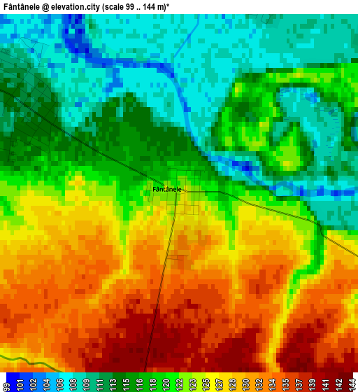
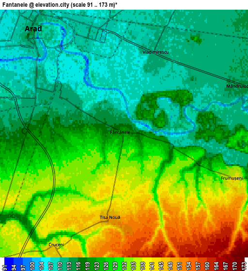
| \ | Map #1 | Map #2 | Topo.Map |
| Scale [m] | 99..144 m | 91..173 m | × |
| Scale [ft] | 325..472 ft | 299..568 ft | × |
| Average | 121.3 m = 398 ft | 123.8 m = 406 ft | × |
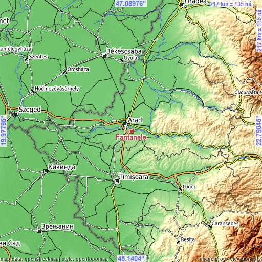
| Width | 6.77 km = 4.2 mi | 13.55 km = 8.4 mi | 216.7 km = 134.7 mi |
| Height | 6.77 km = 4.2 mi | 13.55 km = 8.4 mi | 216.7 km = 134.7 mi |
| ↑Max Latitude | 46.15415° | 46.184584° | 47.08976° |
| Latitude at center | 46.1237° | 46.1237° | 46.1237° |
| ↓Min Latitude | 46.093233° | 46.062749° | 45.1404° |
| ← Min Longitude | 21.340255° | 21.296309° | 19.97795° |
| Longitude center | 21.3842° | 21.3842° | 21.3842° |
| →Max Longitude | 21.428145° | 21.472091° | 22.79045° |
Nearby cities:
Cities around Fântânele sort by population:
• Arad elevation 109 m
8.4 km,  321°
321°
• Vladimirescu 109 m
4.9 km,  15°
15°
• Zăbrani 157 m
14.3 km,  116°
116°
• Păuliş 118 m
15.4 km,  92°
92°
• Maşloc 175 m
14.9 km,  160°
160°
• Şagu 136 m
11.3 km,  223°
223°
• Livada 111 m
11 km,  359°
359°
• Horia 115 m
11.2 km,  32°
32°
• Zădăreni 110 m
12.8 km,  274°
274°
• Sâmbăteni 118 m
11.2 km,  80°
80°
• Frumușeni 140 m
6.4 km,  111°
111°
• Mândruloc 115 m
6.9 km,  66°
66°
Multilingual:
 En español:
Fântânele elevación 125 m.
 En France:
Fântânele élévation 125 m.
 Auf Deutsch:
Fântânele höhe über dem Meeresspiegel ist 125 m.

Sources and notes:
- [note 1] Map square and city borders are not equal. Map elevation data is calculated only from area inside that square.
- [src 1] Elevation data from geonames database provided with same terms of usage.
- [src 2] The elevation map of Fântânele is generated using elevation data from NASA's 3 arcsec (90m) resolution SRTM data.
- [src 3] Base (background) map © OpenStreetMap contributors tiles are generated by Geofabrik and OpenTopoMap.
Copyright & License:
This Fântânele Elevation Map is licensed under CC BY-SA. You may reuse any part from this page, if you give a proper credit by linking to this URL:
 More info on terms of use page.