Sebeş elevation
Sebeş (Alba, Municipiul Sebeş), Romania elevation is 254 meters and Sebeş elevation in feet is 833 ft above sea level [src 1]. Sebeş is a seat of a second-order administrative division (feature code) with elevation that is 2 meters (7 ft) bigger than average city elevation in Romania.
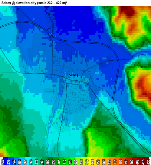
Below is the Elevation map of Sebeş, which displays elevation range with different colors. Scale of the first map is from 232 to 422 m (761 to 1385 ft) with average elevation of 271.9 meters (=892 ft) [note 1]
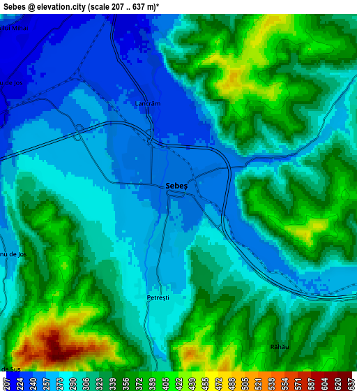
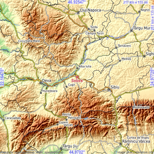
These maps also provides idea of topography and contour of this city, they are displayed at different zoom levels. More info about maps, scale and edge coordinates you can find below images.
| \ | Map #1 | Map #2 | Topo.Map |
| Scale [m] | 232..422 m | 207..637 m | × |
| Scale [ft] | 761..1385 ft | 679..2090 ft | × |
| Average | 271.9 m = 892 ft | 314.6 m = 1032 ft | × |
| Width | 6.79 km = 4.2 mi | 13.59 km = 8.4 mi | 217.4 km = 135.1 mi |
| Height | 6.79 km = 4.2 mi | 13.59 km = 8.4 mi | 217.4 km = 135.1 mi |
| ↑Max Latitude | 45.987003° | 46.017528° | 46.92547° |
| Latitude at center | 45.95646° | 45.95646° | 45.95646° |
| ↓Min Latitude | 45.925901° | 45.895324° | 44.9702° |
| ← Min Longitude | 23.527055° | 23.483109° | 22.16475° |
| Longitude center | 23.571° | 23.571° | 23.571° |
| →Max Longitude | 23.614945° | 23.658891° | 24.97725° |
Nearby cities:
Cities around Sebeş sort by population:
• Săsciori elevation 460 m
10 km,  174°
174°
• Vurpăr 218 m
9.4 km,  300°
300°
• Petrești 275 m
4 km,  191°
191°
• Pianu de Sus 309 m
9.2 km,  227°
227°
• Vințu de Jos 215 m
7.8 km, 302°
• Daia Română 305 m
10 km,  47°
47°
• Ciugud 219 m
11 km,  18°
18°
• Oarda 219 m
8.6 km,  357°
357°
• Lancrăm 238 m
3.6 km,  341°
341°
• Cut 290 m
7.7 km,  104°
104°
• Pianu de Jos 267 m
6.8 km,  249°
249°
• Sebeșel 304 m
7.7 km,  182°
182°
Multilingual:
 En español:
Sebeş elevación 254 m.
 En France:
Sebeş élévation 254 m.
 Auf Deutsch:
Mühlbach höhe über dem Meeresspiegel ist 254 m.

Sources and notes:
- [note 1] Map square and city borders are not equal. Map elevation data is calculated only from area inside that square.
- [src 1] Elevation data from geonames database provided with same terms of usage.
- [src 2] The elevation map of Sebeş is generated using elevation data from NASA's 3 arcsec (90m) resolution SRTM data.
- [src 3] Base (background) map © OpenStreetMap contributors tiles are generated by Geofabrik and OpenTopoMap.
Copyright & License:
This Sebeş Elevation Map is licensed under CC BY-SA. You may reuse any part from this page, if you give a proper credit by linking to this URL:
 More info on terms of use page.