Slobozia elevation
Slobozia (Arges, Comuna Slobozia), Romania elevation is 158 meters and Slobozia elevation in feet is 518 ft above sea level [src 1]. Slobozia is a seat of a second-order administrative division (feature code) with elevation that is 94 meters (308 ft) smaller than average city elevation in Romania.
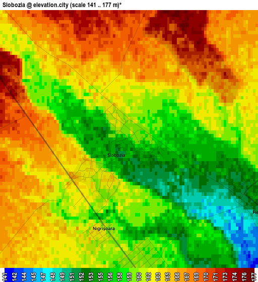
Below is the Elevation map of Slobozia, which displays elevation range with different colors. Scale of the first map is from 141 to 177 m (463 to 581 ft) with average elevation of 161.7 meters (=531 ft) [note 1]
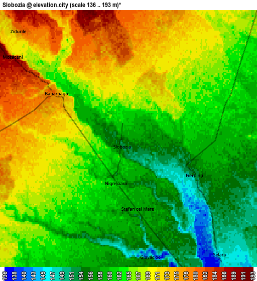
These maps also provides idea of topography and contour of this city, they are displayed at different zoom levels. More info about maps, scale and edge coordinates you can find below images.
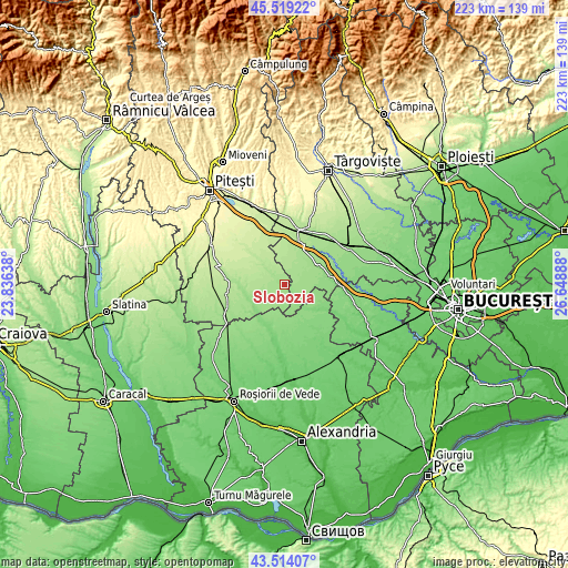
| \ | Map #1 | Map #2 | Topo.Map |
| Scale [m] | 141..177 m | 136..193 m | × |
| Scale [ft] | 463..581 ft | 446..633 ft | × |
| Average | 161.7 m = 531 ft | 164.5 m = 540 ft | × |
| Width | 6.97 km = 4.3 mi | 13.93 km = 8.7 mi | 223 km = 138.6 mi |
| Height | 6.97 km = 4.3 mi | 13.93 km = 8.7 mi | 222.9 km = 138.5 mi |
| ↑Max Latitude | 44.556592° | 44.587897° | 45.51922° |
| Latitude at center | 44.52527° | 44.52527° | 44.52527° |
| ↓Min Latitude | 44.493931° | 44.462575° | 43.51407° |
| ← Min Longitude | 25.198685° | 25.154739° | 23.83638° |
| Longitude center | 25.24263° | 25.24263° | 25.24263° |
| →Max Longitude | 25.286575° | 25.330521° | 26.64888° |
Nearby cities:
Cities around Slobozia sort by population:
• Vişina elevation 165 m
9.7 km,  48°
48°
• Ulieşti 142 m
15.2 km,  64°
64°
• Şelaru 147 m
7.1 km,  139°
139°
• Izvoru 169 m
14.5 km,  256°
256°
• Negraşi 201 m
13 km,  309°
309°
• Mozăceni 169 m
7.6 km, 307°
• Ştefan cel Mare 159 m
3.6 km,  178°
178°
• Răscăeți 177 m
7.8 km,  16°
16°
• Fierbinți 153 m
4.1 km,  119°
119°
• Sârbeni 142 m
12.9 km, 120°
• Croitori 157 m
14.6 km,  67°
67°
• Popeşti 134 m
14.6 km,  230°
230°
Multilingual:
 En español:
Slobozia elevación 158 m.
 En France:
Slobozia élévation 158 m.
 Auf Deutsch:
Slobozia höhe über dem Meeresspiegel ist 158 m.

Sources and notes:
- [note 1] Map square and city borders are not equal. Map elevation data is calculated only from area inside that square.
- [src 1] Elevation data from geonames database provided with same terms of usage.
- [src 2] The elevation map of Slobozia is generated using elevation data from NASA's 3 arcsec (90m) resolution SRTM data.
- [src 3] Base (background) map © OpenStreetMap contributors tiles are generated by Geofabrik and OpenTopoMap.
Copyright & License:
This Slobozia Elevation Map is licensed under CC BY-SA. You may reuse any part from this page, if you give a proper credit by linking to this URL:
 More info on terms of use page.