Stolniceni-Prăjescu elevation
Stolniceni-Prăjescu (Iaşi, Comuna Stolniceni-Prăjescu), Romania elevation is 239 meters and Stolniceni-Prăjescu elevation in feet is 784 ft above sea level [src 1]. Stolniceni-Prăjescu is a seat of a second-order administrative division (feature code) with elevation that is 13 meters (43 ft) smaller than average city elevation in Romania.
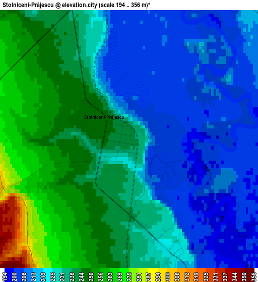
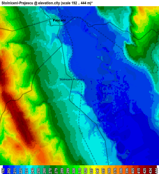
Below is the Elevation map of Stolniceni-Prăjescu, which displays elevation range with different colors. Scale of the first map is from 194 to 356 m (636 to 1168 ft) with average elevation of 230.1 meters (=755 ft) [note 1]
These maps also provides idea of topography and contour of this city, they are displayed at different zoom levels. More info about maps, scale and edge coordinates you can find below images.
| \ | Map #1 | Map #2 | Topo.Map |
| Scale [m] | 194..356 m | 192..444 m | × |
| Scale [ft] | 636..1168 ft | 630..1457 ft | × |
| Average | 230.1 m = 755 ft | 261.3 m = 857 ft | × |
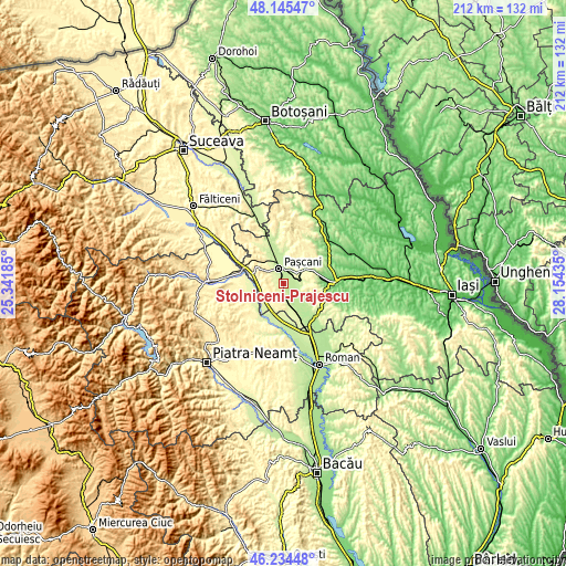
| Width | 6.64 km = 4.1 mi | 13.28 km = 8.3 mi | 212.5 km = 132 mi |
| Height | 6.64 km = 4.1 mi | 13.28 km = 8.3 mi | 212.5 km = 132 mi |
| ↑Max Latitude | 47.228431° | 47.258265° | 48.14547° |
| Latitude at center | 47.19858° | 47.19858° | 47.19858° |
| ↓Min Latitude | 47.168713° | 47.138828° | 46.23448° |
| ← Min Longitude | 26.704155° | 26.660209° | 25.34185° |
| Longitude center | 26.7481° | 26.7481° | 26.7481° |
| →Max Longitude | 26.792045° | 26.835991° | 28.15435° |
Nearby cities:
Cities around Stolniceni-Prăjescu sort by population:
• Paşcani elevation 242 m
5.7 km,  340°
340°
• Mogoşeşti-Siret 231 m
7.7 km,  159°
159°
• Hărmăneasa 275 m
9 km,  88°
88°
• Lunca 212 m
9.3 km,  354°
354°
• Dumbrăvița 306 m
9.4 km,  48°
48°
• Muncelu de Sus 345 m
8.4 km,  186°
186°
• Miroslovești 274 m
9.2 km,  233°
233°
• Ciohorăni 309 m
8.3 km,  212°
212°
• Brătești 341 m
4.8 km,  260°
260°
• Soci 296 m
8 km, 259°
• Boureni 285 m
9 km,  280°
280°
• Sodomeni 300 m
5.2 km,  300°
300°
Multilingual:
 En español:
Stolniceni-Prăjescu elevación 239 m.
 En France:
Stolniceni-Prăjescu élévation 239 m.
 Auf Deutsch:
Stolniceni-Prăjescu höhe über dem Meeresspiegel ist 239 m.
 На русском:
Stolniceni-Prăjescu высота над уровнем моря 239 м
Sources and notes:
- [note 1] Map square and city borders are not equal. Map elevation data is calculated only from area inside that square.
- [src 1] Elevation data from geonames database provided with same terms of usage.
- [src 2] The elevation map of Stolniceni-Prăjescu is generated using elevation data from NASA's 3 arcsec (90m) resolution SRTM data.
- [src 3] Base (background) map © OpenStreetMap contributors tiles are generated by Geofabrik and OpenTopoMap.
Copyright & License:
This Stolniceni-Prăjescu Elevation Map is licensed under CC BY-SA. You may reuse any part from this page, if you give a proper credit by linking to this URL:
 More info on terms of use page.