Surani elevation
Surani (Prahova, Comuna Surani), Romania elevation is 362 meters and Surani elevation in feet is 1188 ft above sea level [src 1]. Surani is a seat of a second-order administrative division (feature code) with elevation that is 110 meters (361 ft) bigger than average city elevation in Romania.
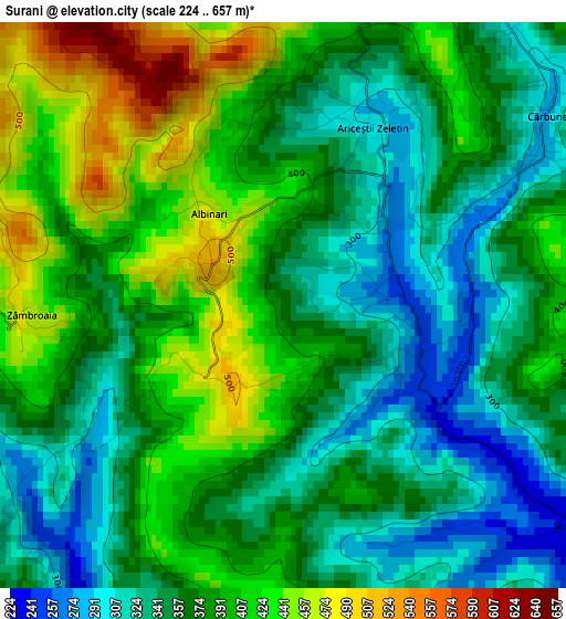
Below is the Elevation map of Surani, which displays elevation range with different colors. Scale of the first map is from 224 to 657 m (735 to 2156 ft) with average elevation of 374.9 meters (=1230 ft) [note 1]
These maps also provides idea of topography and contour of this city, they are displayed at different zoom levels. More info about maps, scale and edge coordinates you can find below images.
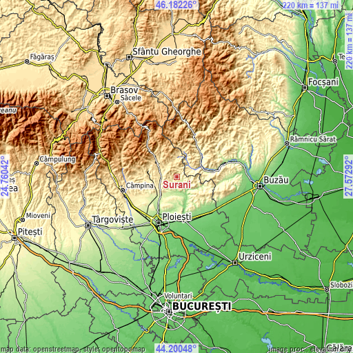
| \ | Map #1 | Topo.Map |
| Scale [m] | 224..657 m | × |
| Scale [ft] | 735..2156 ft | × |
| Average | 374.9 m = 1230 ft | × |
| Width | 6.89 km = 4.3 mi | 220.4 km = 136.9 mi |
| Height | 6.89 km = 4.3 mi | 220.3 km = 136.9 mi |
| ↑Max Latitude | 45.230957° | 46.18226° |
| Latitude at center | 45.2° | 45.2° |
| ↓Min Latitude | 45.169026° | 44.20048° |
| ← Min Longitude | 26.122725° | 24.76042° |
| Longitude center | 26.16667° | 26.16667° |
| →Max Longitude | 26.210615° | 27.57292° |
Nearby cities:
Cities around Surani sort by population:
• Drajna de Jos elevation 381 m
9.3 km,  281°
281°
• Podenii Noi 206 m
9.3 km,  180°
180°
• Şoimari 234 m
3.2 km,  125°
125°
• Păcureţi 291 m
6.1 km,  205°
205°
• Cărbuneşti 337 m
4.5 km,  35°
35°
• Chiojdeanca 359 m
8.7 km,  115°
115°
• Drajna de Sus 461 m
9.6 km,  311°
311°
• Valea Dulce 178 m
10.1 km,  161°
161°
• Poiana Copăceni 337 m
8.6 km,  242°
242°
• Ogretin 450 m
9.3 km,  320°
320°
• Ariceștii Zeletin 294 m
2.7 km,  22°
22°
• Poseștii-Pământeni 470 m
7.5 km,  350°
350°
Multilingual:
 En español:
Surani elevación 362 m.
 En France:
Surani élévation 362 m.


Sources and notes:
- [note 1] Map square and city borders are not equal. Map elevation data is calculated only from area inside that square.
- [src 1] Elevation data from geonames database provided with same terms of usage.
- [src 2] The elevation map of Surani is generated using elevation data from NASA's 3 arcsec (90m) resolution SRTM data.
- [src 3] Base (background) map © OpenStreetMap contributors tiles are generated by Geofabrik and OpenTopoMap.
Copyright & License:
This Surani Elevation Map is licensed under CC BY-SA. You may reuse any part from this page, if you give a proper credit by linking to this URL:
 More info on terms of use page.