Urziceni elevation
Urziceni (Ialomiţa, Municipiul Urziceni), Romania elevation is 52 meters and Urziceni elevation in feet is 171 ft above sea level [src 1]. Urziceni is a seat of a second-order administrative division (feature code) with elevation that is 200 meters (656 ft) smaller than average city elevation in Romania.
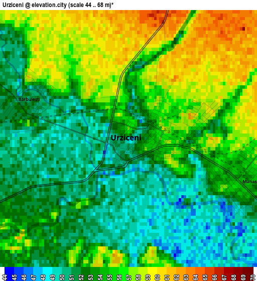
Below is the Elevation map of Urziceni, which displays elevation range with different colors. Scale of the first map is from 44 to 68 m (144 to 223 ft) with average elevation of 53.9 meters (=177 ft) [note 1]
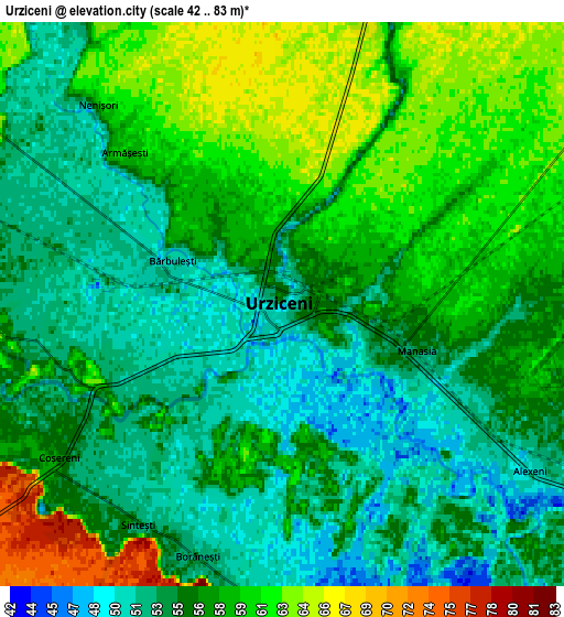
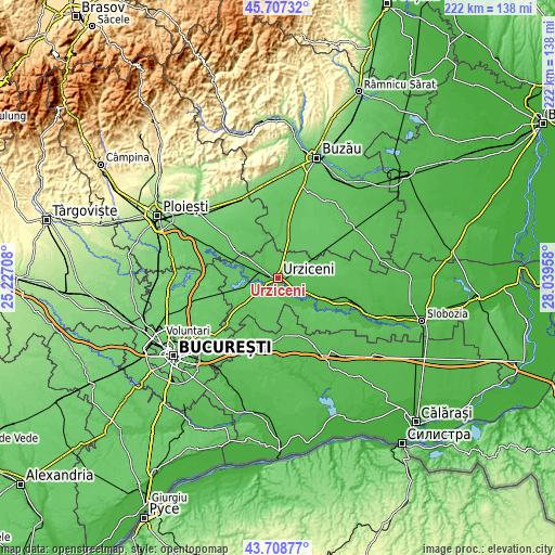
These maps also provides idea of topography and contour of this city, they are displayed at different zoom levels. More info about maps, scale and edge coordinates you can find below images.
| \ | Map #1 | Map #2 | Topo.Map |
| Scale [m] | 44..68 m | 42..83 m | × |
| Scale [ft] | 144..223 ft | 138..272 ft | × |
| Average | 53.9 m = 177 ft | 56.5 m = 185 ft | × |
| Width | 6.94 km = 4.3 mi | 13.89 km = 8.6 mi | 222.2 km = 138.1 mi |
| Height | 6.94 km = 4.3 mi | 13.89 km = 8.6 mi | 222.2 km = 138.1 mi |
| ↑Max Latitude | 44.747889° | 44.779091° | 45.70732° |
| Latitude at center | 44.71667° | 44.71667° | 44.71667° |
| ↓Min Latitude | 44.685434° | 44.654182° | 43.70877° |
| ← Min Longitude | 26.589385° | 26.545439° | 25.22708° |
| Longitude center | 26.63333° | 26.63333° | 26.63333° |
| →Max Longitude | 26.677275° | 26.721221° | 28.03958° |
Nearby cities:
Cities around Urziceni sort by population:
• Armăşeşti elevation 60 m
5.4 km,  313°
313°
• Coşereni 55 m
6.4 km,  234°
234°
• Manasia 51 m
3.2 km,  125°
125°
• Bărcăneşti 78 m
9.4 km,  171°
171°
• Bărbulești 51 m
2.9 km,  291°
291°
• Jilavele 59 m
9.7 km, 305°
• Alexeni 50 m
6.4 km, 125°
• Borănești 53 m
6.6 km,  199°
199°
• Malu Roșu 63 m
8.3 km,  329°
329°
• Moldoveni 56 m
9.1 km,  268°
268°
• Broșteni 51 m
10.3 km,  118°
118°
• Ciocârlia 65 m
9.6 km,  15°
15°
Multilingual:
 En español:
Urziceni elevación 52 m.
 En France:
Urziceni élévation 52 m.


Sources and notes:
- [note 1] Map square and city borders are not equal. Map elevation data is calculated only from area inside that square.
- [src 1] Elevation data from geonames database provided with same terms of usage.
- [src 2] The elevation map of Urziceni is generated using elevation data from NASA's 3 arcsec (90m) resolution SRTM data.
- [src 3] Base (background) map © OpenStreetMap contributors tiles are generated by Geofabrik and OpenTopoMap.
Copyright & License:
This Urziceni Elevation Map is licensed under CC BY-SA. You may reuse any part from this page, if you give a proper credit by linking to this URL:
 More info on terms of use page.