Coşereni elevation
Coşereni (Ialomiţa, Comuna Coşereni), Romania elevation is 55 meters and Coşereni elevation in feet is 180 ft above sea level [src 1]. Coşereni is a seat of a second-order administrative division (feature code) with elevation that is 197 meters (646 ft) smaller than average city elevation in Romania.
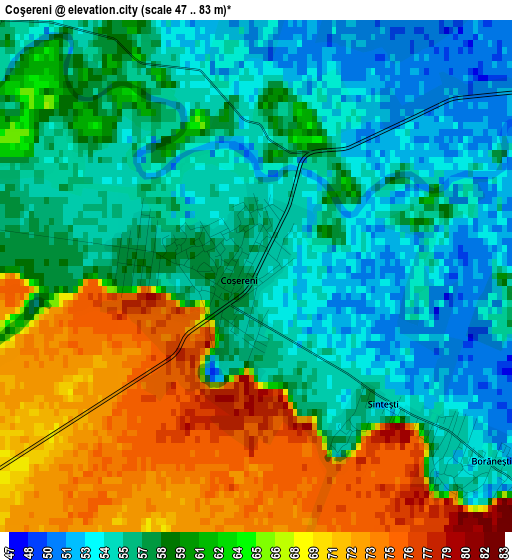
Below is the Elevation map of Coşereni, which displays elevation range with different colors. Scale of the first map is from 47 to 83 m (154 to 272 ft) with average elevation of 60.3 meters (=198 ft) [note 1]
These maps also provides idea of topography and contour of this city, they are displayed at different zoom levels. More info about maps, scale and edge coordinates you can find below images.
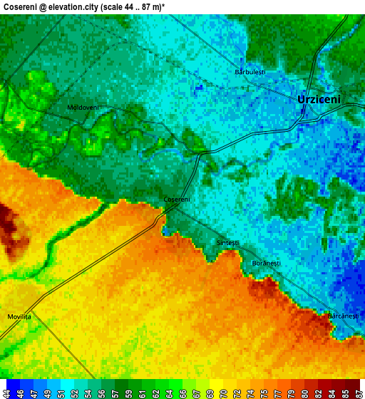
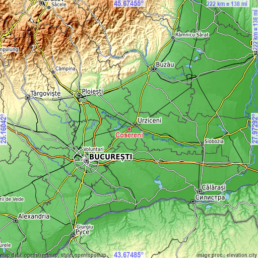
| \ | Map #1 | Map #2 | Topo.Map |
| Scale [m] | 47..83 m | 44..87 m | × |
| Scale [ft] | 154..272 ft | 144..285 ft | × |
| Average | 60.3 m = 198 ft | 61 m = 200 ft | × |
| Width | 6.95 km = 4.3 mi | 13.9 km = 8.6 mi | 222.3 km = 138.1 mi |
| Height | 6.95 km = 4.3 mi | 13.9 km = 8.6 mi | 222.3 km = 138.1 mi |
| ↑Max Latitude | 44.714567° | 44.745787° | 45.67455° |
| Latitude at center | 44.68333° | 44.68333° | 44.68333° |
| ↓Min Latitude | 44.652076° | 44.620806° | 43.67485° |
| ← Min Longitude | 26.522725° | 26.478779° | 25.16042° |
| Longitude center | 26.56667° | 26.56667° | 26.56667° |
| →Max Longitude | 26.610615° | 26.654561° | 27.97292° |
Nearby cities:
Cities around Coşereni sort by population:
• Urziceni elevation 52 m
6.4 km,  54°
54°
• Armăşeşti 60 m
7.5 km,  10°
10°
• Dridu 70 m
9.4 km,  281°
281°
• Moviliţa 71 m
7.6 km,  240°
240°
• Manasia 51 m
8.1 km,  76°
76°
• Bărcăneşti 78 m
8.6 km,  130°
130°
• Bărbulești 51 m
5.4 km,  28°
28°
• Jilavele 59 m
9.6 km,  344°
344°
• Roșiori 67 m
8.2 km,  197°
197°
• Borănești 53 m
3.9 km, 129°
• Moldoveni 56 m
5.1 km,  312°
312°
• Patru Frați 59 m
9.6 km, 308°
Multilingual:
 En español:
Coşereni elevación 55 m.
 En France:
Coşereni élévation 55 m.


Sources and notes:
- [note 1] Map square and city borders are not equal. Map elevation data is calculated only from area inside that square.
- [src 1] Elevation data from geonames database provided with same terms of usage.
- [src 2] The elevation map of Coşereni is generated using elevation data from NASA's 3 arcsec (90m) resolution SRTM data.
- [src 3] Base (background) map © OpenStreetMap contributors tiles are generated by Geofabrik and OpenTopoMap.
Copyright & License:
This Coşereni Elevation Map is licensed under CC BY-SA. You may reuse any part from this page, if you give a proper credit by linking to this URL:
 More info on terms of use page.