Vânători elevation
Vânători (Iaşi, Comuna Popricani), Romania elevation is 69 meters and Vânători elevation in feet is 226 ft above sea level [src 1]. Vânători is a populated place (feature code) with elevation that is 183 meters (600 ft) smaller than average city elevation in Romania.
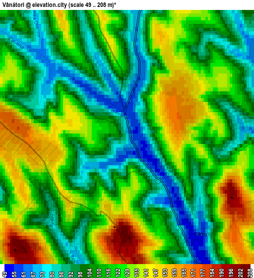
Below is the Elevation map of Vânători, which displays elevation range with different colors. Scale of the first map is from 49 to 208 m (161 to 682 ft) with average elevation of 115.2 meters (=378 ft) [note 1]
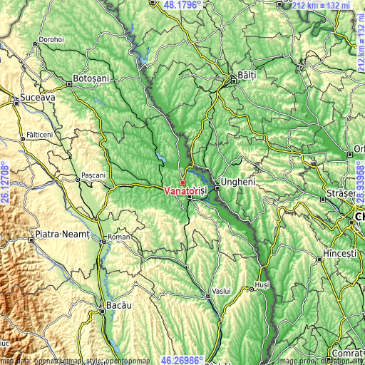
These maps also provides idea of topography and contour of this city, they are displayed at different zoom levels. More info about maps, scale and edge coordinates you can find below images.
| \ | Map #1 | Topo.Map |
| Scale [m] | 49..208 m | × |
| Scale [ft] | 161..682 ft | × |
| Average | 115.2 m = 378 ft | × |
| Width | 6.64 km = 4.1 mi | 212.3 km = 131.9 mi |
| Height | 6.64 km = 4.1 mi | 212.3 km = 131.9 mi |
| ↑Max Latitude | 47.263161° | 48.1796° |
| Latitude at center | 47.23333° | 47.23333° |
| ↓Min Latitude | 47.203482° | 46.26986° |
| ← Min Longitude | 27.489385° | 26.12708° |
| Longitude center | 27.53333° | 27.53333° |
| →Max Longitude | 27.577275° | 28.93958° |
Nearby cities:
Cities around Vânători sort by population:
• Iaşi elevation 66 m
9 km,  145°
145°
• Miroslava 128 m
9.4 km,  187°
187°
• Popricani 143 m
7.5 km,  350°
350°
• Leţcani 46 m
10.4 km,  237°
237°
• Rediu 142 m
3.1 km,  233°
233°
• Victoria 103 m
6.7 km,  34°
34°
• Ţigănaşi 74 m
12.2 km,  335°
335°
• Aroneanu 115 m
6.3 km,  126°
126°
• Valea Lupului 91 m
6.5 km,  202°
202°
• Golăiești 36 m
12.6 km,  90°
90°
• Cârniceni 64 m
12 km, 349°
• Breazu 90 m
2.5 km,  207°
207°
Multilingual:
 En español:
Vânători elevación 69 m.
 En France:
Vânători élévation 69 m.


Sources and notes:
- [note 1] Map square and city borders are not equal. Map elevation data is calculated only from area inside that square.
- [src 1] Elevation data from geonames database provided with same terms of usage.
- [src 2] The elevation map of Vânători is generated using elevation data from NASA's 3 arcsec (90m) resolution SRTM data.
- [src 3] Base (background) map © OpenStreetMap contributors tiles are generated by Geofabrik and OpenTopoMap.
Copyright & License:
This Vânători Elevation Map is licensed under CC BY-SA. You may reuse any part from this page, if you give a proper credit by linking to this URL:
 More info on terms of use page.