Ghioca elevation
Ghioca (Olt, Comuna Crâmpoia), Romania elevation is 131 meters and Ghioca elevation in feet is 430 ft above sea level [src 1]. Ghioca is a populated place (feature code) with elevation that is 121 meters (397 ft) smaller than average city elevation in Romania.
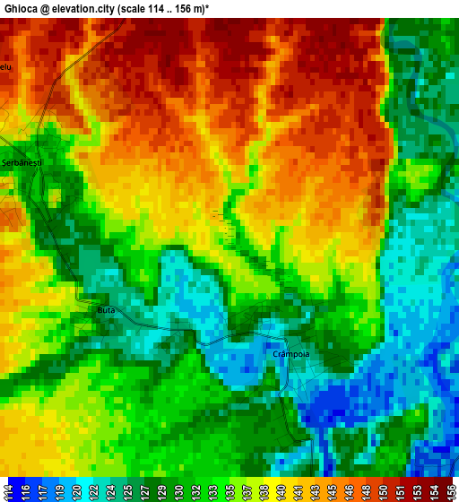
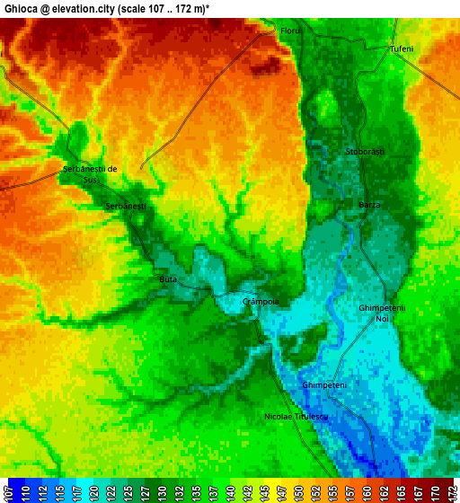
Below is the Elevation map of Ghioca, which displays elevation range with different colors. Scale of the first map is from 114 to 156 m (374 to 512 ft) with average elevation of 135.2 meters (=444 ft) [note 1]
These maps also provides idea of topography and contour of this city, they are displayed at different zoom levels. More info about maps, scale and edge coordinates you can find below images.
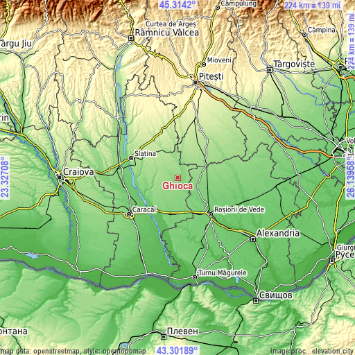
| \ | Map #1 | Map #2 | Topo.Map |
| Scale [m] | 114..156 m | 107..172 m | × |
| Scale [ft] | 374..512 ft | 351..564 ft | × |
| Average | 135.2 m = 444 ft | 139.1 m = 456 ft | × |
| Width | 6.99 km = 4.3 mi | 13.98 km = 8.7 mi | 223.7 km = 139 mi |
| Height | 6.99 km = 4.3 mi | 13.98 km = 8.7 mi | 223.7 km = 139 mi |
| ↑Max Latitude | 44.348104° | 44.379521° | 45.3142° |
| Latitude at center | 44.31667° | 44.31667° | 44.31667° |
| ↓Min Latitude | 44.285219° | 44.253751° | 43.30189° |
| ← Min Longitude | 24.689385° | 24.645439° | 23.32708° |
| Longitude center | 24.73333° | 24.73333° | 24.73333° |
| →Max Longitude | 24.777275° | 24.821221° | 26.13958° |
Nearby cities:
Cities around Ghioca sort by population:
• Dobroteşti elevation 117 m
12.5 km,  107°
107°
• Movileni 160 m
8.6 km,  309°
309°
• Văleni 131 m
10.1 km,  156°
156°
• Tufeni 134 m
6.8 km,  35°
35°
• Crâmpoia 124 m
1.9 km,  149°
149°
• Şerbăneşti 141 m
3.2 km,  304°
304°
• Nicolae Titulescu 138 m
5.6 km, 109°
• Barza 126 m
4.4 km,  65°
65°
• Icoana 144 m
11.2 km,  353°
353°
• Bacea 162 m
11.8 km,  319°
319°
• Ghimpețeni 116 m
5.1 km,  140°
140°
• Tecuci 145 m
10.4 km, 74°
Multilingual:
 En español:
Ghioca elevación 131 m.
 En France:
Ghioca élévation 131 m.


Sources and notes:
- [note 1] Map square and city borders are not equal. Map elevation data is calculated only from area inside that square.
- [src 1] Elevation data from geonames database provided with same terms of usage.
- [src 2] The elevation map of Ghioca is generated using elevation data from NASA's 3 arcsec (90m) resolution SRTM data.
- [src 3] Base (background) map © OpenStreetMap contributors tiles are generated by Geofabrik and OpenTopoMap.
Copyright & License:
This Ghioca Elevation Map is licensed under CC BY-SA. You may reuse any part from this page, if you give a proper credit by linking to this URL:
 More info on terms of use page.