Dobroteşti elevation
Dobroteşti (Teleorman, Comuna Dobroteşti), Romania elevation is 117 meters and Dobroteşti elevation in feet is 384 ft above sea level [src 1]. Dobroteşti is a seat of a second-order administrative division (feature code) with elevation that is 135 meters (443 ft) smaller than average city elevation in Romania.
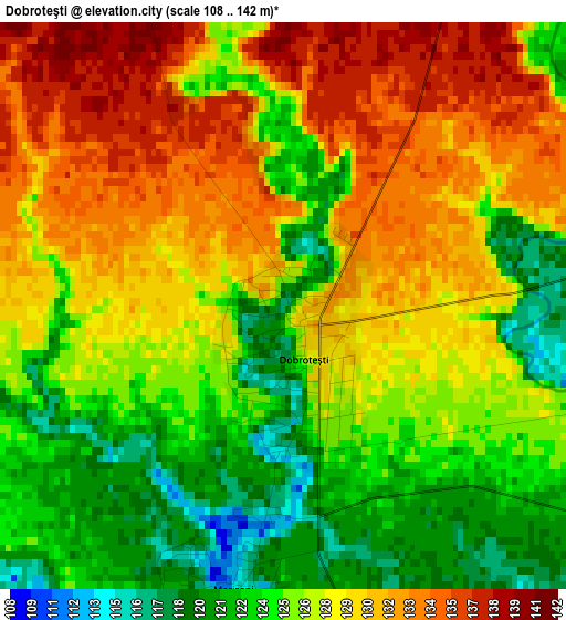
Below is the Elevation map of Dobroteşti, which displays elevation range with different colors. Scale of the first map is from 108 to 142 m (354 to 466 ft) with average elevation of 127.3 meters (=418 ft) [note 1]
These maps also provides idea of topography and contour of this city, they are displayed at different zoom levels. More info about maps, scale and edge coordinates you can find below images.
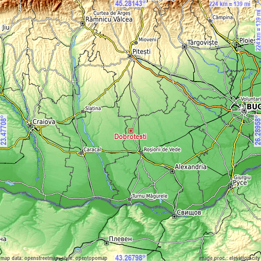
| \ | Map #1 | Map #2 | Topo.Map |
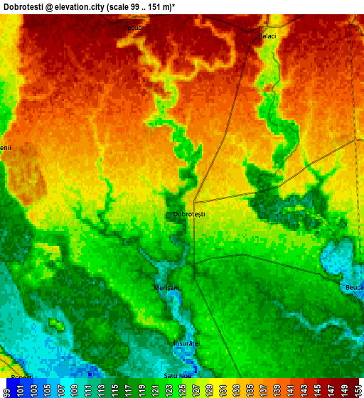
| Scale [m] | 108..142 m | 99..151 m | × |
| Scale [ft] | 354..466 ft | 325..495 ft | × |
| Average | 127.3 m = 418 ft | 127.6 m = 419 ft | × |
| Width | 7 km = 4.3 mi | 13.99 km = 8.7 mi | 223.9 km = 139.1 mi |
| Height | 7 km = 4.3 mi | 13.99 km = 8.7 mi | 223.9 km = 139.1 mi |
| ↑Max Latitude | 44.314782° | 44.346217° | 45.28143° |
| Latitude at center | 44.28333° | 44.28333° | 44.28333° |
| ↓Min Latitude | 44.251861° | 44.220376° | 43.26798° |
| ← Min Longitude | 24.839385° | 24.795439° | 23.47708° |
| Longitude center | 24.88333° | 24.88333° | 24.88333° |
| →Max Longitude | 24.927275° | 24.971221° | 26.28958° |
Nearby cities:
Cities around Dobroteşti sort by population:
• Văleni elevation 131 m
9.7 km,  235°
235°
• Nicolae Titulescu 138 m
6.9 km,  285°
285°
• Barza 126 m
9.7 km,  304°
304°
• Balaci 147 m
7.9 km,  19°
19°
• Zâmbreasca 139 m
8.8 km,  65°
65°
• Merișani 115 m
3.5 km,  190°
190°
• Beuca 111 m
7.5 km,  117°
117°
• Ghimpețeni 116 m
8.7 km,  268°
268°
• Tecuci 145 m
6.8 km,  343°
343°
• Socetu 126 m
10.1 km, 193°
• Drăcșenei 115 m
10.3 km,  127°
127°
• Didești 105 m
7.4 km,  180°
180°
Multilingual:
 En español:
Dobroteşti elevación 117 m.
 En France:
Dobroteşti élévation 117 m.
 Auf Deutsch:
Dobroteşti höhe über dem Meeresspiegel ist 117 m.

Sources and notes:
- [note 1] Map square and city borders are not equal. Map elevation data is calculated only from area inside that square.
- [src 1] Elevation data from geonames database provided with same terms of usage.
- [src 2] The elevation map of Dobroteşti is generated using elevation data from NASA's 3 arcsec (90m) resolution SRTM data.
- [src 3] Base (background) map © OpenStreetMap contributors tiles are generated by Geofabrik and OpenTopoMap.
Copyright & License:
This Dobroteşti Elevation Map is licensed under CC BY-SA. You may reuse any part from this page, if you give a proper credit by linking to this URL:
 More info on terms of use page.