Bras-Panon elevation
Bras-Panon (Réunion), Reunion elevation is 49 meters and Bras-Panon elevation in feet is 161 ft above sea level [src 1]. Bras-Panon is a populated place (feature code) with elevation that is 142 meters (466 ft) smaller than average city elevation in Reunion.
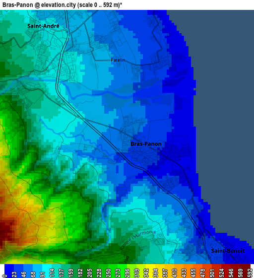
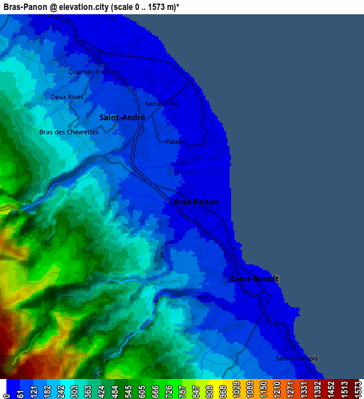
Below is the Elevation map of Bras-Panon, which displays elevation range with different colors. Scale of the first map is from 0 to 592 m (0 to 1942 ft) with average elevation of 122 meters (=400 ft) [note 1]
These maps also provides idea of topography and contour of this city, they are displayed at different zoom levels. More info about maps, scale and edge coordinates you can find below images.
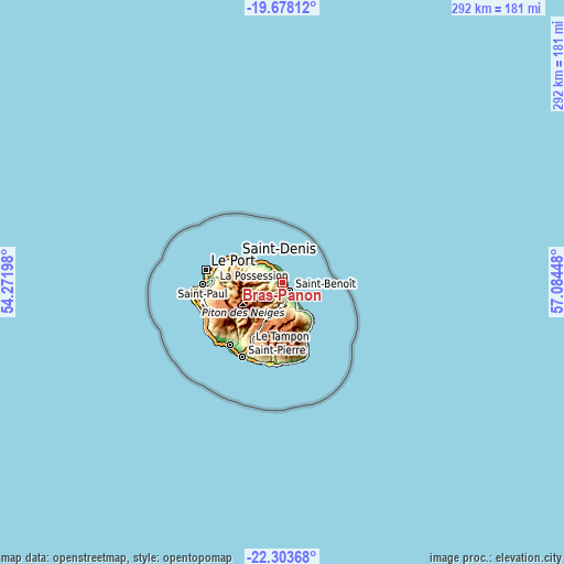
| \ | Map #1 | Map #2 | Topo.Map |
| Scale [m] | 0..592 m | 0..1573 m | × |
| Scale [ft] | 0..1942 ft | 0..5161 ft | × |
| Average | 122 m = 400 ft | 293.4 m = 963 ft | × |
| Width | 9.12 km = 5.7 mi | 18.25 km = 11.3 mi | 291.9 km = 181.4 mi |
| Height | 9.12 km = 5.7 mi | 18.25 km = 11.3 mi | 292 km = 181.4 mi |
| ↑Max Latitude | -20.955637° | -20.914593° | -19.67812° |
| Latitude at center | -20.99667° | -20.99667° | -20.99667° |
| ↓Min Latitude | -21.037692° | -21.078702° | -22.30368° |
| ← Min Longitude | 55.634285° | 55.590339° | 54.27198° |
| Longitude center | 55.67823° | 55.67823° | 55.67823° |
| →Max Longitude | 55.722175° | 55.766121° | 57.08448° |
Nearby cities:
Cities around Bras-Panon sort by population:
• Saint-Denis elevation 44 m
26.9 km,  298°
298°
• Le Tampon 425 m
35.3 km,  208°
208°
• Saint-André 103 m
4.7 km,  321°
321°
• Le Port 1 m
40.4 km,  279°
279°
• Saint-Benoît 78 m
6 km,  139°
139°
• Sainte-Marie 8 m
17.3 km,  309°
309°
• La Possession 24 m
36.4 km, 281°
• Sainte-Suzanne 130 m
12.4 km, 324°
• Salazie 452 m
14.8 km,  256°
256°
• Sainte-Rose 184 m
19.1 km, 140°
• Cilaos 887 m
26.5 km,  234°
234°
• Entre-Deux 445 m
34.3 km,  219°
219°
Multilingual:
 En español:
Bras-Panon elevación 49 m.
 En France:
Bras-Panon élévation 49 m.
 Auf Deutsch:
Bras-Panon höhe über dem Meeresspiegel ist 49 m.

Sources and notes:
- [note 1] Map square and city borders are not equal. Map elevation data is calculated only from area inside that square.
- [src 1] Elevation data from geonames database provided with same terms of usage.
- [src 2] The elevation map of Bras-Panon is generated using elevation data from NASA's 3 arcsec (90m) resolution SRTM data.
- [src 3] Base (background) map © OpenStreetMap contributors tiles are generated by Geofabrik and OpenTopoMap.
Copyright & License:
This Bras-Panon Elevation Map is licensed under CC BY-SA. You may reuse any part from this page, if you give a proper credit by linking to this URL:
 More info on terms of use page.