Salazie elevation
Salazie (Réunion), Reunion elevation is 452 meters and Salazie elevation in feet is 1483 ft above sea level [src 1]. Salazie is a populated place (feature code) with elevation that is 261 meters (856 ft) bigger than average city elevation in Reunion.
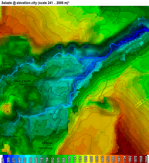
Below is the Elevation map of Salazie, which displays elevation range with different colors. Scale of the first map is from 241 to 2006 m (791 to 6581 ft) with average elevation of 1053.5 meters (=3456 ft) [note 1]
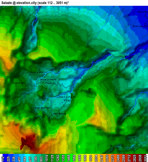
These maps also provides idea of topography and contour of this city, they are displayed at different zoom levels. More info about maps, scale and edge coordinates you can find below images.
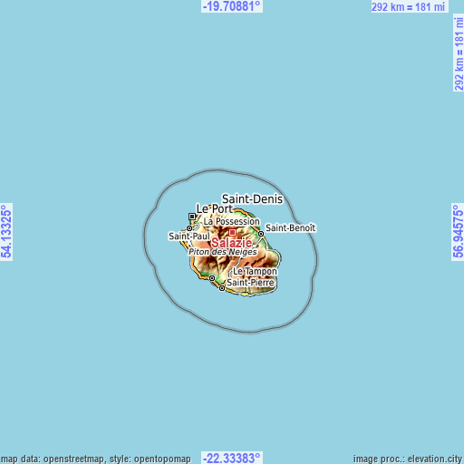
| \ | Map #1 | Map #2 | Topo.Map |
| Scale [m] | 241..2006 m | 112..3051 m | × |
| Scale [ft] | 791..6581 ft | 367..10010 ft | × |
| Average | 1053.5 m = 3456 ft | 1125.6 m = 3693 ft | × |
| Width | 9.12 km = 5.7 mi | 18.24 km = 11.3 mi | 291.9 km = 181.4 mi |
| Height | 9.12 km = 5.7 mi | 18.24 km = 11.3 mi | 291.9 km = 181.4 mi |
| ↑Max Latitude | -20.986075° | -20.945039° | -19.70881° |
| Latitude at center | -21.0271° | -21.0271° | -21.0271° |
| ↓Min Latitude | -21.068113° | -21.109115° | -22.33383° |
| ← Min Longitude | 55.495555° | 55.451609° | 54.13325° |
| Longitude center | 55.5395° | 55.5395° | 55.5395° |
| →Max Longitude | 55.583445° | 55.627391° | 56.94575° |
Nearby cities:
Cities around Salazie sort by population:
• Saint-Denis elevation 44 m
18.6 km,  330°
330°
• Le Tampon 425 m
27.8 km,  184°
184°
• Saint-André 103 m
13.5 km,  58°
58°
• Le Port 1 m
27.3 km,  291°
291°
• Saint-Benoît 78 m
18.3 km,  93°
93°
• Sainte-Marie 8 m
14.5 km,  4°
4°
• La Possession 24 m
23.9 km,  297°
297°
• Sainte-Suzanne 130 m
15.2 km,  27°
27°
• Bras-Panon 49 m
14.8 km,  76°
76°
• Les Trois-Bassins 801 m
26.1 km,  251°
251°
• Cilaos 887 m
14 km,  209°
209°
• Entre-Deux 445 m
24.1 km,  198°
198°
Multilingual:
 En español:
Salazie elevación 452 m.
 En France:
Salazie élévation 452 m.


Sources and notes:
- [note 1] Map square and city borders are not equal. Map elevation data is calculated only from area inside that square.
- [src 1] Elevation data from geonames database provided with same terms of usage.
- [src 2] The elevation map of Salazie is generated using elevation data from NASA's 3 arcsec (90m) resolution SRTM data.
- [src 3] Base (background) map © OpenStreetMap contributors tiles are generated by Geofabrik and OpenTopoMap.
Copyright & License:
This Salazie Elevation Map is licensed under CC BY-SA. You may reuse any part from this page, if you give a proper credit by linking to this URL:
 More info on terms of use page.