Salto del Guairá elevation
Salto del Guairá (Canindeyú, Saltos Del Guaira), Paraguay elevation is 269 meters and Salto del Guairá elevation in feet is 883 ft above sea level [src 1]. Salto del Guairá is a seat of a first-order administrative division (feature code) with elevation that is 95 meters (312 ft) bigger than average city elevation in Paraguay.
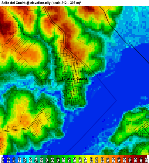
Below is the Elevation map of Salto del Guairá, which displays elevation range with different colors. Scale of the first map is from 212 to 307 m (696 to 1007 ft) with average elevation of 244.5 meters (=802 ft) [note 1]
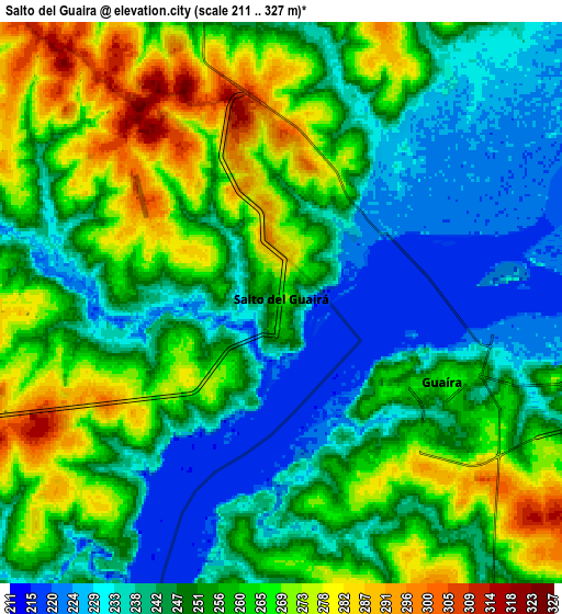
These maps also provides idea of topography and contour of this city, they are displayed at different zoom levels. More info about maps, scale and edge coordinates you can find below images.
| \ | Map #1 | Map #2 | Topo.Map |
| Scale [m] | 212..307 m | 211..327 m | × |
| Scale [ft] | 696..1007 ft | 692..1073 ft | × |
| Average | 244.5 m = 802 ft | 253 m = 830 ft | × |
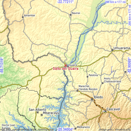
| Width | 8.92 km = 5.5 mi | 17.85 km = 11.1 mi | 285.5 km = 177.4 mi |
| Height | 8.92 km = 5.5 mi | 17.85 km = 11.1 mi | 285.5 km = 177.4 mi |
| ↑Max Latitude | -24.022367° | -23.982222° | -22.77211° |
| Latitude at center | -24.0625° | -24.0625° | -24.0625° |
| ↓Min Latitude | -24.10262° | -24.142728° | -25.34004° |
| ← Min Longitude | -54.350885° | -54.394831° | -55.71319° |
| Longitude center | -54.30694° | -54.30694° | -54.30694° |
| →Max Longitude | -54.262995° | -54.219049° | -52.90069° |
Nearby cities:
Cities around Salto del Guairá sort by population:
• Ciudad del Este elevation 186 m
163.8 km,  190°
190°
• Presidente Franco 206 m
169.7 km, 190°
• Nueva Esperanza 370 m
74.4 km,  228°
228°
• San Isidro de Curuguaty 215 m
147.6 km,  252°
252°
• Capitán Bado 514 m
153.1 km,  305°
305°
• San Alberto 346 m
117.1 km,  210°
210°
• La Paloma 356 m
32 km,  256°
256°
• Colonia Catuete 361 m
32.4 km, 255°
• Itakyry 246 m
133.5 km,  219°
219°
• Ygatimi 197 m
135.9 km,  267°
267°
• Colonia Minga Porá 306 m
107.7 km, 213°
• Corpus Christi 432 m
64.2 km, 268°
Multilingual:
 En español:
Salto del Guairá elevación 269 m.
 En France:
Salto del Guairá élévation 269 m.
 Auf Deutsch:
Salto del Guairá höhe über dem Meeresspiegel ist 269 m.
 На русском:
Сальто-дель-Гуайра высота над уровнем моря 269 м
Sources and notes:
- [note 1] Map square and city borders are not equal. Map elevation data is calculated only from area inside that square.
- [src 1] Elevation data from geonames database provided with same terms of usage.
- [src 2] The elevation map of Salto del Guairá is generated using elevation data from NASA's 3 arcsec (90m) resolution SRTM data.
- [src 3] Base (background) map © OpenStreetMap contributors tiles are generated by Geofabrik and OpenTopoMap.
Copyright & License:
This Salto del Guairá Elevation Map is licensed under CC BY-SA. You may reuse any part from this page, if you give a proper credit by linking to this URL:
 More info on terms of use page.