Santa Elena elevation
Santa Elena (Cordillera), Paraguay elevation is 119 meters and Santa Elena elevation in feet is 390 ft above sea level [src 1]. Santa Elena is a populated place (feature code) with elevation that is 55 meters (180 ft) smaller than average city elevation in Paraguay.
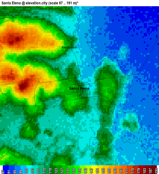
Below is the Elevation map of Santa Elena, which displays elevation range with different colors. Scale of the first map is from 87 to 191 m (285 to 627 ft) with average elevation of 115 meters (=377 ft) [note 1]
These maps also provides idea of topography and contour of this city, they are displayed at different zoom levels. More info about maps, scale and edge coordinates you can find below images.
| \ | Map #1 | Topo.Map |
| Scale [m] | 87..191 m | × |
| Scale [ft] | 285..627 ft | × |
| Average | 115 m = 377 ft | × |
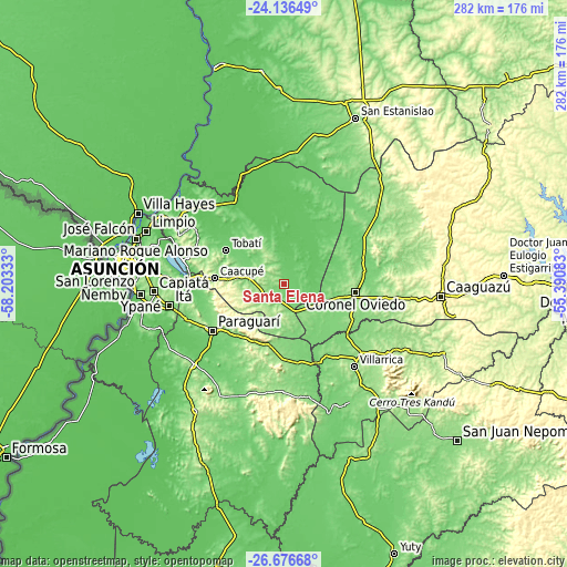
| Width | 8.83 km = 5.5 mi | 282.4 km = 175.5 mi |
| Height | 8.83 km = 5.5 mi | 282.5 km = 175.5 mi |
| ↑Max Latitude | -25.37357° | -24.13649° |
| Latitude at center | -25.41327° | -25.41327° |
| ↓Min Latitude | -25.452956° | -26.67668° |
| ← Min Longitude | -56.841025° | -58.20333° |
| Longitude center | -56.79708° | -56.79708° |
| →Max Longitude | -56.753135° | -55.39083° |
Nearby cities:
Cities around Santa Elena sort by population:
• Coronel Oviedo elevation 169 m
36 km,  95°
95°
• Caacupé 180 m
34.8 km,  275°
275°
• Piribebuy 253 m
25.2 km,  256°
256°
• Paraguarí 134 m
42 km,  236°
236°
• Tobatí 125 m
33.4 km,  300°
300°
• Eusebio Ayala 155 m
16.8 km, 281°
• San José 125 m
14.8 km,  154°
154°
• Atyrá 140 m
40.5 km,  291°
291°
• Itacurubí de la Cordillera 139 m
7.8 km,  226°
226°
• Sapucaí 171 m
32.2 km,  208°
208°
• Caraguatay 96 m
19.7 km,  351°
351°
• Isla Pucú 130 m
15.6 km,  318°
318°
Multilingual:
 En español:
Santa Elena elevación 119 m.
 En France:
Santa Elena élévation 119 m.
 Auf Deutsch:
Santa Elena höhe über dem Meeresspiegel ist 119 m.

Sources and notes:
- [note 1] Map square and city borders are not equal. Map elevation data is calculated only from area inside that square.
- [src 1] Elevation data from geonames database provided with same terms of usage.
- [src 2] The elevation map of Santa Elena is generated using elevation data from NASA's 3 arcsec (90m) resolution SRTM data.
- [src 3] Base (background) map © OpenStreetMap contributors tiles are generated by Geofabrik and OpenTopoMap.
Copyright & License:
This Santa Elena Elevation Map is licensed under CC BY-SA. You may reuse any part from this page, if you give a proper credit by linking to this URL:
 More info on terms of use page.