Baltar elevation
Baltar (Porto, Paredes), Portugal elevation is 288 meters and Baltar elevation in feet is 945 ft above sea level [src 1]. Baltar is a populated place (feature code) with elevation that is 120 meters (394 ft) bigger than average city elevation in Portugal.
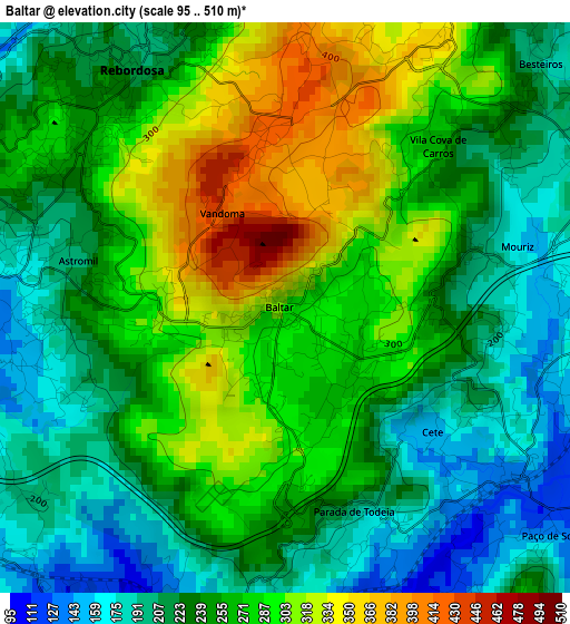
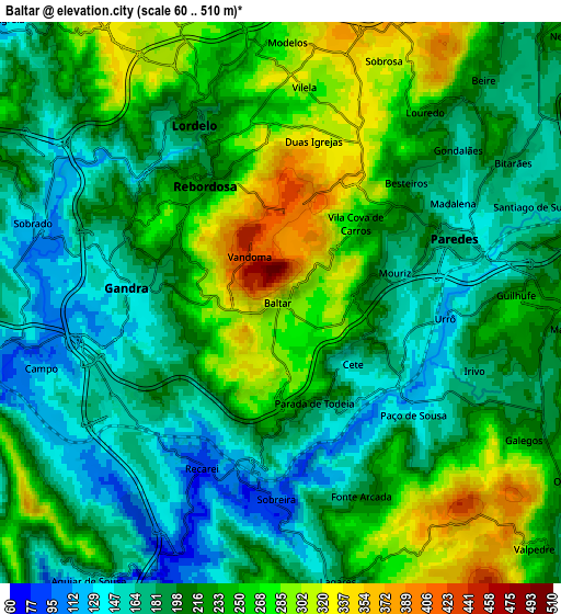
Below is the Elevation map of Baltar, which displays elevation range with different colors. Scale of the first map is from 95 to 510 m (312 to 1673 ft) with average elevation of 253 meters (=830 ft) [note 1]
These maps also provides idea of topography and contour of this city, they are displayed at different zoom levels. More info about maps, scale and edge coordinates you can find below images.
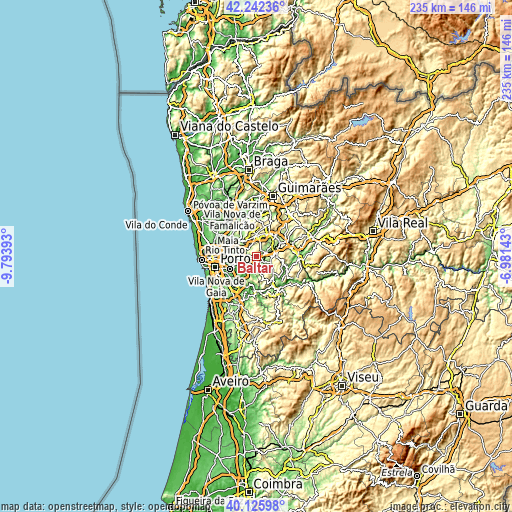
| \ | Map #1 | Map #2 | Topo.Map |
| Scale [m] | 95..510 m | 60..510 m | × |
| Scale [ft] | 312..1673 ft | 197..1673 ft | × |
| Average | 253 m = 830 ft | 217.9 m = 715 ft | × |
| Width | 7.35 km = 4.6 mi | 14.71 km = 9.1 mi | 235.3 km = 146.2 mi |
| Height | 7.35 km = 4.6 mi | 14.71 km = 9.1 mi | 235.3 km = 146.2 mi |
| ↑Max Latitude | 41.22578° | 41.258824° | 42.24236° |
| Latitude at center | 41.19272° | 41.19272° | 41.19272° |
| ↓Min Latitude | 41.159643° | 41.126549° | 40.12598° |
| ← Min Longitude | -8.431625° | -8.475571° | -9.79393° |
| Longitude center | -8.38768° | -8.38768° | -8.38768° |
| →Max Longitude | -8.343735° | -8.299789° | -6.98143° |
Nearby cities:
Cities around Baltar sort by population:
• Paredes elevation 179 m
4.9 km,  73°
73°
• Rebordosa 218 m
3.8 km,  335°
335°
• Lordelo 243 m
4.8 km, 344°
• Madalena 165 m
5.2 km,  59°
59°
• Campo 127 m
6.5 km,  262°
262°
• Castelões de Cepeda 154 m
4.5 km,  75°
75°
• Penafiel 286 m
8.9 km, 78°
• Sobrado 121 m
6 km,  289°
289°
• Gandra 177 m
4 km,  283°
283°
• Recarei 85 m
4.8 km,  204°
204°
• Frazão 258 m
7.4 km,  351°
351°
• Seroa 324 m
8.8 km, 336°
Multilingual:
 En español:
Baltar elevación 288 m.
 En France:
Baltar élévation 288 m.


Sources and notes:
- [note 1] Map square and city borders are not equal. Map elevation data is calculated only from area inside that square.
- [src 1] Elevation data from geonames database provided with same terms of usage.
- [src 2] The elevation map of Baltar is generated using elevation data from NASA's 3 arcsec (90m) resolution SRTM data.
- [src 3] Base (background) map © OpenStreetMap contributors tiles are generated by Geofabrik and OpenTopoMap.
Copyright & License:
This Baltar Elevation Map is licensed under CC BY-SA. You may reuse any part from this page, if you give a proper credit by linking to this URL:
 More info on terms of use page.