Madalena elevation
Madalena (Porto, Paredes), Portugal elevation is 165 meters and Madalena elevation in feet is 541 ft above sea level [src 1]. Madalena is a populated place (feature code) with elevation that is 3 meters (10 ft) smaller than average city elevation in Portugal.
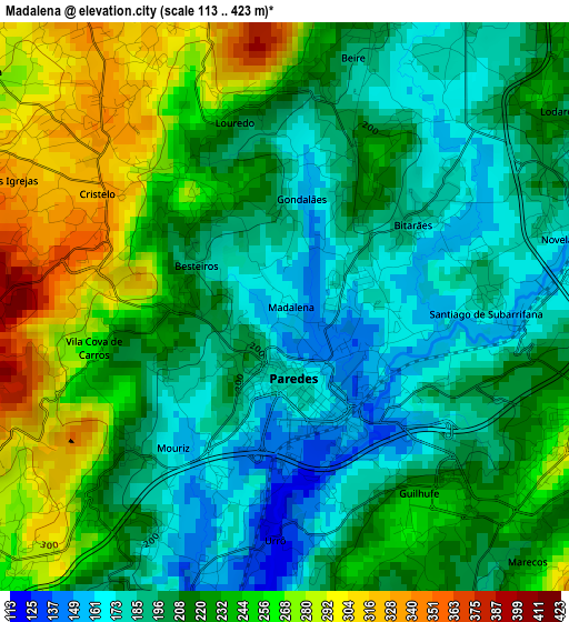
Below is the Elevation map of Madalena, which displays elevation range with different colors. Scale of the first map is from 113 to 423 m (371 to 1388 ft) with average elevation of 220.3 meters (=723 ft) [note 1]
These maps also provides idea of topography and contour of this city, they are displayed at different zoom levels. More info about maps, scale and edge coordinates you can find below images.
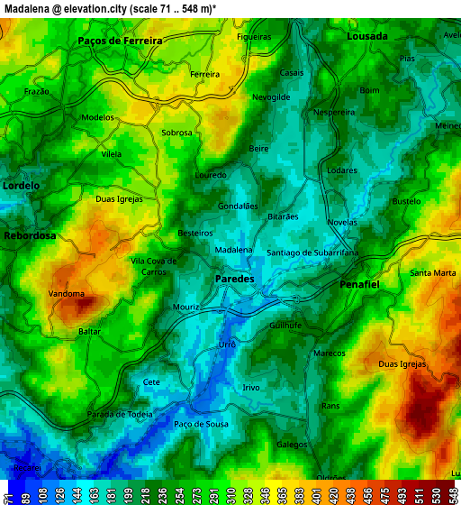
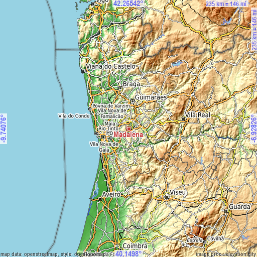
| \ | Map #1 | Map #2 | Topo.Map |
| Scale [m] | 113..423 m | 71..548 m | × |
| Scale [ft] | 371..1388 ft | 233..1798 ft | × |
| Average | 220.3 m = 723 ft | 260.5 m = 855 ft | × |
| Width | 7.35 km = 4.6 mi | 14.7 km = 9.1 mi | 235.2 km = 146.1 mi |
| Height | 7.35 km = 4.6 mi | 14.7 km = 9.1 mi | 235.2 km = 146.1 mi |
| ↑Max Latitude | 41.249209° | 41.28224° | 42.26542° |
| Latitude at center | 41.21616° | 41.21616° | 41.21616° |
| ↓Min Latitude | 41.183095° | 41.150013° | 40.1498° |
| ← Min Longitude | -8.378455° | -8.422401° | -9.74076° |
| Longitude center | -8.33451° | -8.33451° | -8.33451° |
| →Max Longitude | -8.290565° | -8.246619° | -6.92826° |
Nearby cities:
Cities around Madalena sort by population:
• Paredes elevation 179 m
1.3 km,  168°
168°
• Perafita 437 m
7.7 km,  119°
119°
• Rebordosa 218 m
6.1 km,  278°
278°
• Lordelo 243 m
6.1 km,  289°
289°
• Castelões de Cepeda 154 m
1.5 km,  182°
182°
• Penafiel 286 m
4.4 km,  101°
101°
• Freamunde 360 m
8 km,  359°
359°
• Paços de Ferreira 312 m
7.6 km,  332°
332°
• Baltar 288 m
5.2 km,  239°
239°
• Meinedo 219 m
7.3 km,  60°
60°
• Frazão 258 m
7.2 km,  310°
310°
• Ferreira 336 m
5.7 km,  351°
351°
Multilingual:
 En español:
Madalena elevación 165 m.
 En France:
Madalena élévation 165 m.
 Auf Deutsch:
Madalena höhe über dem Meeresspiegel ist 165 m.

Sources and notes:
- [note 1] Map square and city borders are not equal. Map elevation data is calculated only from area inside that square.
- [src 1] Elevation data from geonames database provided with same terms of usage.
- [src 2] The elevation map of Madalena is generated using elevation data from NASA's 3 arcsec (90m) resolution SRTM data.
- [src 3] Base (background) map © OpenStreetMap contributors tiles are generated by Geofabrik and OpenTopoMap.
Copyright & License:
This Madalena Elevation Map is licensed under CC BY-SA. You may reuse any part from this page, if you give a proper credit by linking to this URL:
 More info on terms of use page.