Carvalhosa elevation
Carvalhosa (Porto, Paços de Ferreira), Portugal elevation is 344 meters and Carvalhosa elevation in feet is 1129 ft above sea level [src 1]. Carvalhosa is a populated place (feature code) with elevation that is 176 meters (577 ft) bigger than average city elevation in Portugal.
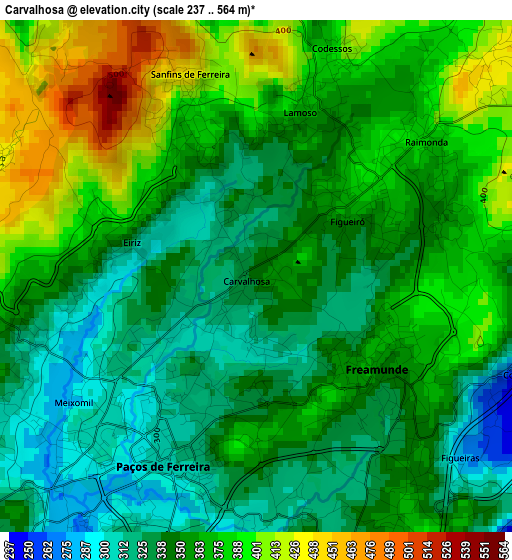
Below is the Elevation map of Carvalhosa, which displays elevation range with different colors. Scale of the first map is from 237 to 564 m (778 to 1850 ft) with average elevation of 358.5 meters (=1176 ft) [note 1]
These maps also provides idea of topography and contour of this city, they are displayed at different zoom levels. More info about maps, scale and edge coordinates you can find below images.

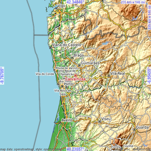
| \ | Map #1 | Map #2 | Topo.Map |
| Scale [m] | 237..564 m | 44..574 m | × |
| Scale [ft] | 778..1850 ft | 144..1883 ft | × |
| Average | 358.5 m = 1176 ft | 312.1 m = 1024 ft | × |
| Width | 7.34 km = 4.6 mi | 14.68 km = 9.1 mi | 234.9 km = 146 mi |
| Height | 7.34 km = 4.6 mi | 14.68 km = 9.1 mi | 234.9 km = 146 mi |
| ↑Max Latitude | 41.333576° | 41.366565° | 42.34846° |
| Latitude at center | 41.30057° | 41.30057° | 41.30057° |
| ↓Min Latitude | 41.267547° | 41.234508° | 40.23557° |
| ← Min Longitude | -8.404745° | -8.448691° | -9.76705° |
| Longitude center | -8.3608° | -8.3608° | -8.3608° |
| →Max Longitude | -8.316855° | -8.272909° | -6.95455° |
Nearby cities:
Cities around Carvalhosa sort by population:
• Lordelo elevation 243 m
8.1 km,  205°
205°
• Freamunde 360 m
2.5 km,  122°
122°
• Paços de Ferreira 312 m
3 km, 205°
• Negrelos 164 m
6.4 km,  328°
328°
• Barrosas 180 m
8 km,  40°
40°
• Lustosa 393 m
5.8 km, 39°
• Frazão 258 m
5.7 km,  215°
215°
• Ferreira 336 m
4 km,  159°
159°
• Vilarinho 203 m
7 km,  20°
20°
• Seroa 324 m
6.9 km,  235°
235°
• Rebordões 105 m
8 km,  319°
319°
• Lousada 283 m
7.2 km,  110°
110°
Multilingual:
 En español:
Carvalhosa elevación 344 m.
 En France:
Carvalhosa élévation 344 m.
 Auf Deutsch:
Carvalhosa höhe über dem Meeresspiegel ist 344 m.

Sources and notes:
- [note 1] Map square and city borders are not equal. Map elevation data is calculated only from area inside that square.
- [src 1] Elevation data from geonames database provided with same terms of usage.
- [src 2] The elevation map of Carvalhosa is generated using elevation data from NASA's 3 arcsec (90m) resolution SRTM data.
- [src 3] Base (background) map © OpenStreetMap contributors tiles are generated by Geofabrik and OpenTopoMap.
Copyright & License:
This Carvalhosa Elevation Map is licensed under CC BY-SA. You may reuse any part from this page, if you give a proper credit by linking to this URL:
 More info on terms of use page.