Vilarinho elevation
Vilarinho (Porto, Santo Tirso), Portugal elevation is 203 meters and Vilarinho elevation in feet is 666 ft above sea level [src 1]. Vilarinho is a populated place (feature code) with elevation that is 35 meters (115 ft) bigger than average city elevation in Portugal.
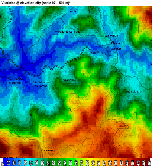
Below is the Elevation map of Vilarinho, which displays elevation range with different colors. Scale of the first map is from 97 to 501 m (318 to 1644 ft) with average elevation of 246.5 meters (=809 ft) [note 1]
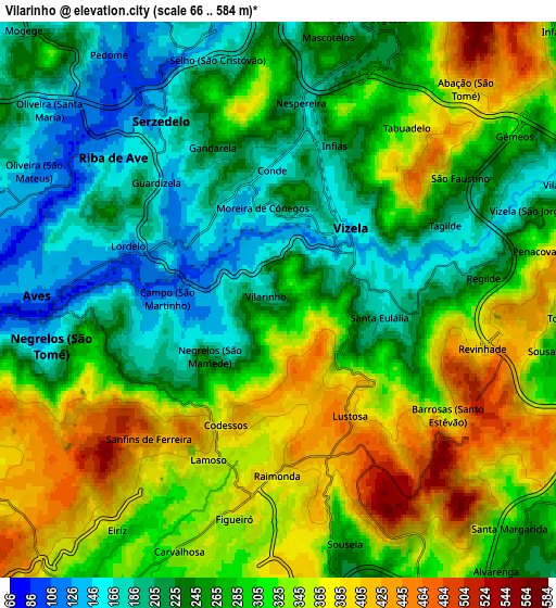
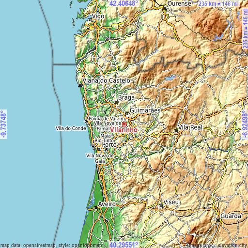
These maps also provides idea of topography and contour of this city, they are displayed at different zoom levels. More info about maps, scale and edge coordinates you can find below images.
| \ | Map #1 | Map #2 | Topo.Map |
| Scale [m] | 97..501 m | 66..584 m | × |
| Scale [ft] | 318..1644 ft | 217..1916 ft | × |
| Average | 246.5 m = 809 ft | 286.2 m = 939 ft | × |
| Width | 7.33 km = 4.6 mi | 14.67 km = 9.1 mi | 234.7 km = 145.8 mi |
| Height | 7.34 km = 4.6 mi | 14.67 km = 9.1 mi | 234.7 km = 145.8 mi |
| ↑Max Latitude | 41.392526° | 41.425485° | 42.40648° |
| Latitude at center | 41.35955° | 41.35955° | 41.35955° |
| ↓Min Latitude | 41.326557° | 41.293548° | 40.29551° |
| ← Min Longitude | -8.375175° | -8.419121° | -9.73748° |
| Longitude center | -8.33123° | -8.33123° | -8.33123° |
| →Max Longitude | -8.287285° | -8.243339° | -6.92498° |
Nearby cities:
Cities around Vilarinho sort by population:
• Caldas de Vizela elevation 174 m
3.1 km,  36°
36°
• Selho 180 m
6.8 km,  349°
349°
• Aves 116 m
6.7 km,  280°
280°
• Negrelos 164 m
6 km,  259°
259°
• Moreira de Conegos 151 m
3.1 km, 347°
• Barrosas 180 m
2.7 km,  100°
100°
• Lustosa 393 m
2.4 km,  150°
150°
• Lordelo 150 m
4.4 km,  291°
291°
• Carvalhosa 344 m
7 km,  200°
200°
• Serzedelo 149 m
5.6 km,  325°
325°
• Riba de Ave 113 m
6.2 km,  311°
311°
• Vizela 223 m
6.6 km,  58°
58°
Multilingual:
 En español:
Vilarinho elevación 203 m.
 En France:
Vilarinho élévation 203 m.
 Auf Deutsch:
Vilarinho höhe über dem Meeresspiegel ist 203 m.

Sources and notes:
- [note 1] Map square and city borders are not equal. Map elevation data is calculated only from area inside that square.
- [src 1] Elevation data from geonames database provided with same terms of usage.
- [src 2] The elevation map of Vilarinho is generated using elevation data from NASA's 3 arcsec (90m) resolution SRTM data.
- [src 3] Base (background) map © OpenStreetMap contributors tiles are generated by Geofabrik and OpenTopoMap.
Copyright & License:
This Vilarinho Elevation Map is licensed under CC BY-SA. You may reuse any part from this page, if you give a proper credit by linking to this URL:
 More info on terms of use page.