Covilhã elevation
Covilhã (Castelo Branco), Portugal elevation is 534 meters and Covilhã elevation in feet is 1752 ft above sea level [src 1]. Covilhã is a populated place (feature code) with elevation that is 366 meters (1201 ft) bigger than average city elevation in Portugal.
Below is the Elevation map of Covilhã, which displays elevation range with different colors. Scale of the first map is from 406 to 1614 m (1332 to 5295 ft) with average elevation of 760.3 meters (=2494 ft) [note 1]
These maps also provides idea of topography and contour of this city, they are displayed at different zoom levels. More info about maps, scale and edge coordinates you can find below images.
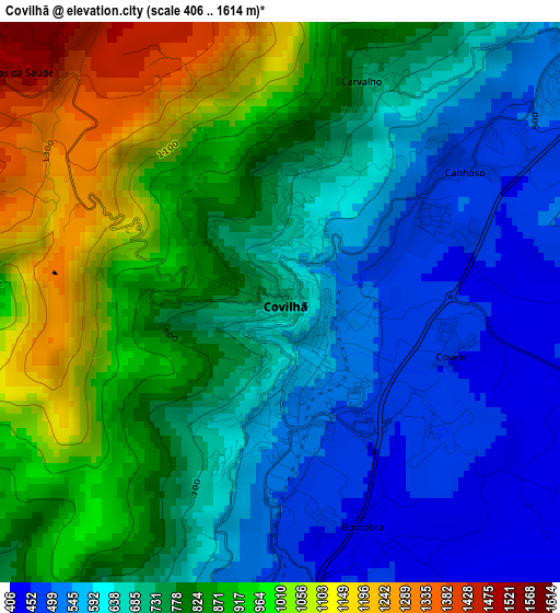
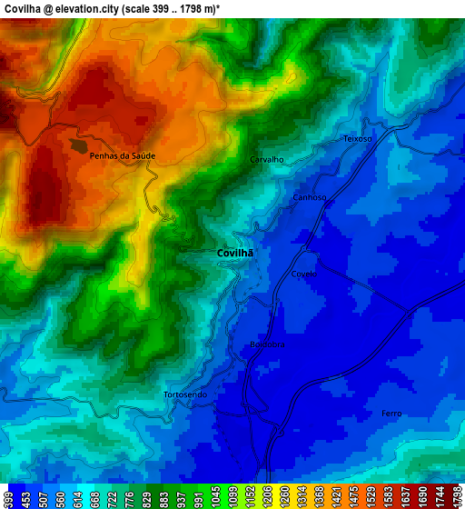
| \ | Map #1 | Map #2 | Topo.Map |
| Scale [m] | 406..1614 m | 399..1798 m | × |
| Scale [ft] | 1332..5295 ft | 1309..5899 ft | × |
| Average | 760.3 m = 2494 ft | 809 m = 2654 ft | × |
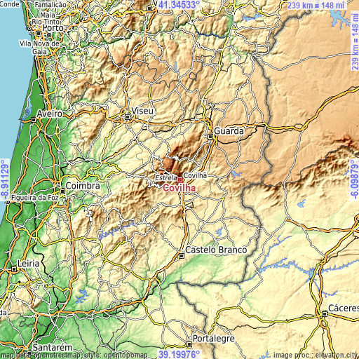
| Width | 7.46 km = 4.6 mi | 14.91 km = 9.3 mi | 238.6 km = 148.3 mi |
| Height | 7.46 km = 4.6 mi | 14.91 km = 9.3 mi | 238.6 km = 148.3 mi |
| ↑Max Latitude | 40.314577° | 40.348077° | 41.34533° |
| Latitude at center | 40.28106° | 40.28106° | 40.28106° |
| ↓Min Latitude | 40.247527° | 40.213977° | 39.19976° |
| ← Min Longitude | -7.548985° | -7.592931° | -8.91129° |
| Longitude center | -7.50504° | -7.50504° | -7.50504° |
| →Max Longitude | -7.461095° | -7.417149° | -6.09879° |
Nearby cities:
Cities around Covilhã sort by population:
• Guarda elevation 1008 m
35 km,  35°
35°
• Fundão 482 m
15.7 km,  178°
178°
• Seia 551 m
22.8 km,  310°
310°
• São Romão 594 m
22.2 km, 306°
• Oliveira do Hospital 508 m
31.4 km,  286°
286°
• Teixoso 561 m
5.5 km,  47°
47°
• Manteigas 794 m
13.9 km,  347°
347°
• Aldeia de Joanes 471 m
15.8 km, 183°
• Loriga 755 m
16.4 km, 287°
• Sabugal 753 m
36 km,  77°
77°
• Penamacor 561 m
31.1 km,  113°
113°
• Belmonte 606 m
15.9 km,  56°
56°
Multilingual:
 En español:
Covilhã elevación 534 m.
 En France:
Covilhã élévation 534 m.


Sources and notes:
- [note 1] Map square and city borders are not equal. Map elevation data is calculated only from area inside that square.
- [src 1] Elevation data from geonames database provided with same terms of usage.
- [src 2] The elevation map of Covilhã is generated using elevation data from NASA's 3 arcsec (90m) resolution SRTM data.
- [src 3] Base (background) map © OpenStreetMap contributors tiles are generated by Geofabrik and OpenTopoMap.
Copyright & License:
This Covilhã Elevation Map is licensed under CC BY-SA. You may reuse any part from this page, if you give a proper credit by linking to this URL:
 More info on terms of use page.