Macieira de Cambra elevation
Macieira de Cambra (Aveiro, Vale de Cambra), Portugal elevation is 362 meters and Macieira de Cambra elevation in feet is 1188 ft above sea level [src 1]. Macieira de Cambra is a populated place (feature code) with elevation that is 194 meters (636 ft) bigger than average city elevation in Portugal.
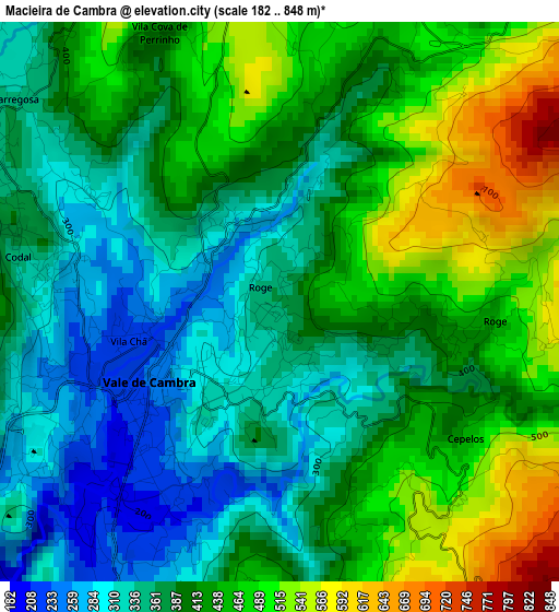
Below is the Elevation map of Macieira de Cambra, which displays elevation range with different colors. Scale of the first map is from 182 to 848 m (597 to 2782 ft) with average elevation of 406.3 meters (=1333 ft) [note 1]
These maps also provides idea of topography and contour of this city, they are displayed at different zoom levels. More info about maps, scale and edge coordinates you can find below images.
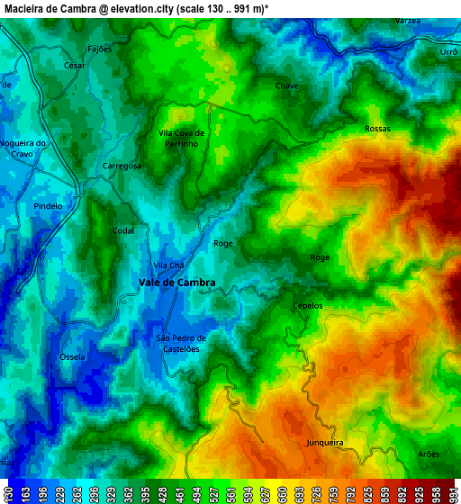
| \ | Map #1 | Map #2 | Topo.Map |
| Scale [m] | 182..848 m | 130..991 m | × |
| Scale [ft] | 597..2782 ft | 427..3251 ft | × |
| Average | 406.3 m = 1333 ft | 454.3 m = 1490 ft | × |
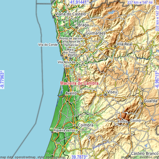
| Width | 7.39 km = 4.6 mi | 14.78 km = 9.2 mi | 236.5 km = 147 mi |
| Height | 7.39 km = 4.6 mi | 14.78 km = 9.2 mi | 236.5 km = 147 mi |
| ↑Max Latitude | 40.892618° | 40.92583° | 41.91441° |
| Latitude at center | 40.85939° | 40.85939° | 40.85939° |
| ↓Min Latitude | 40.826145° | 40.792883° | 39.7873° |
| ← Min Longitude | -8.417325° | -8.461271° | -9.77963° |
| Longitude center | -8.37338° | -8.37338° | -8.37338° |
| →Max Longitude | -8.329435° | -8.285489° | -6.96713° |
Nearby cities:
Cities around Macieira de Cambra sort by population:
• São João da Madeira elevation 204 m
10.8 km,  295°
295°
• Oliveira de Azemeis 221 m
8.8 km,  256°
256°
• Cucujães 236 m
11.3 km,  278°
278°
• Vale de Cambra 240 m
2 km,  238°
238°
• Arrifana 271 m
12.1 km, 301°
• Branca 161 m
13.8 km,  221°
221°
• São Roque 208 m
8.4 km, 279°
• Milheirós de Poiares 246 m
10.5 km,  311°
311°
• Vila Chã 216 m
7.9 km, 275°
• Mosteirô 226 m
14 km,  288°
288°
• Sever do Vouga 289 m
13.9 km,  177°
177°
• Arouca 313 m
13.4 km,  53°
53°
Multilingual:
 En español:
Macieira de Cambra elevación 362 m.
 En France:
Macieira de Cambra élévation 362 m.
 Auf Deutsch:
Macieira de Cambra höhe über dem Meeresspiegel ist 362 m.
 На русском:
Macieira de Cambra высота над уровнем моря 362 м
Sources and notes:
- [note 1] Map square and city borders are not equal. Map elevation data is calculated only from area inside that square.
- [src 1] Elevation data from geonames database provided with same terms of usage.
- [src 2] The elevation map of Macieira de Cambra is generated using elevation data from NASA's 3 arcsec (90m) resolution SRTM data.
- [src 3] Base (background) map © OpenStreetMap contributors tiles are generated by Geofabrik and OpenTopoMap.
Copyright & License:
This Macieira de Cambra Elevation Map is licensed under CC BY-SA. You may reuse any part from this page, if you give a proper credit by linking to this URL:
 More info on terms of use page.