Bucelas elevation
Bucelas (Lisbon, Loures), Portugal elevation is 91 meters and Bucelas elevation in feet is 299 ft above sea level [src 1]. Bucelas is a populated place (feature code) with elevation that is 77 meters (253 ft) smaller than average city elevation in Portugal.
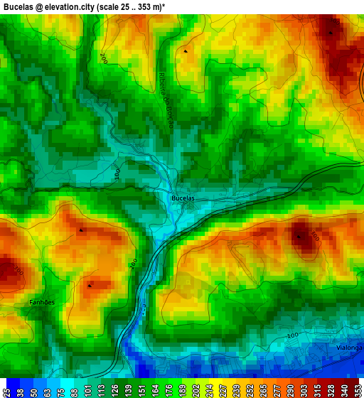
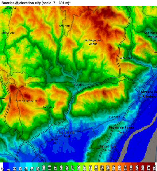
Below is the Elevation map of Bucelas, which displays elevation range with different colors. Scale of the first map is from 25 to 353 m (82 to 1158 ft) with average elevation of 173.1 meters (=568 ft) [note 1]
These maps also provides idea of topography and contour of this city, they are displayed at different zoom levels. More info about maps, scale and edge coordinates you can find below images.
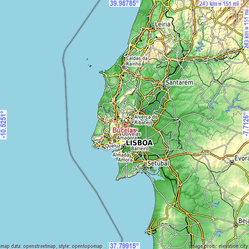
| \ | Map #1 | Map #2 | Topo.Map |
| Scale [m] | 25..353 m | -7..391 m | × |
| Scale [ft] | 82..1158 ft | -23..1283 ft | × |
| Average | 173.1 m = 568 ft | 160.6 m = 527 ft | × |
| Width | 7.61 km = 4.7 mi | 15.21 km = 9.5 mi | 243.4 km = 151.2 mi |
| Height | 7.61 km = 4.7 mi | 15.21 km = 9.5 mi | 243.4 km = 151.2 mi |
| ↑Max Latitude | 38.936121° | 38.970295° | 39.98785° |
| Latitude at center | 38.90193° | 38.90193° | 38.90193° |
| ↓Min Latitude | 38.867723° | 38.833499° | 37.79915° |
| ← Min Longitude | -9.162795° | -9.206741° | -10.5251° |
| Longitude center | -9.11885° | -9.11885° | -9.11885° |
| →Max Longitude | -9.074905° | -9.030959° | -7.7126° |
Nearby cities:
Cities around Bucelas sort by population:
• Loures elevation 23 m
9 km,  208°
208°
• Póvoa de Santa Iria 18 m
6.5 km,  134°
134°
• São João da Talha 10 m
8.9 km,  167°
167°
• Santa Iria da Azóia 48 m
7 km, 165°
• Vialonga 50 m
4.8 km, 133°
• Unhos 38 m
9.2 km,  180°
180°
• Arruda dos Vinhos 99 m
9.8 km,  21°
21°
• Milharado 211 m
8.6 km,  306°
306°
• São João dos Montes 133 m
9.6 km,  64°
64°
• Sobralinho 46 m
8.2 km,  78°
78°
• Santo Antão do Tojal 22 m
5.9 km,  197°
197°
• Arranhó 242 m
5.9 km,  346°
346°
Multilingual:
 En español:
Bucelas elevación 91 m.
 En France:
Bucelas élévation 91 m.


Sources and notes:
- [note 1] Map square and city borders are not equal. Map elevation data is calculated only from area inside that square.
- [src 1] Elevation data from geonames database provided with same terms of usage.
- [src 2] The elevation map of Bucelas is generated using elevation data from NASA's 3 arcsec (90m) resolution SRTM data.
- [src 3] Base (background) map © OpenStreetMap contributors tiles are generated by Geofabrik and OpenTopoMap.
Copyright & License:
This Bucelas Elevation Map is licensed under CC BY-SA. You may reuse any part from this page, if you give a proper credit by linking to this URL:
 More info on terms of use page.