Unhos elevation
Unhos (Lisbon, Loures), Portugal elevation is 38 meters and Unhos elevation in feet is 125 ft above sea level [src 1]. Unhos is a populated place (feature code) with elevation that is 130 meters (427 ft) smaller than average city elevation in Portugal.
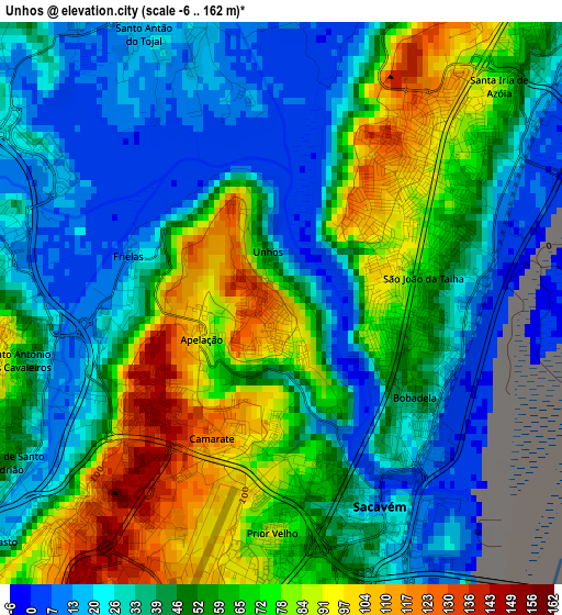
Below is the Elevation map of Unhos, which displays elevation range with different colors. Scale of the first map is from -6 to 162 m (-20 to 531 ft) with average elevation of 50.6 meters (=166 ft) [note 1]
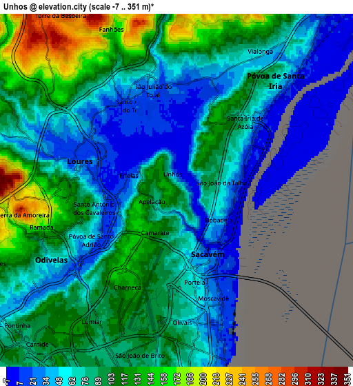
These maps also provides idea of topography and contour of this city, they are displayed at different zoom levels. More info about maps, scale and edge coordinates you can find below images.
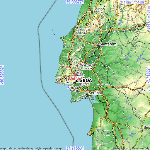
| \ | Map #1 | Map #2 | Topo.Map |
| Scale [m] | -6..162 m | -7..351 m | × |
| Scale [ft] | -20..531 ft | -23..1152 ft | × |
| Average | 50.6 m = 166 ft | 82.8 m = 272 ft | × |
| Width | 7.61 km = 4.7 mi | 15.23 km = 9.5 mi | 243.6 km = 151.4 mi |
| Height | 7.61 km = 4.7 mi | 15.23 km = 9.5 mi | 243.6 km = 151.4 mi |
| ↑Max Latitude | 38.853811° | 38.888025° | 39.90677° |
| Latitude at center | 38.81958° | 38.81958° | 38.81958° |
| ↓Min Latitude | 38.785333° | 38.751069° | 37.71553° |
| ← Min Longitude | -9.164015° | -9.207961° | -10.52632° |
| Longitude center | -9.12007° | -9.12007° | -9.12007° |
| →Max Longitude | -9.076125° | -9.032179° | -7.71382° |
Nearby cities:
Cities around Unhos sort by population:
• Loures elevation 23 m
4.4 km,  286°
286°
• Moscavide e Portela 32 m
4.7 km,  160°
160°
• Camarate 108 m
1.9 km,  201°
201°
• São João da Talha 10 m
2 km,  76°
76°
• Santa Iria da Azóia 48 m
3 km,  37°
37°
• Sacavém 39 m
3.2 km, 161°
• Póvoa de Santo Adrião 51 m
4.6 km,  241°
241°
• Charneca 123 m
4.5 km,  206°
206°
• Bobadela 44 m
2.2 km,  126°
126°
• Apelação 89 m
1.2 km, 238°
• Prior Velho 57 m
3.1 km,  181°
181°
• Santo Antão do Tojal 22 m
3.9 km,  334°
334°
Multilingual:
 En español:
Unhos elevación 38 m.
 En France:
Unhos élévation 38 m.


Sources and notes:
- [note 1] Map square and city borders are not equal. Map elevation data is calculated only from area inside that square.
- [src 1] Elevation data from geonames database provided with same terms of usage.
- [src 2] The elevation map of Unhos is generated using elevation data from NASA's 3 arcsec (90m) resolution SRTM data.
- [src 3] Base (background) map © OpenStreetMap contributors tiles are generated by Geofabrik and OpenTopoMap.
Copyright & License:
This Unhos Elevation Map is licensed under CC BY-SA. You may reuse any part from this page, if you give a proper credit by linking to this URL:
 More info on terms of use page.