Funchal elevation
Funchal (Madeira), Portugal elevation is 280 meters and Funchal elevation in feet is 919 ft above sea level [src 1]. Funchal is a seat of a first-order administrative division (feature code) with elevation that is 112 meters (367 ft) bigger than average city elevation in Portugal.
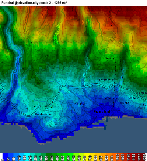
Below is the Elevation map of Funchal, which displays elevation range with different colors. Scale of the first map is from 2 to 1266 m (7 to 4154 ft) with average elevation of 468.1 meters (=1536 ft) [note 1]
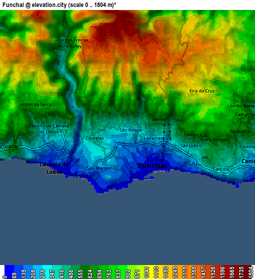
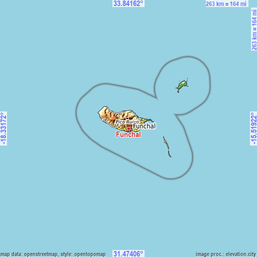
These maps also provides idea of topography and contour of this city, they are displayed at different zoom levels. More info about maps, scale and edge coordinates you can find below images.
| \ | Map #1 | Map #2 | Topo.Map |
| Scale [m] | 2..1266 m | 0..1804 m | × |
| Scale [ft] | 7..4154 ft | 0..5919 ft | × |
| Average | 468.1 m = 1536 ft | 770.7 m = 2529 ft | × |
| Width | 8.23 km = 5.1 mi | 16.45 km = 10.2 mi | 263.2 km = 163.5 mi |
| Height | 8.23 km = 5.1 mi | 16.45 km = 10.2 mi | 263.3 km = 163.6 mi |
| ↑Max Latitude | 32.702667° | 32.739639° | 33.84162° |
| Latitude at center | 32.66568° | 32.66568° | 32.66568° |
| ↓Min Latitude | 32.628678° | 32.59166° | 31.47406° |
| ← Min Longitude | -16.969415° | -17.013361° | -18.33172° |
| Longitude center | -16.92547° | -16.92547° | -16.92547° |
| →Max Longitude | -16.881525° | -16.837579° | -15.51922° |
Nearby cities:
Cities around Funchal sort by population:
• Câmara de Lobos elevation 252 m
5.1 km,  250°
250°
• São Martinho 193 m
2.6 km,  207°
207°
• Caniço 337 m
8.4 km,  101°
101°
• São Roque 294 m
0.8 km,  82°
82°
• Camacha 703 m
7.7 km, 78°
• Nossa Senhora do Monte 350 m
2.4 km,  87°
87°
• Santa Cruz 240 m
12.6 km, 78°
• Ribeira Brava 208 m
12.9 km,  274°
274°
• Campanário 234 m
10.3 km, 270°
• Porto da Cruz 220 m
14.2 km,  37°
37°
• Água de Pena 160 m
14.3 km,  73°
73°
• Curral das Freiras 435 m
7.4 km,  325°
325°
Multilingual:
 En español:
Funchal elevación 280 m.
 En France:
Funchal élévation 280 m.


Sources and notes:
- [note 1] Map square and city borders are not equal. Map elevation data is calculated only from area inside that square.
- [src 1] Elevation data from geonames database provided with same terms of usage.
- [src 2] The elevation map of Funchal is generated using elevation data from NASA's 3 arcsec (90m) resolution SRTM data.
- [src 3] Base (background) map © OpenStreetMap contributors tiles are generated by Geofabrik and OpenTopoMap.
Copyright & License:
This Funchal Elevation Map is licensed under CC BY-SA. You may reuse any part from this page, if you give a proper credit by linking to this URL:
 More info on terms of use page.