Golegã elevation
Golegã (Santarém), Portugal elevation is 25 meters and Golegã elevation in feet is 82 ft above sea level [src 1]. Golegã is a seat of a second-order administrative division (feature code) with elevation that is 143 meters (469 ft) smaller than average city elevation in Portugal.
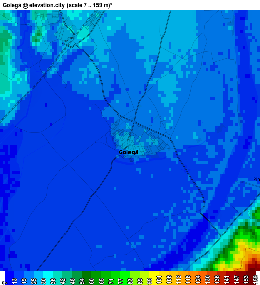
Below is the Elevation map of Golegã, which displays elevation range with different colors. Scale of the first map is from 7 to 159 m (23 to 522 ft) with average elevation of 21.3 meters (=70 ft) [note 1]
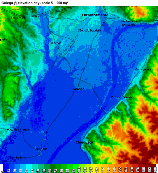
These maps also provides idea of topography and contour of this city, they are displayed at different zoom levels. More info about maps, scale and edge coordinates you can find below images.
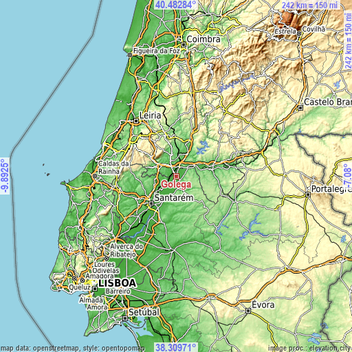
| \ | Map #1 | Map #2 | Topo.Map |
| Scale [m] | 7..159 m | 5..200 m | × |
| Scale [ft] | 23..522 ft | 16..656 ft | × |
| Average | 21.3 m = 70 ft | 49.5 m = 162 ft | × |
| Width | 7.55 km = 4.7 mi | 15.1 km = 9.4 mi | 241.6 km = 150.1 mi |
| Height | 7.55 km = 4.7 mi | 15.1 km = 9.4 mi | 241.6 km = 150.1 mi |
| ↑Max Latitude | 39.438687° | 39.472618° | 40.48284° |
| Latitude at center | 39.40474° | 39.40474° | 39.40474° |
| ↓Min Latitude | 39.370776° | 39.336796° | 38.30971° |
| ← Min Longitude | -8.530195° | -8.574141° | -9.8925° |
| Longitude center | -8.48625° | -8.48625° | -8.48625° |
| →Max Longitude | -8.442305° | -8.398359° | -7.08° |
Nearby cities:
Cities around Golegã sort by population:
• Entroncamento elevation 34 m
7.1 km,  13°
13°
• Torres Novas 61 m
9.3 km,  328°
328°
• Vila Nova da Barquinha 91 m
7.6 km,  34°
34°
• Riachos 42 m
5.1 km, 331°
• Alcanena 85 m
16.8 km,  291°
291°
• São Vicente do Paul 20 m
13.2 km,  242°
242°
• Vale de Figueira 58 m
16.5 km,  228°
228°
• Santa Margarida da Coutada 125 m
15.4 km,  70°
70°
• Praia do Ribatejo 45 m
13.6 km,  59°
59°
• Azinhaga 19 m
7.3 km,  211°
211°
• Pinheiro Grande 46 m
4.7 km,  107°
107°
• Constância 37 m
15.2 km, 57°
Multilingual:
 En español:
Golegã elevación 25 m.
 En France:
Golegã élévation 25 m.


Sources and notes:
- [note 1] Map square and city borders are not equal. Map elevation data is calculated only from area inside that square.
- [src 1] Elevation data from geonames database provided with same terms of usage.
- [src 2] The elevation map of Golegã is generated using elevation data from NASA's 3 arcsec (90m) resolution SRTM data.
- [src 3] Base (background) map © OpenStreetMap contributors tiles are generated by Geofabrik and OpenTopoMap.
Copyright & License:
This Golegã Elevation Map is licensed under CC BY-SA. You may reuse any part from this page, if you give a proper credit by linking to this URL:
 More info on terms of use page.