Mafra elevation
Mafra (Lisbon), Portugal elevation is 230 meters and Mafra elevation in feet is 755 ft above sea level [src 1]. Mafra is a seat of a second-order administrative division (feature code) with elevation that is 62 meters (203 ft) bigger than average city elevation in Portugal.
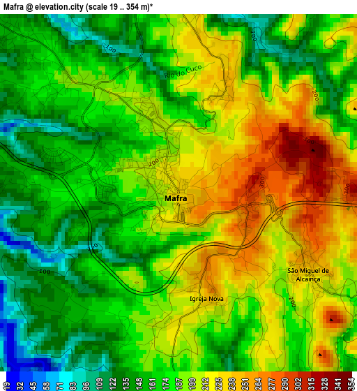
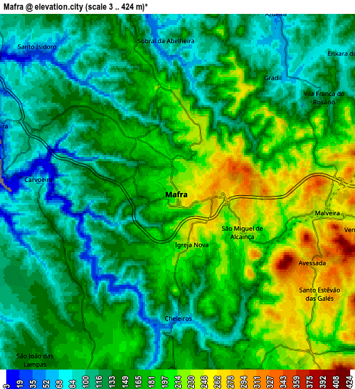
Below is the Elevation map of Mafra, which displays elevation range with different colors. Scale of the first map is from 19 to 354 m (62 to 1161 ft) with average elevation of 185.7 meters (=609 ft) [note 1]
These maps also provides idea of topography and contour of this city, they are displayed at different zoom levels. More info about maps, scale and edge coordinates you can find below images.
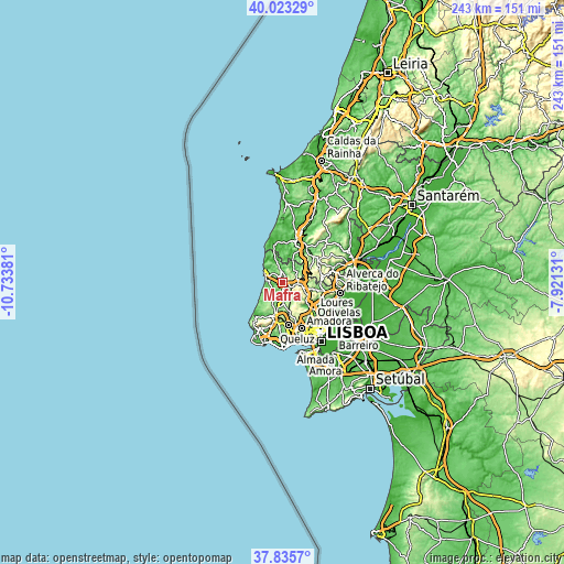
| \ | Map #1 | Map #2 | Topo.Map |
| Scale [m] | 19..354 m | 3..424 m | × |
| Scale [ft] | 62..1161 ft | 10..1391 ft | × |
| Average | 185.7 m = 609 ft | 157.7 m = 517 ft | × |
| Width | 7.6 km = 4.7 mi | 15.2 km = 9.4 mi | 243.2 km = 151.1 mi |
| Height | 7.6 km = 4.7 mi | 15.2 km = 9.4 mi | 243.2 km = 151.1 mi |
| ↑Max Latitude | 38.972104° | 39.006261° | 40.02329° |
| Latitude at center | 38.93793° | 38.93793° | 38.93793° |
| ↓Min Latitude | 38.90374° | 38.869533° | 37.8357° |
| ← Min Longitude | -9.371505° | -9.415451° | -10.73381° |
| Longitude center | -9.32756° | -9.32756° | -9.32756° |
| →Max Longitude | -9.283615° | -9.239669° | -7.92131° |
Nearby cities:
Cities around Mafra sort by population:
• Algueirão elevation 170 m
15.7 km,  185°
185°
• Sintra 197 m
15.8 km,  196°
196°
• São João das Lampas 154 m
9.4 km,  220°
220°
• Almargem 267 m
11.4 km,  155°
155°
• Ericeira 33 m
8.1 km,  289°
289°
• Fontanelas 129 m
13.9 km, 224°
• Milharado 211 m
11.2 km,  84°
84°
• Venda do Pinheiro 263 m
8.4 km,  100°
100°
• Pero Pinheiro 158 m
8.9 km,  177°
177°
• Malveira 253 m
6.1 km, 96°
• São Pedro da Cadeira 61 m
15.2 km,  345°
345°
• Santo Isidoro 73 m
9 km,  316°
316°
Multilingual:
 En español:
Mafra elevación 230 m.
 En France:
Mafra élévation 230 m.


Sources and notes:
- [note 1] Map square and city borders are not equal. Map elevation data is calculated only from area inside that square.
- [src 1] Elevation data from geonames database provided with same terms of usage.
- [src 2] The elevation map of Mafra is generated using elevation data from NASA's 3 arcsec (90m) resolution SRTM data.
- [src 3] Base (background) map © OpenStreetMap contributors tiles are generated by Geofabrik and OpenTopoMap.
Copyright & License:
This Mafra Elevation Map is licensed under CC BY-SA. You may reuse any part from this page, if you give a proper credit by linking to this URL:
 More info on terms of use page.