Malveira elevation
Malveira (Lisbon, Mafra), Portugal elevation is 253 meters and Malveira elevation in feet is 830 ft above sea level [src 1]. Malveira is a populated place (feature code) with elevation that is 85 meters (279 ft) bigger than average city elevation in Portugal.
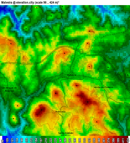
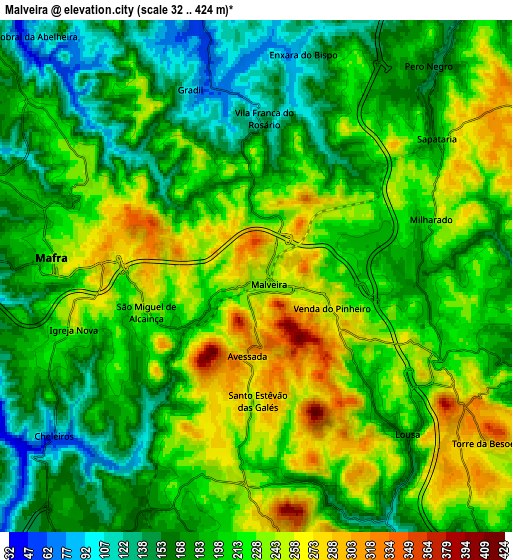
Below is the Elevation map of Malveira, which displays elevation range with different colors. Scale of the first map is from 96 to 424 m (315 to 1391 ft) with average elevation of 244.7 meters (=803 ft) [note 1]
These maps also provides idea of topography and contour of this city, they are displayed at different zoom levels. More info about maps, scale and edge coordinates you can find below images.
| \ | Map #1 | Map #2 | Topo.Map |
| Scale [m] | 96..424 m | 32..424 m | × |
| Scale [ft] | 315..1391 ft | 105..1391 ft | × |
| Average | 244.7 m = 803 ft | 205.3 m = 674 ft | × |
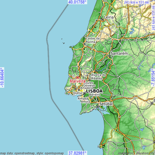
| Width | 7.6 km = 4.7 mi | 15.2 km = 9.4 mi | 243.3 km = 151.2 mi |
| Height | 7.6 km = 4.7 mi | 15.2 km = 9.4 mi | 243.3 km = 151.2 mi |
| ↑Max Latitude | 38.966306° | 39.000466° | 40.01758° |
| Latitude at center | 38.93213° | 38.93213° | 38.93213° |
| ↓Min Latitude | 38.897937° | 38.863728° | 37.82981° |
| ← Min Longitude | -9.301735° | -9.345681° | -10.66404° |
| Longitude center | -9.25779° | -9.25779° | -9.25779° |
| →Max Longitude | -9.213845° | -9.169899° | -7.85154° |
Nearby cities:
Cities around Malveira sort by population:
• Loures elevation 23 m
13.7 km,  145°
145°
• Mafra 230 m
6.1 km,  276°
276°
• Caneças 234 m
13.5 km,  168°
168°
• São João das Lampas 154 m
13.8 km,  241°
241°
• Almargem 267 m
9.8 km,  187°
187°
• Milharado 211 m
5.3 km,  71°
71°
• Venda do Pinheiro 263 m
2.4 km,  112°
112°
• Pero Pinheiro 158 m
10 km,  214°
214°
• Bucelas 91 m
12.5 km, 105°
• Santo Antão do Tojal 22 m
13.6 km,  131°
131°
• Sobral de Monte Agraço 262 m
13.4 km,  43°
43°
• Arranhó 242 m
10.9 km,  77°
77°
Multilingual:
 En español:
Malveira elevación 253 m.
 En France:
Malveira élévation 253 m.
 Auf Deutsch:
Malveira höhe über dem Meeresspiegel ist 253 m.

Sources and notes:
- [note 1] Map square and city borders are not equal. Map elevation data is calculated only from area inside that square.
- [src 1] Elevation data from geonames database provided with same terms of usage.
- [src 2] The elevation map of Malveira is generated using elevation data from NASA's 3 arcsec (90m) resolution SRTM data.
- [src 3] Base (background) map © OpenStreetMap contributors tiles are generated by Geofabrik and OpenTopoMap.
Copyright & License:
This Malveira Elevation Map is licensed under CC BY-SA. You may reuse any part from this page, if you give a proper credit by linking to this URL:
 More info on terms of use page.