Pombal elevation
Pombal (Leiria), Portugal elevation is 69 meters and Pombal elevation in feet is 226 ft above sea level [src 1]. Pombal is a seat of a second-order administrative division (feature code) with elevation that is 99 meters (325 ft) smaller than average city elevation in Portugal.
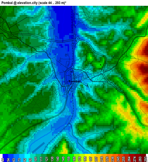
Below is the Elevation map of Pombal, which displays elevation range with different colors. Scale of the first map is from 44 to 293 m (144 to 961 ft) with average elevation of 117.7 meters (=386 ft) [note 1]
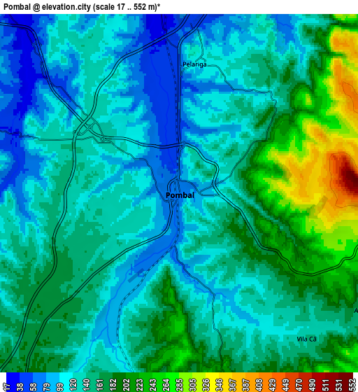
These maps also provides idea of topography and contour of this city, they are displayed at different zoom levels. More info about maps, scale and edge coordinates you can find below images.
| \ | Map #1 | Map #2 | Topo.Map |
| Scale [m] | 44..293 m | 17..552 m | × |
| Scale [ft] | 144..961 ft | 56..1811 ft | × |
| Average | 117.7 m = 386 ft | 148.9 m = 489 ft | × |
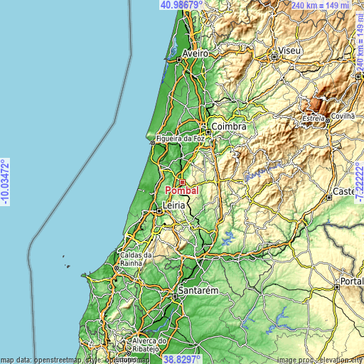
| Width | 7.5 km = 4.7 mi | 14.99 km = 9.3 mi | 239.8 km = 149 mi |
| Height | 7.5 km = 4.7 mi | 14.99 km = 9.3 mi | 239.8 km = 149 mi |
| ↑Max Latitude | 39.950437° | 39.984117° | 40.98679° |
| Latitude at center | 39.91674° | 39.91674° | 39.91674° |
| ↓Min Latitude | 39.883027° | 39.849297° | 38.8297° |
| ← Min Longitude | -8.672415° | -8.716361° | -10.03472° |
| Longitude center | -8.62847° | -8.62847° | -8.62847° |
| →Max Longitude | -8.584525° | -8.540579° | -7.22222° |
Nearby cities:
Cities around Pombal sort by population:
• Leiria elevation 33 m
24.6 km,  218°
218°
• Condeixa-a-Nova 109 m
24.5 km,  26°
26°
• Soure 23 m
15.9 km,  0°
0°
• Monte Real 20 m
21.3 km,  250°
250°
• Caranguejeira 129 m
20.1 km,  199°
199°
• Louriçal 29 m
13.4 km,  316°
316°
• Amor 25 m
23.4 km,  237°
237°
• Monte Redondo 47 m
17.4 km,  263°
263°
• Souto da Carpalhosa 51 m
19.2 km, 246°
• Penela 164 m
24.6 km,  58°
58°
• Alvaiázere 311 m
23.6 km,  116°
116°
• Ansião 206 m
16.5 km,  91°
91°
Multilingual:
 En español:
Pombal elevación 69 m.
 En France:
Pombal élévation 69 m.


Sources and notes:
- [note 1] Map square and city borders are not equal. Map elevation data is calculated only from area inside that square.
- [src 1] Elevation data from geonames database provided with same terms of usage.
- [src 2] The elevation map of Pombal is generated using elevation data from NASA's 3 arcsec (90m) resolution SRTM data.
- [src 3] Base (background) map © OpenStreetMap contributors tiles are generated by Geofabrik and OpenTopoMap.
Copyright & License:
This Pombal Elevation Map is licensed under CC BY-SA. You may reuse any part from this page, if you give a proper credit by linking to this URL:
 More info on terms of use page.