Redondo elevation
Redondo (Évora), Portugal elevation is 298 meters and Redondo elevation in feet is 978 ft above sea level [src 1]. Redondo is a seat of a second-order administrative division (feature code) with elevation that is 130 meters (427 ft) bigger than average city elevation in Portugal.
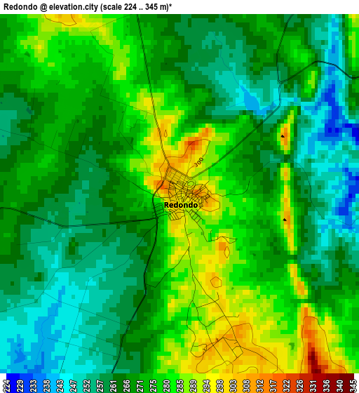
Below is the Elevation map of Redondo, which displays elevation range with different colors. Scale of the first map is from 224 to 345 m (735 to 1132 ft) with average elevation of 270 meters (=886 ft) [note 1]
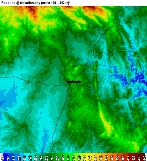
These maps also provides idea of topography and contour of this city, they are displayed at different zoom levels. More info about maps, scale and edge coordinates you can find below images.
| \ | Map #1 | Map #2 | Topo.Map |
| Scale [m] | 224..345 m | 196..442 m | × |
| Scale [ft] | 735..1132 ft | 643..1450 ft | × |
| Average | 270 m = 886 ft | 273.8 m = 898 ft | × |
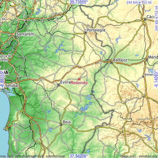
| Width | 7.63 km = 4.7 mi | 15.26 km = 9.5 mi | 244.2 km = 151.7 mi |
| Height | 7.63 km = 4.7 mi | 15.26 km = 9.5 mi | 244.2 km = 151.7 mi |
| ↑Max Latitude | 38.683033° | 38.717329° | 39.73855° |
| Latitude at center | 38.64872° | 38.64872° | 38.64872° |
| ↓Min Latitude | 38.614391° | 38.580045° | 37.54206° |
| ← Min Longitude | -7.591025° | -7.634971° | -8.95333° |
| Longitude center | -7.54708° | -7.54708° | -7.54708° |
| →Max Longitude | -7.503135° | -7.459189° | -6.14083° |
Nearby cities:
Cities around Redondo sort by population:
• Évora elevation 269 m
32 km,  253°
253°
• Elvas 326 m
42.2 km,  52°
52°
• Estremoz 417 m
22 km,  351°
351°
• Vila Viçosa 403 m
18.2 km,  38°
38°
• Reguengos de Monsaraz 218 m
24.9 km,  177°
177°
• Borba 403 m
19.2 km,  24°
24°
• Monforte 285 m
46 km,  11°
11°
• Fronteira 257 m
46.2 km, 349°
• Portel 297 m
40.3 km,  199°
199°
• Arraiolos 341 m
38.9 km,  282°
282°
• Mourão 178 m
34.5 km,  148°
148°
• Alandroal 345 m
13.8 km,  64°
64°
Multilingual:
 En español:
Redondo elevación 298 m.
 En France:
Redondo élévation 298 m.


Sources and notes:
- [note 1] Map square and city borders are not equal. Map elevation data is calculated only from area inside that square.
- [src 1] Elevation data from geonames database provided with same terms of usage.
- [src 2] The elevation map of Redondo is generated using elevation data from NASA's 3 arcsec (90m) resolution SRTM data.
- [src 3] Base (background) map © OpenStreetMap contributors tiles are generated by Geofabrik and OpenTopoMap.
Copyright & License:
This Redondo Elevation Map is licensed under CC BY-SA. You may reuse any part from this page, if you give a proper credit by linking to this URL:
 More info on terms of use page.