Vila Viçosa elevation
Vila Viçosa (Évora), Portugal elevation is 403 meters and Vila Viçosa elevation in feet is 1322 ft above sea level [src 1]. Vila Viçosa is a seat of a second-order administrative division (feature code) with elevation that is 235 meters (771 ft) bigger than average city elevation in Portugal.
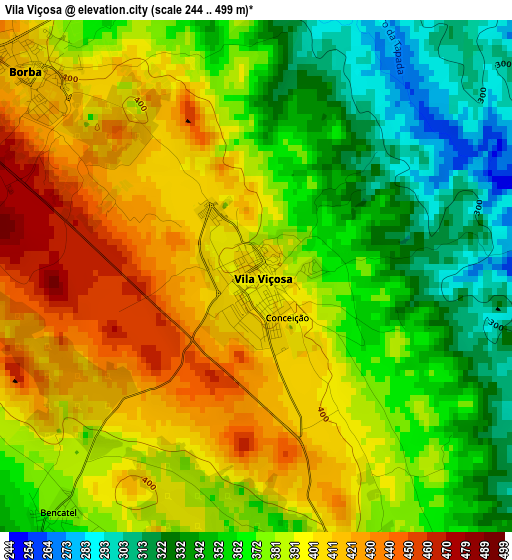
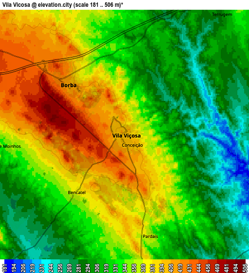
Below is the Elevation map of Vila Viçosa, which displays elevation range with different colors. Scale of the first map is from 244 to 499 m (801 to 1637 ft) with average elevation of 379.6 meters (=1245 ft) [note 1]
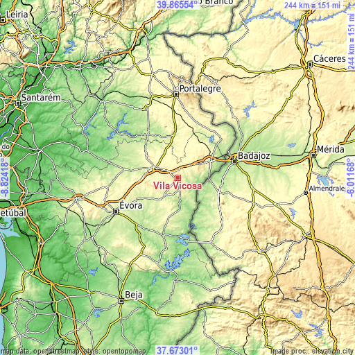
These maps also provides idea of topography and contour of this city, they are displayed at different zoom levels. More info about maps, scale and edge coordinates you can find below images.
| \ | Map #1 | Map #2 | Topo.Map |
| Scale [m] | 244..499 m | 181..506 m | × |
| Scale [ft] | 801..1637 ft | 594..1660 ft | × |
| Average | 379.6 m = 1245 ft | 341 m = 1119 ft | × |
| Width | 7.62 km = 4.7 mi | 15.24 km = 9.5 mi | 243.8 km = 151.5 mi |
| Height | 7.62 km = 4.7 mi | 15.24 km = 9.5 mi | 243.8 km = 151.5 mi |
| ↑Max Latitude | 38.811951° | 38.846185° | 39.86554° |
| Latitude at center | 38.7777° | 38.7777° | 38.7777° |
| ↓Min Latitude | 38.743433° | 38.709149° | 37.67301° |
| ← Min Longitude | -7.461875° | -7.505821° | -8.82418° |
| Longitude center | -7.41793° | -7.41793° | -7.41793° |
| →Max Longitude | -7.373985° | -7.330039° | -6.01168° |
Nearby cities:
Cities around Vila Viçosa sort by population:
• Vale da Amoreira elevation 207 m
40.5 km,  323°
323°
• Elvas 326 m
24.9 km,  62°
62°
• Estremoz 417 m
16.3 km,  296°
296°
• Campo Maior 292 m
40.6 km,  48°
48°
• Reguengos de Monsaraz 218 m
40.5 km,  194°
194°
• Redondo 298 m
18.2 km,  218°
218°
• Borba 403 m
4.4 km,  314°
314°
• Monforte 285 m
30.7 km,  356°
356°
• Arronches 292 m
40 km,  16°
16°
• Mourão 178 m
44.3 km,  171°
171°
• Fronteira 257 m
36.9 km,  327°
327°
• Alandroal 345 m
8.5 km, 171°
Multilingual:
 En español:
Vila Viçosa elevación 403 m.
 En France:
Vila Viçosa élévation 403 m.
 Auf Deutsch:
Vila Viçosa höhe über dem Meeresspiegel ist 403 m.

Sources and notes:
- [note 1] Map square and city borders are not equal. Map elevation data is calculated only from area inside that square.
- [src 1] Elevation data from geonames database provided with same terms of usage.
- [src 2] The elevation map of Vila Viçosa is generated using elevation data from NASA's 3 arcsec (90m) resolution SRTM data.
- [src 3] Base (background) map © OpenStreetMap contributors tiles are generated by Geofabrik and OpenTopoMap.
Copyright & License:
This Vila Viçosa Elevation Map is licensed under CC BY-SA. You may reuse any part from this page, if you give a proper credit by linking to this URL:
 More info on terms of use page.