Bal‘ā elevation
Bal‘ā (West Bank, Tulkarm), Palestinian Territory elevation is 352 meters and Bal‘ā elevation in feet is 1155 ft above sea level [src 1]. Bal‘ā is a populated place (feature code) with elevation that is 115 meters (377 ft) smaller than average city elevation in Palestinian Territory.
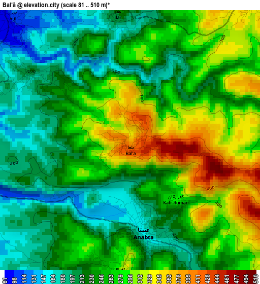
Below is the Elevation map of Bal‘ā, which displays elevation range with different colors. Scale of the first map is from 81 to 510 m (266 to 1673 ft) with average elevation of 251.7 meters (=826 ft) [note 1]
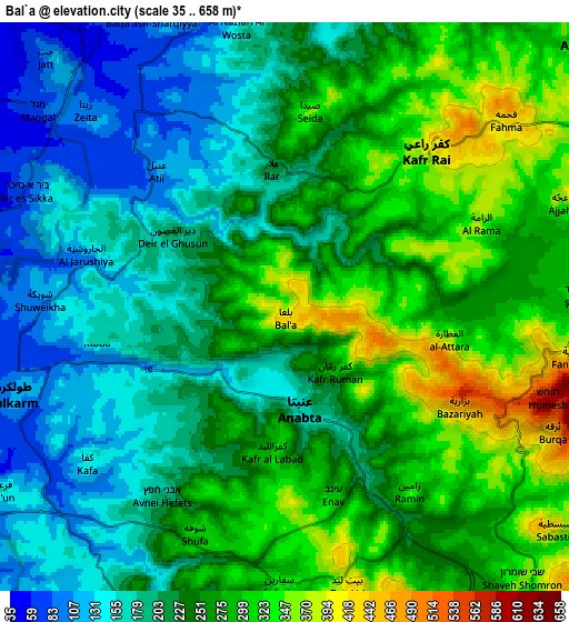
These maps also provides idea of topography and contour of this city, they are displayed at different zoom levels. More info about maps, scale and edge coordinates you can find below images.
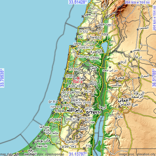
| \ | Map #1 | Map #2 | Topo.Map |
| Scale [m] | 81..510 m | 35..658 m | × |
| Scale [ft] | 266..1673 ft | 115..2159 ft | × |
| Average | 251.7 m = 826 ft | 238.7 m = 783 ft | × |
| Width | 8.26 km = 5.1 mi | 16.51 km = 10.3 mi | 264.2 km = 164.2 mi |
| Height | 8.26 km = 5.1 mi | 16.51 km = 10.3 mi | 264.2 km = 164.2 mi |
| ↑Max Latitude | 32.371044° | 32.408152° | 33.51428° |
| Latitude at center | 32.33392° | 32.33392° | 32.33392° |
| ↓Min Latitude | 32.296781° | 32.259627° | 31.13797° |
| ← Min Longitude | 35.067655° | 35.023709° | 33.70535° |
| Longitude center | 35.1116° | 35.1116° | 35.1116° |
| →Max Longitude | 35.155545° | 35.199491° | 36.51785° |
Nearby cities:
Cities around Bal‘ā sort by population:
• ‘Attīl elevation 111 m
5.4 km,  316°
316°
• Dayr al Ghuşūn 203 m
3.9 km,  302°
302°
• Kafr Rā‘ī 399 m
6 km,  42°
42°
• ‘Anabtā 174 m
2.9 km,  170°
170°
• ‘Illār 226 m
4.1 km,  353°
353°
• Sīlat az̧ Z̧ahr 390 m
7 km,  103°
103°
• Kafr al Labad 296 m
3.8 km,  182°
182°
• Şaydā 350 m
5.7 km,  6°
6°
• Bazzāryah 478 m
5.9 km,  119°
119°
• Rāmīn 337 m
6.5 km,  146°
146°
• Iktābah 162 m
5.6 km,  261°
261°
• Al ‘Aţţārah 360 m
5 km, 100°
Multilingual:
 En español:
Bal‘ā elevación 352 m.
 En France:
Bal‘ā élévation 352 m.


Sources and notes:
- [note 1] Map square and city borders are not equal. Map elevation data is calculated only from area inside that square.
- [src 1] Elevation data from geonames database provided with same terms of usage.
- [src 2] The elevation map of Bal‘ā is generated using elevation data from NASA's 3 arcsec (90m) resolution SRTM data.
- [src 3] Base (background) map © OpenStreetMap contributors tiles are generated by Geofabrik and OpenTopoMap.
Copyright & License:
This Bal‘ā Elevation Map is licensed under CC BY-SA. You may reuse any part from this page, if you give a proper credit by linking to this URL:
 More info on terms of use page.