Bayt ‘Anān elevation
Bayt ‘Anān (West Bank), Palestinian Territory elevation is 680 meters and Bayt ‘Anān elevation in feet is 2231 ft above sea level [src 1]. Bayt ‘Anān is a populated place (feature code) with elevation that is 213 meters (699 ft) bigger than average city elevation in Palestinian Territory.
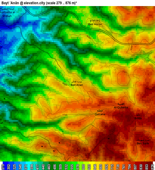
Below is the Elevation map of Bayt ‘Anān, which displays elevation range with different colors. Scale of the first map is from 279 to 876 m (915 to 2874 ft) with average elevation of 613.4 meters (=2012 ft) [note 1]
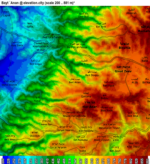
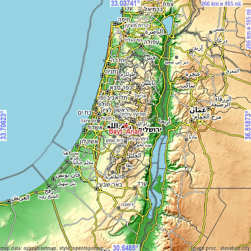
These maps also provides idea of topography and contour of this city, they are displayed at different zoom levels. More info about maps, scale and edge coordinates you can find below images.
| \ | Map #1 | Map #2 | Topo.Map |
| Scale [m] | 279..876 m | 200..881 m | × |
| Scale [ft] | 915..2874 ft | 656..2890 ft | × |
| Average | 613.4 m = 2012 ft | 573.7 m = 1882 ft | × |
| Width | 8.3 km = 5.2 mi | 16.6 km = 10.3 mi | 265.6 km = 165 mi |
| Height | 8.3 km = 5.2 mi | 16.6 km = 10.3 mi | 265.6 km = 165 mi |
| ↑Max Latitude | 31.888011° | 31.925316° | 33.03741° |
| Latitude at center | 31.85069° | 31.85069° | 31.85069° |
| ↓Min Latitude | 31.813354° | 31.776003° | 30.6485° |
| ← Min Longitude | 35.068535° | 35.024589° | 33.70623° |
| Longitude center | 35.11248° | 35.11248° | 35.11248° |
| →Max Longitude | 35.156425° | 35.200371° | 36.51873° |
Nearby cities:
Cities around Bayt ‘Anān sort by population:
• Givat Zeev elevation 754 m
5.4 km,  77°
77°
• Bayt Liqyā 293 m
4.9 km,  295°
295°
• Qaţanah 725 m
2 km,  162°
162°
• Biddū 812 m
3.9 km,  116°
116°
• Kharbathā al Mişbāḩ 360 m
5.4 km,  315°
315°
• Al Jīb 749 m
6.8 km,  88°
88°
• Bayt ‘Ūr at Taḩtā 388 m
5.8 km,  330°
330°
• Bayt Sūrīk 833 m
4.6 km,  130°
130°
• Al Qubaybah 786 m
2.6 km, 119°
• Bayt Duqqū 651 m
2 km,  62°
62°
• ‘Ayn ‘Arīk 541 m
6.8 km,  24°
24°
• Aţ Ţīrah 635 m
2.6 km,  31°
31°
Multilingual:
 En español:
Bayt ‘Anān elevación 680 m.
 En France:
Bayt ‘Anān élévation 680 m.
 Auf Deutsch:
Bayt ‘Anān höhe über dem Meeresspiegel ist 680 m.

Sources and notes:
- [note 1] Map square and city borders are not equal. Map elevation data is calculated only from area inside that square.
- [src 1] Elevation data from geonames database provided with same terms of usage.
- [src 2] The elevation map of Bayt ‘Anān is generated using elevation data from NASA's 3 arcsec (90m) resolution SRTM data.
- [src 3] Base (background) map © OpenStreetMap contributors tiles are generated by Geofabrik and OpenTopoMap.
Copyright & License:
This Bayt ‘Anān Elevation Map is licensed under CC BY-SA. You may reuse any part from this page, if you give a proper credit by linking to this URL:
 More info on terms of use page.