Al Jīb elevation
Al Jīb (West Bank), Palestinian Territory elevation is 749 meters and Al Jīb elevation in feet is 2457 ft above sea level [src 1]. Al Jīb is a populated place (feature code) with elevation that is 282 meters (925 ft) bigger than average city elevation in Palestinian Territory.
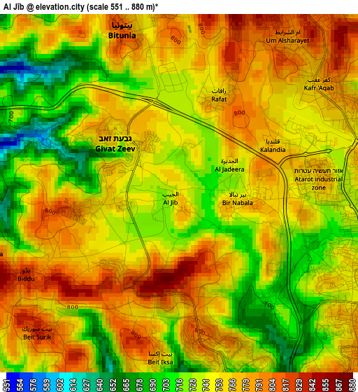
Below is the Elevation map of Al Jīb, which displays elevation range with different colors. Scale of the first map is from 551 to 880 m (1808 to 2887 ft) with average elevation of 750.6 meters (=2463 ft) [note 1]
These maps also provides idea of topography and contour of this city, they are displayed at different zoom levels. More info about maps, scale and edge coordinates you can find below images.
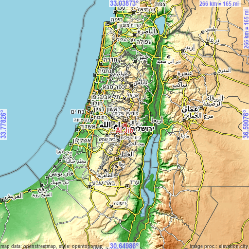
| \ | Map #1 | Map #2 | Topo.Map |
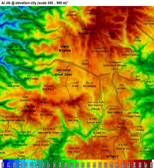
| Scale [m] | 551..880 m | 349..909 m | × |
| Scale [ft] | 1808..2887 ft | 1145..2982 ft | × |
| Average | 750.6 m = 2463 ft | 705.7 m = 2315 ft | × |
| Width | 8.3 km = 5.2 mi | 16.6 km = 10.3 mi | 265.6 km = 165 mi |
| Height | 8.3 km = 5.2 mi | 16.6 km = 10.3 mi | 265.6 km = 165 mi |
| ↑Max Latitude | 31.88935° | 31.926655° | 33.03873° |
| Latitude at center | 31.85203° | 31.85203° | 31.85203° |
| ↓Min Latitude | 31.814695° | 31.777344° | 30.64986° |
| ← Min Longitude | 35.140565° | 35.096619° | 33.77826° |
| Longitude center | 35.18451° | 35.18451° | 35.18451° |
| →Max Longitude | 35.228455° | 35.272401° | 36.59076° |
Nearby cities:
Cities around Al Jīb sort by population:
• Kalandia elevation 751 m
3.4 km,  61°
61°
• Ar Rām wa Ḑāḩiyat al Barīd 750 m
4.7 km,  93°
93°
• Givat Zeev 754 m
1.8 km,  304°
304°
• Biddū 812 m
3.8 km,  239°
239°
• Bīr Nabālā 759 m
1.8 km, 94°
• Bayt Sūrīk 833 m
4.5 km,  227°
227°
• Rāfāt 774 m
2.2 km,  18°
18°
• Al Judayrah 731 m
1.3 km,  70°
70°
• Al Qubaybah 786 m
4.7 km,  252°
252°
• Bayt Iksā 775 m
3.9 km,  187°
187°
• Bayt Duqqū 651 m
5.1 km,  278°
278°
• Qalandiyā 765 m
2.5 km, 61°
Multilingual:
 En español:
Al Jīb elevación 749 m.
 En France:
Al Jīb élévation 749 m.


Sources and notes:
- [note 1] Map square and city borders are not equal. Map elevation data is calculated only from area inside that square.
- [src 1] Elevation data from geonames database provided with same terms of usage.
- [src 2] The elevation map of Al Jīb is generated using elevation data from NASA's 3 arcsec (90m) resolution SRTM data.
- [src 3] Base (background) map © OpenStreetMap contributors tiles are generated by Geofabrik and OpenTopoMap.
Copyright & License:
This Al Jīb Elevation Map is licensed under CC BY-SA. You may reuse any part from this page, if you give a proper credit by linking to this URL:
 More info on terms of use page.