Dayr Ballūţ elevation
Dayr Ballūţ (West Bank, Salfit), Palestinian Territory elevation is 284 meters and Dayr Ballūţ elevation in feet is 932 ft above sea level [src 1]. Dayr Ballūţ is a populated place (feature code) with elevation that is 183 meters (600 ft) smaller than average city elevation in Palestinian Territory.
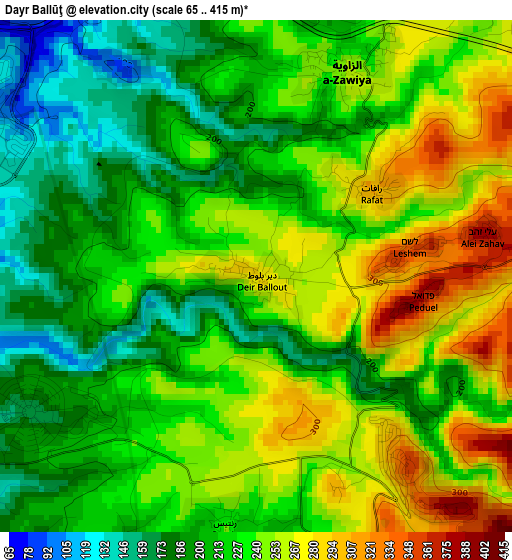
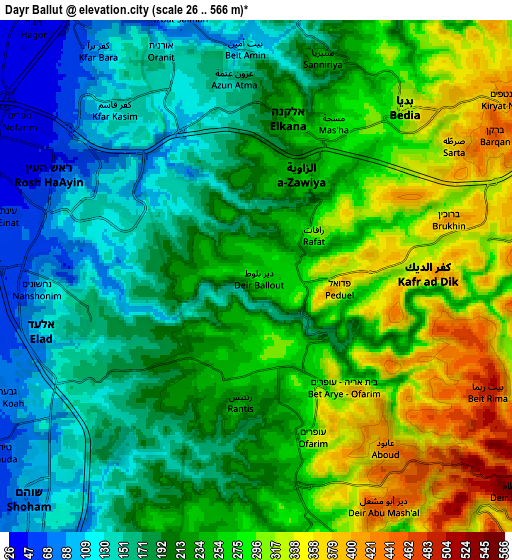
Below is the Elevation map of Dayr Ballūţ, which displays elevation range with different colors. Scale of the first map is from 65 to 415 m (213 to 1362 ft) with average elevation of 228.2 meters (=749 ft) [note 1]
These maps also provides idea of topography and contour of this city, they are displayed at different zoom levels. More info about maps, scale and edge coordinates you can find below images.
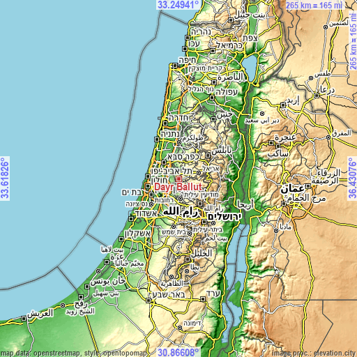
| \ | Map #1 | Map #2 | Topo.Map |
| Scale [m] | 65..415 m | 26..566 m | × |
| Scale [ft] | 213..1362 ft | 85..1857 ft | × |
| Average | 228.2 m = 749 ft | 227.6 m = 747 ft | × |
| Width | 8.28 km = 5.1 mi | 16.56 km = 10.3 mi | 265 km = 164.7 mi |
| Height | 8.28 km = 5.1 mi | 16.56 km = 10.3 mi | 265 km = 164.7 mi |
| ↑Max Latitude | 32.102744° | 32.139962° | 33.24941° |
| Latitude at center | 32.06551° | 32.06551° | 32.06551° |
| ↓Min Latitude | 32.028261° | 31.990998° | 30.86608° |
| ← Min Longitude | 34.980565° | 34.936619° | 33.61826° |
| Longitude center | 35.02451° | 35.02451° | 35.02451° |
| →Max Longitude | 35.068455° | 35.112401° | 36.43076° |
Nearby cities:
Cities around Dayr Ballūţ sort by population:
• Bidyā elevation 344 m
7.6 km,  43°
43°
• Kafr ad Dīk 377 m
5.5 km,  88°
88°
• Az Zāwiyah 250 m
3.7 km,  22°
22°
• Brūqīn 368 m
7.1 km,  84°
84°
• Sannīryā 245 m
7.3 km, 16°
• Rantīs 240 m
4.2 km,  187°
187°
• Şarţah 374 m
7.7 km,  55°
55°
• ‘Ābūd 422 m
6.8 km,  142°
142°
• Masḩah 293 m
5.4 km,  27°
27°
• Rāfāt 306 m
2.3 km,  53°
53°
• Azun Atme 165 m
6.3 km,  356°
356°
• Al Lubban al Gharbī 284 m
3.7 km,  157°
157°
Multilingual:
 En español:
Dayr Ballūţ elevación 284 m.
 En France:
Dayr Ballūţ élévation 284 m.
 Auf Deutsch:
Dayr Ballūţ höhe über dem Meeresspiegel ist 284 m.

Sources and notes:
- [note 1] Map square and city borders are not equal. Map elevation data is calculated only from area inside that square.
- [src 1] Elevation data from geonames database provided with same terms of usage.
- [src 2] The elevation map of Dayr Ballūţ is generated using elevation data from NASA's 3 arcsec (90m) resolution SRTM data.
- [src 3] Base (background) map © OpenStreetMap contributors tiles are generated by Geofabrik and OpenTopoMap.
Copyright & License:
This Dayr Ballūţ Elevation Map is licensed under CC BY-SA. You may reuse any part from this page, if you give a proper credit by linking to this URL:
 More info on terms of use page.