Dhannābah elevation
Dhannābah (West Bank, Tulkarm), Palestinian Territory elevation is 136 meters and Dhannābah elevation in feet is 446 ft above sea level [src 1]. Dhannābah is a populated place (feature code) with elevation that is 331 meters (1086 ft) smaller than average city elevation in Palestinian Territory.
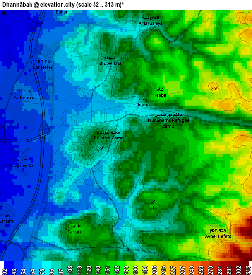
Below is the Elevation map of Dhannābah, which displays elevation range with different colors. Scale of the first map is from 32 to 313 m (105 to 1027 ft) with average elevation of 111.5 meters (=366 ft) [note 1]
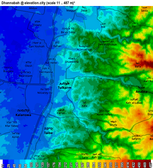
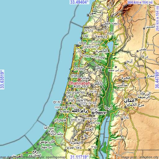
These maps also provides idea of topography and contour of this city, they are displayed at different zoom levels. More info about maps, scale and edge coordinates you can find below images.
| \ | Map #1 | Map #2 | Topo.Map |
| Scale [m] | 32..313 m | 11..487 m | × |
| Scale [ft] | 105..1027 ft | 36..1598 ft | × |
| Average | 111.5 m = 366 ft | 132.7 m = 435 ft | × |
| Width | 8.26 km = 5.1 mi | 16.52 km = 10.3 mi | 264.3 km = 164.2 mi |
| Height | 8.26 km = 5.1 mi | 16.52 km = 10.3 mi | 264.3 km = 164.2 mi |
| ↑Max Latitude | 32.350542° | 32.387659° | 33.49404° |
| Latitude at center | 32.31341° | 32.31341° | 32.31341° |
| ↓Min Latitude | 32.276263° | 32.2391° | 31.11719° |
| ← Min Longitude | 34.997495° | 34.953549° | 33.63519° |
| Longitude center | 35.04144° | 35.04144° | 35.04144° |
| →Max Longitude | 35.085385° | 35.129331° | 36.44769° |
Nearby cities:
Cities around Dhannābah sort by population:
• Ţūlkarm elevation 117 m
1.3 km,  254°
254°
• ‘Attīl 111 m
6.8 km,  24°
24°
• Dayr al Ghuşūn 203 m
5.5 km,  37°
37°
• ‘Anabtā 174 m
7.1 km,  94°
94°
• ‘Illār 226 m
8.8 km, 44°
• Bal‘ā 352 m
7 km,  70°
70°
• Kafr al Labad 296 m
6.6 km,  103°
103°
• Far‘ūn 155 m
3.5 km,  209°
209°
• Zaytā 99 m
8.1 km,  6°
6°
• Shūfah 314 m
5.6 km,  138°
138°
• Iktābah 162 m
1.8 km, 35°
• Kafr Şūr 293 m
8 km,  164°
164°
Multilingual:
 En español:
Dhannābah elevación 136 m.
 En France:
Dhannābah élévation 136 m.
 Auf Deutsch:
Dhannābah höhe über dem Meeresspiegel ist 136 m.

Sources and notes:
- [note 1] Map square and city borders are not equal. Map elevation data is calculated only from area inside that square.
- [src 1] Elevation data from geonames database provided with same terms of usage.
- [src 2] The elevation map of Dhannābah is generated using elevation data from NASA's 3 arcsec (90m) resolution SRTM data.
- [src 3] Base (background) map © OpenStreetMap contributors tiles are generated by Geofabrik and OpenTopoMap.
Copyright & License:
This Dhannābah Elevation Map is licensed under CC BY-SA. You may reuse any part from this page, if you give a proper credit by linking to this URL:
 More info on terms of use page.