Bayt ‘Awwā elevation
Bayt ‘Awwā (West Bank, Al Khalil), Palestinian Territory elevation is 448 meters and Bayt ‘Awwā elevation in feet is 1470 ft above sea level [src 1]. Bayt ‘Awwā is a populated place (feature code) with elevation that is 19 meters (62 ft) smaller than average city elevation in Palestinian Territory.
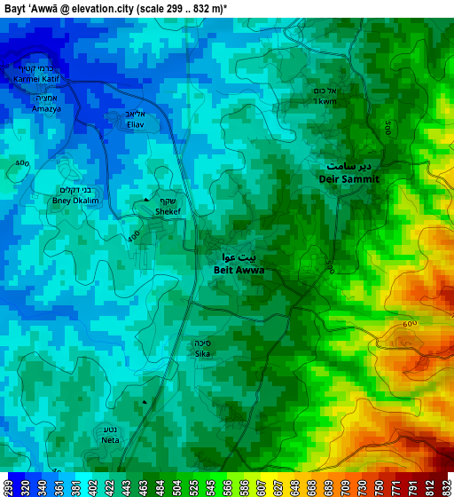
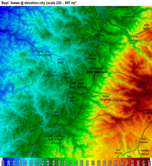
Below is the Elevation map of Bayt ‘Awwā, which displays elevation range with different colors. Scale of the first map is from 299 to 832 m (981 to 2730 ft) with average elevation of 454.2 meters (=1490 ft) [note 1]
These maps also provides idea of topography and contour of this city, they are displayed at different zoom levels. More info about maps, scale and edge coordinates you can find below images.
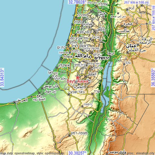
| \ | Map #1 | Map #2 | Topo.Map |
| Scale [m] | 299..832 m | 220..897 m | × |
| Scale [ft] | 981..2730 ft | 722..2943 ft | × |
| Average | 454.2 m = 1490 ft | 493.7 m = 1620 ft | × |
| Width | 8.33 km = 5.2 mi | 16.66 km = 10.4 mi | 266.6 km = 165.7 mi |
| Height | 8.33 km = 5.2 mi | 16.66 km = 10.4 mi | 266.6 km = 165.7 mi |
| ↑Max Latitude | 31.546568° | 31.584012° | 32.70028° |
| Latitude at center | 31.50911° | 31.50911° | 31.50911° |
| ↓Min Latitude | 31.471637° | 31.434148° | 30.30257° |
| ← Min Longitude | 34.905435° | 34.861489° | 33.54313° |
| Longitude center | 34.94938° | 34.94938° | 34.94938° |
| →Max Longitude | 34.993325° | 35.037271° | 36.35563° |
Nearby cities:
Cities around Bayt ‘Awwā sort by population:
• Dūrā elevation 871 m
7.6 km,  91°
91°
• Idhnā 471 m
6 km,  23°
23°
• Tarqūmyā 510 m
9.5 km,  38°
38°
• Dayr Sāmit 445 m
2.7 km,  61°
61°
• Khursā 844 m
7.1 km,  114°
114°
• Bayt Maqdum 456 m
3.6 km, 36°
• al-Kum 432 m
2.7 km, 23°
• Al Burj 516 m
8.7 km,  200°
200°
• Aş Şūrrah 829 m
6.3 km,  132°
132°
• Al Majd 474 m
3.1 km,  177°
177°
• Imrīsh 780 m
7.1 km, 128°
• Dayr al ‘Asal al Fawqā 477 m
4.7 km,  193°
193°
Multilingual:
 En español:
Bayt ‘Awwā elevación 448 m.
 En France:
Bayt ‘Awwā élévation 448 m.
 Auf Deutsch:
Bayt ‘Awwā höhe über dem Meeresspiegel ist 448 m.

Sources and notes:
- [note 1] Map square and city borders are not equal. Map elevation data is calculated only from area inside that square.
- [src 1] Elevation data from geonames database provided with same terms of usage.
- [src 2] The elevation map of Bayt ‘Awwā is generated using elevation data from NASA's 3 arcsec (90m) resolution SRTM data.
- [src 3] Base (background) map © OpenStreetMap contributors tiles are generated by Geofabrik and OpenTopoMap.
Copyright & License:
This Bayt ‘Awwā Elevation Map is licensed under CC BY-SA. You may reuse any part from this page, if you give a proper credit by linking to this URL:
 More info on terms of use page.