Şarrah elevation
Şarrah (West Bank, Nablus), Palestinian Territory elevation is 502 meters and Şarrah elevation in feet is 1647 ft above sea level [src 1]. Şarrah is a populated place (feature code) with elevation that is 35 meters (115 ft) bigger than average city elevation in Palestinian Territory.
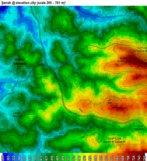
Below is the Elevation map of Şarrah, which displays elevation range with different colors. Scale of the first map is from 285 to 761 m (935 to 2497 ft) with average elevation of 478.2 meters (=1569 ft) [note 1]
These maps also provides idea of topography and contour of this city, they are displayed at different zoom levels. More info about maps, scale and edge coordinates you can find below images.
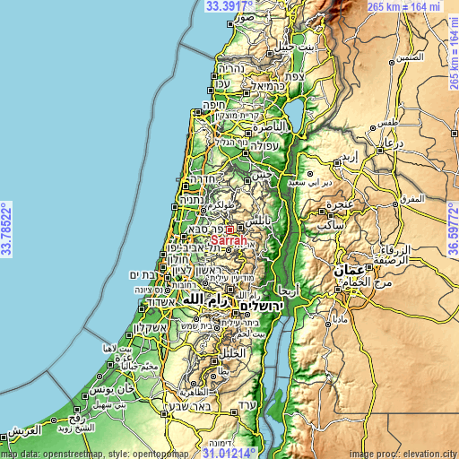
| \ | Map #1 | Topo.Map |
| Scale [m] | 285..761 m | × |
| Scale [ft] | 935..2497 ft | × |
| Average | 478.2 m = 1569 ft | × |
| Width | 8.27 km = 5.1 mi | 264.6 km = 164.4 mi |
| Height | 8.27 km = 5.1 mi | 264.6 km = 164.4 mi |
| ↑Max Latitude | 32.246875° | 33.3917° |
| Latitude at center | 32.2097° | 32.2097° |
| ↓Min Latitude | 32.17251° | 31.01214° |
| ← Min Longitude | 35.147525° | 33.78522° |
| Longitude center | 35.19147° | 35.19147° |
| →Max Longitude | 35.235415° | 36.59772° |
Nearby cities:
Cities around Şarrah sort by population:
• Till elevation 610 m
2.3 km,  116°
116°
• Kafr Qaddūm 389 m
4.6 km,  286°
286°
• Bayt Ībā 363 m
3.5 km,  29°
29°
• Dayr Sharaf 332 m
4.8 km,  357°
357°
• Ḩajjah 409 m
5.7 km,  263°
263°
• Immātīn 424 m
3.7 km,  237°
237°
• ‘Aşīrah al Qiblīyah 579 m
4.2 km,  146°
146°
• Jīt 502 m
2 km,  284°
284°
• Zawātā 467 m
5.2 km,  39°
39°
• Mādamā 509 m
4.6 km,  125°
125°
• Qūşīn 502 m
3.3 km,  345°
345°
• Bayt Wazan 534 m
3.3 km, 43°
Multilingual:
 En español:
Şarrah elevación 502 m.
 En France:
Şarrah élévation 502 m.


Sources and notes:
- [note 1] Map square and city borders are not equal. Map elevation data is calculated only from area inside that square.
- [src 1] Elevation data from geonames database provided with same terms of usage.
- [src 2] The elevation map of Şarrah is generated using elevation data from NASA's 3 arcsec (90m) resolution SRTM data.
- [src 3] Base (background) map © OpenStreetMap contributors tiles are generated by Geofabrik and OpenTopoMap.
Copyright & License:
This Şarrah Elevation Map is licensed under CC BY-SA. You may reuse any part from this page, if you give a proper credit by linking to this URL:
 More info on terms of use page.