Turmus‘ayyā elevation
Turmus‘ayyā (West Bank, Ramallah), Palestinian Territory elevation is 683 meters and Turmus‘ayyā elevation in feet is 2241 ft above sea level [src 1]. Turmus‘ayyā is a populated place (feature code) with elevation that is 216 meters (709 ft) bigger than average city elevation in Palestinian Territory.
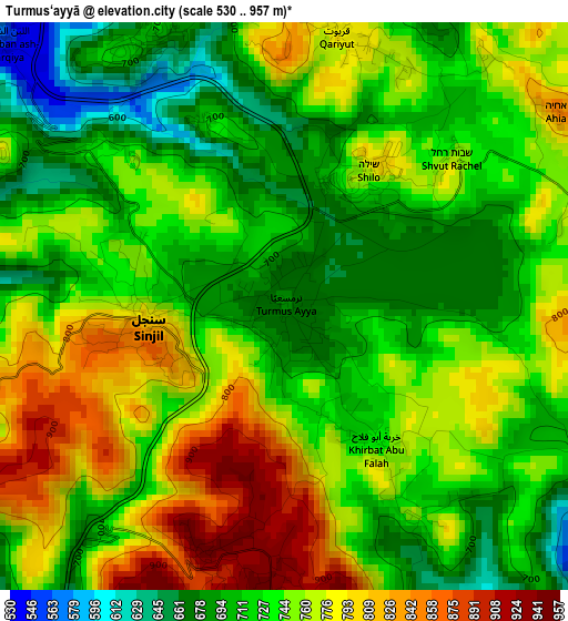
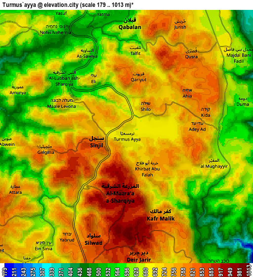
Below is the Elevation map of Turmus‘ayyā, which displays elevation range with different colors. Scale of the first map is from 530 to 957 m (1739 to 3140 ft) with average elevation of 742.3 meters (=2435 ft) [note 1]
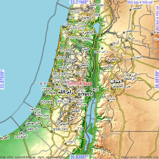
These maps also provides idea of topography and contour of this city, they are displayed at different zoom levels. More info about maps, scale and edge coordinates you can find below images.
| \ | Map #1 | Map #2 | Topo.Map |
| Scale [m] | 530..957 m | 179..1013 m | × |
| Scale [ft] | 1739..3140 ft | 587..3323 ft | × |
| Average | 742.3 m = 2435 ft | 685.5 m = 2249 ft | × |
| Width | 8.28 km = 5.1 mi | 16.57 km = 10.3 mi | 265.1 km = 164.7 mi |
| Height | 8.28 km = 5.1 mi | 16.57 km = 10.3 mi | 265.1 km = 164.7 mi |
| ↑Max Latitude | 32.072626° | 32.109856° | 33.21968° |
| Latitude at center | 32.03538° | 32.03538° | 32.03538° |
| ↓Min Latitude | 31.998119° | 31.960843° | 30.83557° |
| ← Min Longitude | 35.241695° | 35.197749° | 33.87939° |
| Longitude center | 35.28564° | 35.28564° | 35.28564° |
| →Max Longitude | 35.329585° | 35.373531° | 36.69189° |
Nearby cities:
Cities around Turmus‘ayyā sort by population:
• Qabalān elevation 620 m
7.4 km,  2°
2°
• Silwād 844 m
7 km,  199°
199°
• Sinjil 801 m
1.9 km,  263°
263°
• Al Mazra‘ah ash Sharqīyah 938 m
3.9 km,  185°
185°
• Quşrah 753 m
7 km,  36°
36°
• Khirbat Abū Falāḩ 745 m
2.5 km,  144°
144°
• Talfīt 693 m
5.7 km,  5°
5°
• Kafr Mālik 790 m
5.7 km,  156°
156°
• Al Lubban ash Sharqīyah 586 m
5.8 km,  312°
312°
• Qaryūt 791 m
3.9 km, 11°
• Al Mughayyir 673 m
6.1 km,  107°
107°
• As Sāwiyah 643 m
6.1 km,  334°
334°
Multilingual:
 En español:
Turmus‘ayyā elevación 683 m.
 En France:
Turmus‘ayyā élévation 683 m.
 Auf Deutsch:
Turmus‘ayyā höhe über dem Meeresspiegel ist 683 m.

Sources and notes:
- [note 1] Map square and city borders are not equal. Map elevation data is calculated only from area inside that square.
- [src 1] Elevation data from geonames database provided with same terms of usage.
- [src 2] The elevation map of Turmus‘ayyā is generated using elevation data from NASA's 3 arcsec (90m) resolution SRTM data.
- [src 3] Base (background) map © OpenStreetMap contributors tiles are generated by Geofabrik and OpenTopoMap.
Copyright & License:
This Turmus‘ayyā Elevation Map is licensed under CC BY-SA. You may reuse any part from this page, if you give a proper credit by linking to this URL:
 More info on terms of use page.