Gdów elevation
Gdów (Lesser Poland, Powiat wielicki), Poland elevation is 228 meters and Gdów elevation in feet is 748 ft above sea level [src 1]. Gdów is a seat of a third-order administrative division (feature code) with elevation that is 37 meters (121 ft) bigger than average city elevation in Poland.
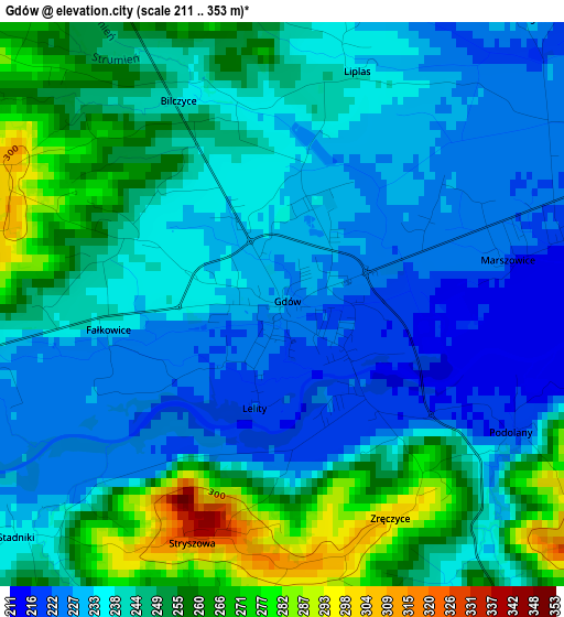
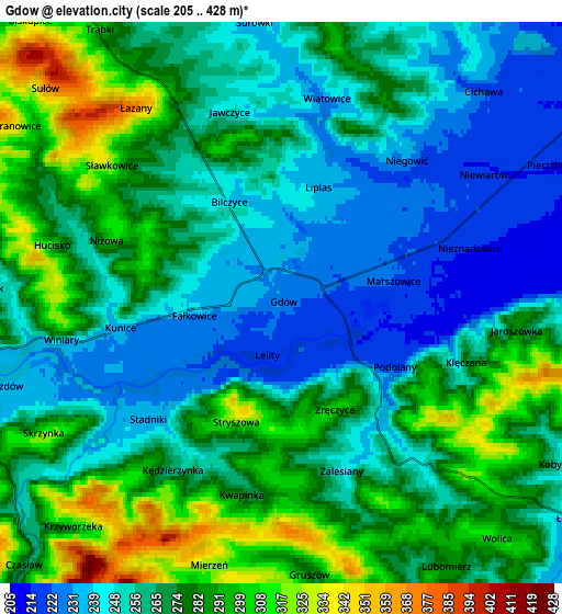
Below is the Elevation map of Gdów, which displays elevation range with different colors. Scale of the first map is from 211 to 353 m (692 to 1158 ft) with average elevation of 242.1 meters (=794 ft) [note 1]
These maps also provides idea of topography and contour of this city, they are displayed at different zoom levels. More info about maps, scale and edge coordinates you can find below images.
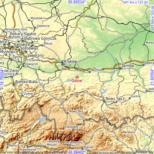
| \ | Map #1 | Map #2 | Topo.Map |
| Scale [m] | 211..353 m | 205..428 m | × |
| Scale [ft] | 692..1158 ft | 673..1404 ft | × |
| Average | 242.1 m = 794 ft | 267.5 m = 878 ft | × |
| Width | 6.29 km = 3.9 mi | 12.59 km = 7.8 mi | 201.4 km = 125.1 mi |
| Height | 6.29 km = 3.9 mi | 12.59 km = 7.8 mi | 201.4 km = 125.1 mi |
| ↑Max Latitude | 49.936473° | 49.96475° | 50.80534° |
| Latitude at center | 49.90818° | 49.90818° | 49.90818° |
| ↓Min Latitude | 49.87987° | 49.851544° | 48.99402° |
| ← Min Longitude | 20.154845° | 20.110899° | 18.79254° |
| Longitude center | 20.19879° | 20.19879° | 20.19879° |
| →Max Longitude | 20.242735° | 20.286681° | 21.60504° |
Nearby cities:
Cities around Gdów sort by population:
• Wieliczka elevation 261 m
13 km,  312°
312°
• Dobczyce 243 m
8.4 km,  248°
248°
• Kłaj 211 m
11.8 km,  37°
37°
• Podłęże 203 m
12 km,  349°
349°
• Targowisko 212 m
10.9 km, 38°
• Węgrzce Wielkie 204 m
13.4 km,  332°
332°
• Szarów 229 m
10.9 km,  27°
27°
• Brzączowice 310 m
12.2 km, 252°
• Pawlikowice 341 m
11.4 km,  295°
295°
• Trąbki 296 m
7.2 km, 326°
• Łapanów 232 m
8.2 km,  125°
125°
• Tomaszkowice 282 m
10.6 km,  318°
318°
Multilingual:
 En español:
Gdów elevación 228 m.
 En France:
Gdów élévation 228 m.


Sources and notes:
- [note 1] Map square and city borders are not equal. Map elevation data is calculated only from area inside that square.
- [src 1] Elevation data from geonames database provided with same terms of usage.
- [src 2] The elevation map of Gdów is generated using elevation data from NASA's 3 arcsec (90m) resolution SRTM data.
- [src 3] Base (background) map © OpenStreetMap contributors tiles are generated by Geofabrik and OpenTopoMap.
Copyright & License:
This Gdów Elevation Map is licensed under CC BY-SA. You may reuse any part from this page, if you give a proper credit by linking to this URL:
 More info on terms of use page.