Józefów elevation
Józefów (Mazovia, Powiat warszawski zachodni), Poland elevation is 87 meters and Józefów elevation in feet is 285 ft above sea level [src 1]. Józefów is a populated place (feature code) with elevation that is 104 meters (341 ft) smaller than average city elevation in Poland.
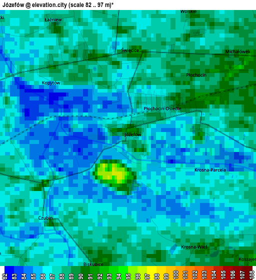
Below is the Elevation map of Józefów, which displays elevation range with different colors. Scale of the first map is from 82 to 97 m (269 to 318 ft) with average elevation of 86.7 meters (=284 ft) [note 1]
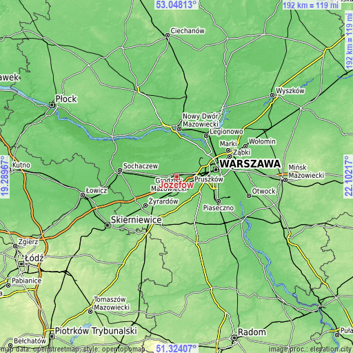
These maps also provides idea of topography and contour of this city, they are displayed at different zoom levels. More info about maps, scale and edge coordinates you can find below images.
| \ | Map #1 | Topo.Map |
| Scale [m] | 82..97 m | × |
| Scale [ft] | 269..318 ft | × |
| Average | 86.7 m = 284 ft | × |
| Width | 5.99 km = 3.7 mi | 191.7 km = 119.1 mi |
| Height | 5.99 km = 3.7 mi | 191.7 km = 119.1 mi |
| ↑Max Latitude | 52.22139° | 53.04813° |
| Latitude at center | 52.19446° | 52.19446° |
| ↓Min Latitude | 52.167514° | 51.32407° |
| ← Min Longitude | 20.651975° | 19.28967° |
| Longitude center | 20.69592° | 20.69592° |
| →Max Longitude | 20.739865° | 22.10217° |
Nearby cities:
Cities around Józefów sort by population:
• Pruszków elevation 92 m
8.4 km,  108°
108°
• Piastów 98 m
9.9 km,  96°
96°
• Milanówek 102 m
8.6 km,  191°
191°
• Brwinów 96 m
5.9 km,  165°
165°
• Błonie 88 m
5.4 km,  274°
274°
• Ożarów Mazowiecki 98 m
7.1 km,  75°
75°
• Komorów 108 m
9.8 km,  123°
123°
• Podkowa Leśna 104 m
8.3 km, 165°
• Otrębusy 99 m
8.6 km,  148°
148°
• Owczarnia 107 m
9.3 km,  176°
176°
• Bieniewice 91 m
9.2 km,  261°
261°
• Granica 100 m
10 km,  132°
132°
Multilingual:
 En español:
Józefów elevación 87 m.
 En France:
Józefów élévation 87 m.


Sources and notes:
- [note 1] Map square and city borders are not equal. Map elevation data is calculated only from area inside that square.
- [src 1] Elevation data from geonames database provided with same terms of usage.
- [src 2] The elevation map of Józefów is generated using elevation data from NASA's 3 arcsec (90m) resolution SRTM data.
- [src 3] Base (background) map © OpenStreetMap contributors tiles are generated by Geofabrik and OpenTopoMap.
Copyright & License:
This Józefów Elevation Map is licensed under CC BY-SA. You may reuse any part from this page, if you give a proper credit by linking to this URL:
 More info on terms of use page.