Piastów elevation
Piastów (Mazovia, Powiat pruszkowski), Poland elevation is 98 meters and Piastów elevation in feet is 322 ft above sea level [src 1]. Piastów is a seat of a third-order administrative division (feature code) with elevation that is 93 meters (305 ft) smaller than average city elevation in Poland.
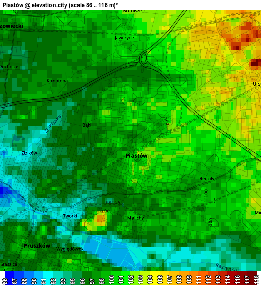
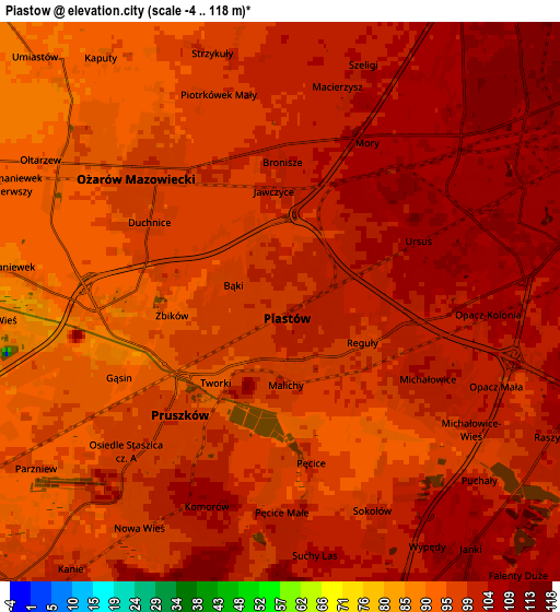
Below is the Elevation map of Piastów, which displays elevation range with different colors. Scale of the first map is from 86 to 118 m (282 to 387 ft) with average elevation of 98.5 meters (=323 ft) [note 1]
These maps also provides idea of topography and contour of this city, they are displayed at different zoom levels. More info about maps, scale and edge coordinates you can find below images.
| \ | Map #1 | Map #2 | Topo.Map |
| Scale [m] | 86..118 m | -4..118 m | × |
| Scale [ft] | 282..387 ft | -13..387 ft | × |
| Average | 98.5 m = 323 ft | 99.2 m = 325 ft | × |
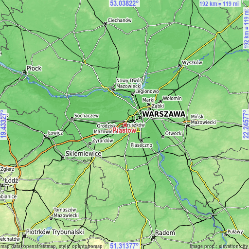
| Width | 5.99 km = 3.7 mi | 11.98 km = 7.4 mi | 191.7 km = 119.1 mi |
| Height | 5.99 km = 3.7 mi | 11.98 km = 7.4 mi | 191.7 km = 119.1 mi |
| ↑Max Latitude | 52.211286° | 52.238205° | 53.03822° |
| Latitude at center | 52.18435° | 52.18435° | 52.18435° |
| ↓Min Latitude | 52.157398° | 52.13043° | 51.31377° |
| ← Min Longitude | 20.795575° | 20.751629° | 19.43327° |
| Longitude center | 20.83952° | 20.83952° | 20.83952° |
| →Max Longitude | 20.883465° | 20.927411° | 22.24577° |
Nearby cities:
Cities around Piastów sort by population:
• Pruszków elevation 92 m
2.4 km,  230°
230°
• Ursus 105 m
3.3 km,  68°
68°
• Włochy 109 m
7.3 km,  94°
94°
• Ożarów Mazowiecki 98 m
4.1 km,  315°
315°
• Raszyn 102 m
6.5 km,  119°
119°
• Komorów 108 m
4.6 km,  200°
200°
• Rybie 103 m
7.5 km, 118°
• Michałowice 102 m
3 km,  111°
111°
• Otrębusy 99 m
8.2 km,  220°
220°
• Stare Babice 97 m
8.5 km,  357°
357°
• Granica 100 m
6.2 km, 203°
• Nowe Grocholice 99 m
5.6 km, 119°
Multilingual:
 En español:
Piastów elevación 98 m.
 En France:
Piastów élévation 98 m.


Sources and notes:
- [note 1] Map square and city borders are not equal. Map elevation data is calculated only from area inside that square.
- [src 1] Elevation data from geonames database provided with same terms of usage.
- [src 2] The elevation map of Piastów is generated using elevation data from NASA's 3 arcsec (90m) resolution SRTM data.
- [src 3] Base (background) map © OpenStreetMap contributors tiles are generated by Geofabrik and OpenTopoMap.
Copyright & License:
This Piastów Elevation Map is licensed under CC BY-SA. You may reuse any part from this page, if you give a proper credit by linking to this URL:
 More info on terms of use page.