Milanówek elevation
Milanówek (Mazovia, Powiat grodziski), Poland elevation is 102 meters and Milanówek elevation in feet is 335 ft above sea level [src 1]. Milanówek is a seat of a third-order administrative division (feature code) with elevation that is 89 meters (292 ft) smaller than average city elevation in Poland.
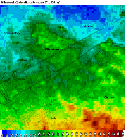
Below is the Elevation map of Milanówek, which displays elevation range with different colors. Scale of the first map is from 87 to 130 m (285 to 427 ft) with average elevation of 102.6 meters (=337 ft) [note 1]
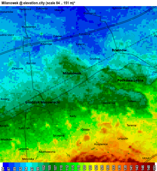
These maps also provides idea of topography and contour of this city, they are displayed at different zoom levels. More info about maps, scale and edge coordinates you can find below images.
| \ | Map #1 | Map #2 | Topo.Map |
| Scale [m] | 87..130 m | 84..151 m | × |
| Scale [ft] | 285..427 ft | 276..495 ft | × |
| Average | 102.6 m = 337 ft | 104.6 m = 343 ft | × |
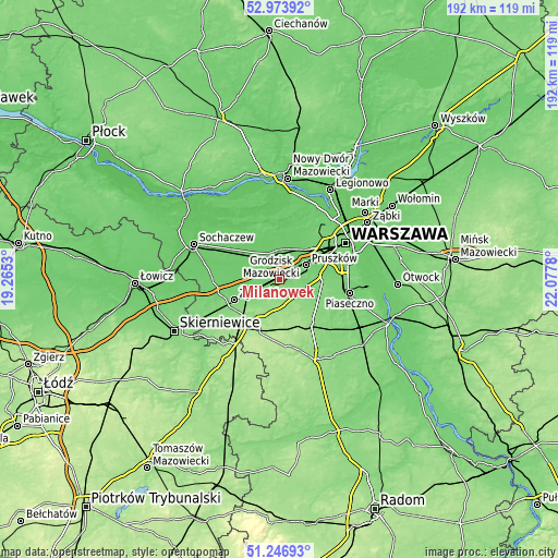
| Width | 6 km = 3.7 mi | 12 km = 7.5 mi | 192 km = 119.3 mi |
| Height | 6 km = 3.7 mi | 12 km = 7.5 mi | 192 km = 119.3 mi |
| ↑Max Latitude | 52.145765° | 52.172724° | 52.97392° |
| Latitude at center | 52.11879° | 52.11879° | 52.11879° |
| ↓Min Latitude | 52.091798° | 52.06479° | 51.24693° |
| ← Min Longitude | 20.627605° | 20.583659° | 19.2653° |
| Longitude center | 20.67155° | 20.67155° | 20.67155° |
| →Max Longitude | 20.715495° | 20.759441° | 22.0778° |
Nearby cities:
Cities around Milanówek sort by population:
• Grodzisk Mazowiecki elevation 103 m
3.1 km,  237°
237°
• Brwinów 96 m
4.1 km,  49°
49°
• Błonie 88 m
9.6 km,  337°
337°
• Nadarzyn 111 m
9.7 km,  106°
106°
• Komorów 108 m
10.3 km,  73°
73°
• Podkowa Leśna 104 m
3.8 km,  83°
83°
• Otrębusy 99 m
6.2 km, 80°
• Józefów 87 m
8.6 km,  11°
11°
• Owczarnia 107 m
2.4 km, 110°
• Żabia Wola 148 m
9.8 km,  172°
172°
• Bieniewice 91 m
10.3 km,  313°
313°
• Granica 100 m
9.1 km, 79°
Multilingual:
 En español:
Milanówek elevación 102 m.
 En France:
Milanówek élévation 102 m.
 Auf Deutsch:
Milanówek höhe über dem Meeresspiegel ist 102 m.

Sources and notes:
- [note 1] Map square and city borders are not equal. Map elevation data is calculated only from area inside that square.
- [src 1] Elevation data from geonames database provided with same terms of usage.
- [src 2] The elevation map of Milanówek is generated using elevation data from NASA's 3 arcsec (90m) resolution SRTM data.
- [src 3] Base (background) map © OpenStreetMap contributors tiles are generated by Geofabrik and OpenTopoMap.
Copyright & License:
This Milanówek Elevation Map is licensed under CC BY-SA. You may reuse any part from this page, if you give a proper credit by linking to this URL:
 More info on terms of use page.