Łączna elevation
Łączna (Świętokrzyskie, Powiat skarżyski), Poland elevation is 295 meters and Łączna elevation in feet is 968 ft above sea level [src 1]. Łączna is a seat of a third-order administrative division (feature code) with elevation that is 104 meters (341 ft) bigger than average city elevation in Poland.
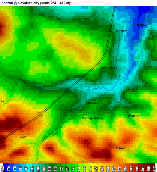
Below is the Elevation map of Łączna, which displays elevation range with different colors. Scale of the first map is from 264 to 412 m (866 to 1352 ft) with average elevation of 333.4 meters (=1094 ft) [note 1]
These maps also provides idea of topography and contour of this city, they are displayed at different zoom levels. More info about maps, scale and edge coordinates you can find below images.
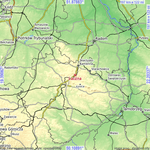
| \ | Map #1 | Topo.Map |
| Scale [m] | 264..412 m | × |
| Scale [ft] | 866..1352 ft | × |
| Average | 333.4 m = 1094 ft | × |
| Width | 6.15 km = 3.8 mi | 196.8 km = 122.3 mi |
| Height | 6.15 km = 3.8 mi | 196.8 km = 122.3 mi |
| ↑Max Latitude | 51.029956° | 51.87883° |
| Latitude at center | 51.00231° | 51.00231° |
| ↓Min Latitude | 50.974647° | 50.10891° |
| ← Min Longitude | 20.753175° | 19.39087° |
| Longitude center | 20.79712° | 20.79712° |
| →Max Longitude | 20.841065° | 22.20337° |
Nearby cities:
Cities around Łączna sort by population:
• Skarżysko-Kamienna elevation 238 m
13.4 km,  22°
22°
• Suchedniów 265 m
5.5 km, 23°
• Wąchock 215 m
17 km,  62°
62°
• Skarżysko Kościelne 234 m
17.1 km,  27°
27°
• Bodzentyn 287 m
13.1 km,  121°
121°
• Bliżyn 265 m
12 km,  347°
347°
• Zagnańsk 319 m
9.7 km,  255°
255°
• Kostomłoty Pierwsze 273 m
16.7 km,  238°
238°
• Masłów 295 m
12.4 km,  204°
204°
• Wielka Wieś 286 m
14.1 km, 57°
• Kaniów 314 m
9.5 km, 258°
• Domaszowice 285 m
16.3 km,  209°
209°
Multilingual:
 En español:
Łączna elevación 295 m.
 En France:
Łączna élévation 295 m.


Sources and notes:
- [note 1] Map square and city borders are not equal. Map elevation data is calculated only from area inside that square.
- [src 1] Elevation data from geonames database provided with same terms of usage.
- [src 2] The elevation map of Łączna is generated using elevation data from NASA's 3 arcsec (90m) resolution SRTM data.
- [src 3] Base (background) map © OpenStreetMap contributors tiles are generated by Geofabrik and OpenTopoMap.
Copyright & License:
This Łączna Elevation Map is licensed under CC BY-SA. You may reuse any part from this page, if you give a proper credit by linking to this URL:
 More info on terms of use page.