Pilawa elevation
Pilawa (Mazovia, Powiat garwoliński), Poland elevation is 148 meters and Pilawa elevation in feet is 486 ft above sea level [src 1]. Pilawa is a seat of a third-order administrative division (feature code) with elevation that is 43 meters (141 ft) smaller than average city elevation in Poland.
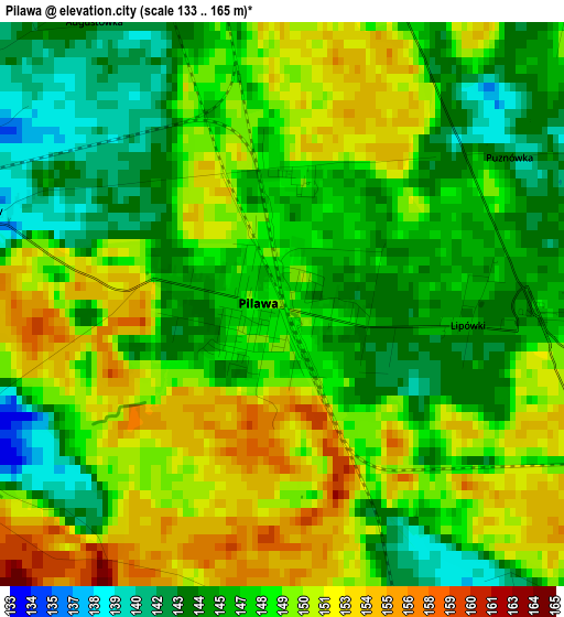
Below is the Elevation map of Pilawa, which displays elevation range with different colors. Scale of the first map is from 133 to 165 m (436 to 541 ft) with average elevation of 148 meters (=486 ft) [note 1]
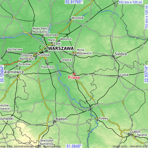
These maps also provides idea of topography and contour of this city, they are displayed at different zoom levels. More info about maps, scale and edge coordinates you can find below images.
| \ | Map #1 | Map #2 | Topo.Map |
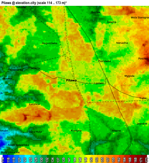
| Scale [m] | 133..165 m | 114..173 m | × |
| Scale [ft] | 436..541 ft | 374..568 ft | × |
| Average | 148 m = 486 ft | 145 m = 476 ft | × |
| Width | 6.02 km = 3.7 mi | 12.04 km = 7.5 mi | 192.7 km = 119.7 mi |
| Height | 6.02 km = 3.7 mi | 12.04 km = 7.5 mi | 192.7 km = 119.7 mi |
| ↑Max Latitude | 51.986522° | 52.013577° | 52.81765° |
| Latitude at center | 51.95945° | 51.95945° | 51.95945° |
| ↓Min Latitude | 51.932362° | 51.905257° | 51.0845° |
| ← Min Longitude | 21.486945° | 21.442999° | 20.12464° |
| Longitude center | 21.53089° | 21.53089° | 21.53089° |
| →Max Longitude | 21.574835° | 21.618781° | 22.93714° |
Nearby cities:
Cities around Pilawa sort by population:
• Garwolin elevation 130 m
9 km,  140°
140°
• Celestynów 135 m
14.8 km,  319°
319°
• Kołbiel 115 m
12.1 km,  343°
343°
• Siennica 144 m
15.9 km,  22°
22°
• Trąbki 149 m
4.9 km,  105°
105°
• Miętne 137 m
5.2 km, 144°
• Wola Rębkowska 128 m
6.7 km,  163°
163°
• Parysów 144 m
10.4 km,  79°
79°
• Sulbiny Górne 142 m
11.8 km, 144°
• Wilga 98 m
15.9 km,  221°
221°
• Osieck 112 m
7.7 km,  275°
275°
• Sobienie Jeziory 97 m
15.9 km,  259°
259°
Multilingual:
 En español:
Pilawa elevación 148 m.
 En France:
Pilawa élévation 148 m.


Sources and notes:
- [note 1] Map square and city borders are not equal. Map elevation data is calculated only from area inside that square.
- [src 1] Elevation data from geonames database provided with same terms of usage.
- [src 2] The elevation map of Pilawa is generated using elevation data from NASA's 3 arcsec (90m) resolution SRTM data.
- [src 3] Base (background) map © OpenStreetMap contributors tiles are generated by Geofabrik and OpenTopoMap.
Copyright & License:
This Pilawa Elevation Map is licensed under CC BY-SA. You may reuse any part from this page, if you give a proper credit by linking to this URL:
 More info on terms of use page.