Garwolin elevation
Garwolin (Mazovia, Powiat garwoliński), Poland elevation is 130 meters and Garwolin elevation in feet is 427 ft above sea level [src 1]. Garwolin is a seat of a second-order administrative division (feature code) with elevation that is 61 meters (200 ft) smaller than average city elevation in Poland.
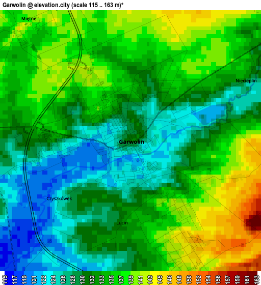
Below is the Elevation map of Garwolin, which displays elevation range with different colors. Scale of the first map is from 115 to 163 m (377 to 535 ft) with average elevation of 133.1 meters (=437 ft) [note 1]
These maps also provides idea of topography and contour of this city, they are displayed at different zoom levels. More info about maps, scale and edge coordinates you can find below images.
| \ | Map #1 | Map #2 | Topo.Map |
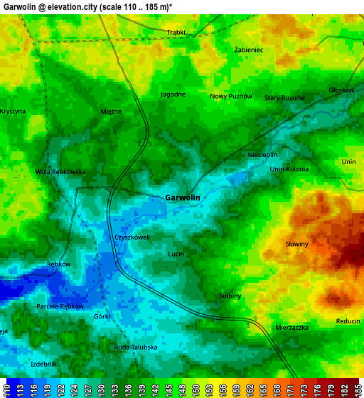
| Scale [m] | 115..163 m | 110..185 m | × |
| Scale [ft] | 377..535 ft | 361..607 ft | × |
| Average | 133.1 m = 437 ft | 140 m = 459 ft | × |
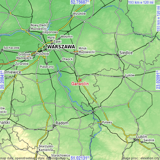
| Width | 6.03 km = 3.7 mi | 12.06 km = 7.5 mi | 193 km = 119.9 mi |
| Height | 6.03 km = 3.7 mi | 12.06 km = 7.5 mi | 193 km = 119.9 mi |
| ↑Max Latitude | 51.924579° | 51.951672° | 52.75687° |
| Latitude at center | 51.89747° | 51.89747° | 51.89747° |
| ↓Min Latitude | 51.870344° | 51.843203° | 51.02131° |
| ← Min Longitude | 21.570715° | 21.526769° | 20.20841° |
| Longitude center | 21.61466° | 21.61466° | 21.61466° |
| →Max Longitude | 21.658605° | 21.702551° | 23.02091° |
Nearby cities:
Cities around Garwolin sort by population:
• Łaskarzew elevation 131 m
12.1 km,  187°
187°
• Pilawa 148 m
9 km,  320°
320°
• Trąbki 149 m
5.7 km,  349°
349°
• Miętne 137 m
3.8 km,  313°
313°
• Wola Rębkowska 128 m
3.9 km,  277°
277°
• Parysów 144 m
9.8 km,  27°
27°
• Sulbiny Górne 142 m
2.9 km,  156°
156°
• Wilga 98 m
17 km,  252°
252°
• Osieck 112 m
15.4 km,  299°
299°
• Górzno 153 m
8.6 km,  130°
130°
• Miastków Kościelny 160 m
14.5 km,  95°
95°
• Borowie 152 m
11.8 km,  61°
61°
Multilingual:
 En español:
Garwolin elevación 130 m.
 En France:
Garwolin élévation 130 m.
 Auf Deutsch:
Garwolin höhe über dem Meeresspiegel ist 130 m.

Sources and notes:
- [note 1] Map square and city borders are not equal. Map elevation data is calculated only from area inside that square.
- [src 1] Elevation data from geonames database provided with same terms of usage.
- [src 2] The elevation map of Garwolin is generated using elevation data from NASA's 3 arcsec (90m) resolution SRTM data.
- [src 3] Base (background) map © OpenStreetMap contributors tiles are generated by Geofabrik and OpenTopoMap.
Copyright & License:
This Garwolin Elevation Map is licensed under CC BY-SA. You may reuse any part from this page, if you give a proper credit by linking to this URL:
 More info on terms of use page.