Pokrzywnica elevation
Pokrzywnica (Mazovia, Powiat pułtuski), Poland elevation is 107 meters and Pokrzywnica elevation in feet is 351 ft above sea level [src 1]. Pokrzywnica is a seat of a third-order administrative division (feature code) with elevation that is 84 meters (276 ft) smaller than average city elevation in Poland.
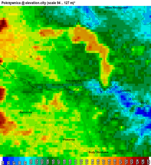
Below is the Elevation map of Pokrzywnica, which displays elevation range with different colors. Scale of the first map is from 94 to 127 m (308 to 417 ft) with average elevation of 107.8 meters (=354 ft) [note 1]
These maps also provides idea of topography and contour of this city, they are displayed at different zoom levels. More info about maps, scale and edge coordinates you can find below images.
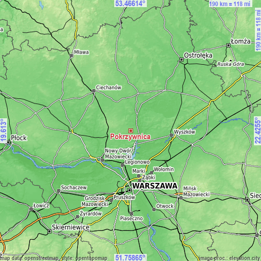
| \ | Map #1 | Topo.Map |
| Scale [m] | 94..127 m | × |
| Scale [ft] | 308..417 ft | × |
| Average | 107.8 m = 354 ft | × |
| Width | 5.93 km = 3.7 mi | 189.9 km = 118 mi |
| Height | 5.93 km = 3.7 mi | 189.8 km = 117.9 mi |
| ↑Max Latitude | 52.647391° | 53.46614° |
| Latitude at center | 52.62072° | 52.62072° |
| ↓Min Latitude | 52.594033° | 51.75865° |
| ← Min Longitude | 20.975305° | 19.613° |
| Longitude center | 21.01925° | 21.01925° |
| →Max Longitude | 21.063195° | 22.4255° |
Nearby cities:
Cities around Pokrzywnica sort by population:
• Pułtusk elevation 95 m
10.1 km,  25°
25°
• Nasielsk 108 m
14.9 km,  256°
256°
• Serock 112 m
12.7 km,  164°
164°
• Wieliszew 75 m
19.2 km,  190°
190°
• Nieporęt 76 m
21.1 km,  177°
177°
• Łajski 76 m
21.9 km, 192°
• Białobrzegi 84 m
20 km,  173°
173°
• Zatory 96 m
11.3 km,  102°
102°
• Obryte 109 m
18.8 km,  55°
55°
• Świercze 152 m
18.1 km,  287°
287°
• Winnica 121 m
5.8 km,  295°
295°
• Gzy 106 m
14.3 km,  339°
339°
Multilingual:
 En español:
Pokrzywnica elevación 107 m.
 En France:
Pokrzywnica élévation 107 m.
 Auf Deutsch:
Pokrzywnica höhe über dem Meeresspiegel ist 107 m.

Sources and notes:
- [note 1] Map square and city borders are not equal. Map elevation data is calculated only from area inside that square.
- [src 1] Elevation data from geonames database provided with same terms of usage.
- [src 2] The elevation map of Pokrzywnica is generated using elevation data from NASA's 3 arcsec (90m) resolution SRTM data.
- [src 3] Base (background) map © OpenStreetMap contributors tiles are generated by Geofabrik and OpenTopoMap.
Copyright & License:
This Pokrzywnica Elevation Map is licensed under CC BY-SA. You may reuse any part from this page, if you give a proper credit by linking to this URL:
 More info on terms of use page.