Potok Wielki elevation
Potok Wielki (Lublin, Powiat janowski), Poland elevation is 207 meters and Potok Wielki elevation in feet is 679 ft above sea level [src 1]. Potok Wielki is a seat of a third-order administrative division (feature code) with elevation that is 16 meters (52 ft) bigger than average city elevation in Poland.
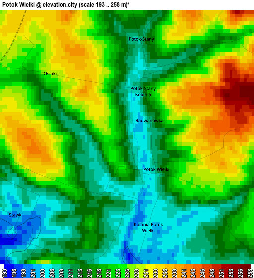
Below is the Elevation map of Potok Wielki, which displays elevation range with different colors. Scale of the first map is from 193 to 258 m (633 to 846 ft) with average elevation of 220.1 meters (=722 ft) [note 1]
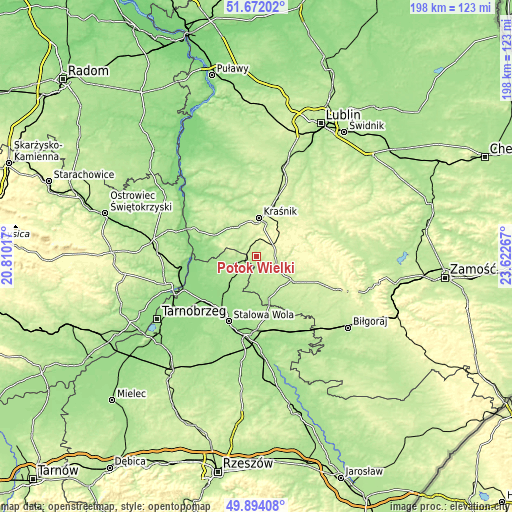
These maps also provides idea of topography and contour of this city, they are displayed at different zoom levels. More info about maps, scale and edge coordinates you can find below images.
| \ | Map #1 | Topo.Map |
| Scale [m] | 193..258 m | × |
| Scale [ft] | 633..846 ft | × |
| Average | 220.1 m = 722 ft | × |
| Width | 6.18 km = 3.8 mi | 197.7 km = 122.8 mi |
| Height | 6.18 km = 3.8 mi | 197.7 km = 122.8 mi |
| ↑Max Latitude | 50.819272° | 51.67202° |
| Latitude at center | 50.7915° | 50.7915° |
| ↓Min Latitude | 50.763712° | 49.89408° |
| ← Min Longitude | 22.172475° | 20.81017° |
| Longitude center | 22.21642° | 22.21642° |
| →Max Longitude | 22.260365° | 23.62267° |
Nearby cities:
Cities around Potok Wielki sort by population:
• Kraśnik elevation 199 m
14.7 km,  2°
2°
• Janów Lubelski 215 m
16.6 km,  124°
124°
• Zaklików 180 m
8.9 km,  244°
244°
• Godziszów 260 m
20.4 km,  103°
103°
• Modliborzyce 214 m
9 km, 117°
• Sułów 235 m
16.3 km,  38°
38°
• Godziszów Pierwszy 261 m
19.2 km, 101°
• Zdziechowice Drugie 187 m
7.5 km,  264°
264°
• Szastarka 278 m
10.1 km,  45°
45°
• Batorz 247 m
20.5 km,  71°
71°
• Gościeradów 174 m
17.1 km,  300°
300°
• Trzydnik Duży 210 m
8.6 km,  317°
317°
Multilingual:
 En español:
Potok Wielki elevación 207 m.
 En France:
Potok Wielki élévation 207 m.
 Auf Deutsch:
Potok Wielki höhe über dem Meeresspiegel ist 207 m.

Sources and notes:
- [note 1] Map square and city borders are not equal. Map elevation data is calculated only from area inside that square.
- [src 1] Elevation data from geonames database provided with same terms of usage.
- [src 2] The elevation map of Potok Wielki is generated using elevation data from NASA's 3 arcsec (90m) resolution SRTM data.
- [src 3] Base (background) map © OpenStreetMap contributors tiles are generated by Geofabrik and OpenTopoMap.
Copyright & License:
This Potok Wielki Elevation Map is licensed under CC BY-SA. You may reuse any part from this page, if you give a proper credit by linking to this URL:
 More info on terms of use page.