Sułów elevation
Sułów (Lublin, Powiat kraśnicki), Poland elevation is 235 meters and Sułów elevation in feet is 771 ft above sea level [src 1]. Sułów is a populated place (feature code) with elevation that is 44 meters (144 ft) bigger than average city elevation in Poland.
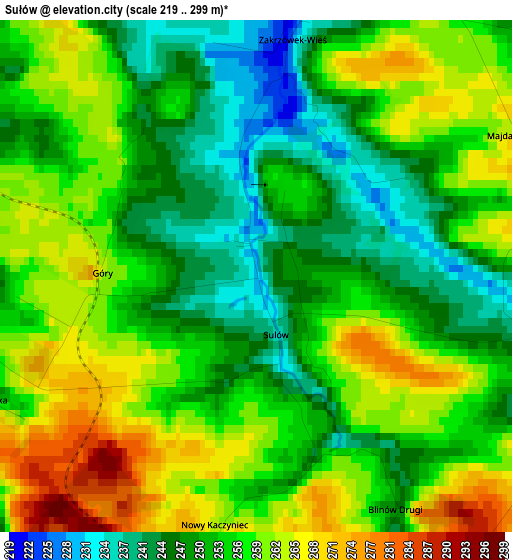
Below is the Elevation map of Sułów, which displays elevation range with different colors. Scale of the first map is from 219 to 299 m (719 to 981 ft) with average elevation of 254.7 meters (=836 ft) [note 1]
These maps also provides idea of topography and contour of this city, they are displayed at different zoom levels. More info about maps, scale and edge coordinates you can find below images.
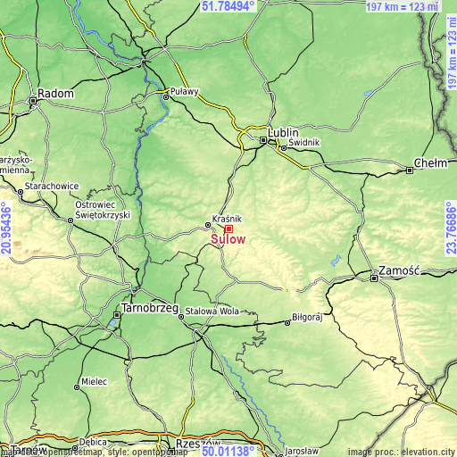
| \ | Map #1 | Topo.Map |
| Scale [m] | 219..299 m | × |
| Scale [ft] | 719..981 ft | × |
| Average | 254.7 m = 836 ft | × |
| Width | 6.16 km = 3.8 mi | 197.2 km = 122.5 mi |
| Height | 6.16 km = 3.8 mi | 197.2 km = 122.5 mi |
| ↑Max Latitude | 50.934313° | 51.78494° |
| Latitude at center | 50.90661° | 50.90661° |
| ↓Min Latitude | 50.87889° | 50.01138° |
| ← Min Longitude | 22.316665° | 20.95436° |
| Longitude center | 22.36061° | 22.36061° |
| →Max Longitude | 22.404555° | 23.76686° |
Nearby cities:
Cities around Sułów sort by population:
• Kraśnik elevation 199 m
9.6 km,  281°
281°
• Bychawa 215 m
17.1 km,  44°
44°
• Wilkołaz 225 m
12 km,  356°
356°
• Modliborzyce 214 m
17.1 km,  187°
187°
• Zakrzówek 214 m
5.2 km,  16°
16°
• Szastarka 278 m
6.4 km,  206°
206°
• Batorz 247 m
11.2 km,  123°
123°
• Urzędów 184 m
18.1 km,  302°
302°
• Strzyżowice 199 m
16.7 km, 19°
• Zakrzew 219 m
16.3 km,  96°
96°
• Potok Wielki 207 m
16.3 km,  218°
218°
• Trzydnik Duży 210 m
17.2 km,  248°
248°
Multilingual:
 En español:
Sułów elevación 235 m.
 En France:
Sułów élévation 235 m.


Sources and notes:
- [note 1] Map square and city borders are not equal. Map elevation data is calculated only from area inside that square.
- [src 1] Elevation data from geonames database provided with same terms of usage.
- [src 2] The elevation map of Sułów is generated using elevation data from NASA's 3 arcsec (90m) resolution SRTM data.
- [src 3] Base (background) map © OpenStreetMap contributors tiles are generated by Geofabrik and OpenTopoMap.
Copyright & License:
This Sułów Elevation Map is licensed under CC BY-SA. You may reuse any part from this page, if you give a proper credit by linking to this URL:
 More info on terms of use page.