Żelechów elevation
Żelechów (Mazovia, Powiat garwoliński), Poland elevation is 171 meters and Żelechów elevation in feet is 561 ft above sea level [src 1]. Żelechów is a seat of a third-order administrative division (feature code) with elevation that is 20 meters (66 ft) smaller than average city elevation in Poland.
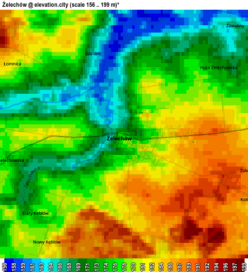
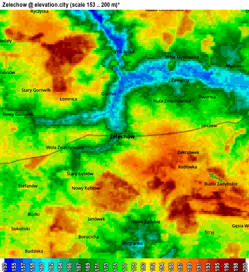
Below is the Elevation map of Żelechów, which displays elevation range with different colors. Scale of the first map is from 156 to 199 m (512 to 653 ft) with average elevation of 177.4 meters (=582 ft) [note 1]
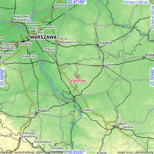
These maps also provides idea of topography and contour of this city, they are displayed at different zoom levels. More info about maps, scale and edge coordinates you can find below images.
| \ | Map #1 | Map #2 | Topo.Map |
| Scale [m] | 156..199 m | 153..200 m | × |
| Scale [ft] | 512..653 ft | 502..656 ft | × |
| Average | 177.4 m = 582 ft | 177.9 m = 584 ft | × |
| Width | 6.04 km = 3.8 mi | 12.08 km = 7.5 mi | 193.3 km = 120.1 mi |
| Height | 6.04 km = 3.8 mi | 12.08 km = 7.5 mi | 193.3 km = 120.1 mi |
| ↑Max Latitude | 51.837672° | 51.864817° | 52.67158° |
| Latitude at center | 51.81051° | 51.81051° | 51.81051° |
| ↓Min Latitude | 51.783332° | 51.756138° | 50.93267° |
| ← Min Longitude | 21.853265° | 21.809319° | 20.49096° |
| Longitude center | 21.89721° | 21.89721° | 21.89721° |
| →Max Longitude | 21.941155° | 21.985101° | 23.30346° |
Nearby cities:
Cities around Żelechów sort by population:
• Ryki elevation 149 m
20.7 km,  173°
173°
• Łaskarzew 131 m
21.2 km,  263°
263°
• Stoczek Łukowski 162 m
17.5 km,  16°
16°
• Sobolew 159 m
18.1 km,  242°
242°
• Krzywda 167 m
20.9 km,  94°
94°
• Podebłocie 148 m
21.7 km,  209°
209°
• Sulbiny Górne 142 m
19.5 km,  290°
290°
• Kłoczew 157 m
11 km,  154°
154°
• Trojanów 143 m
14.4 km,  204°
204°
• Górzno 153 m
13.5 km, 287°
• Miastków Kościelny 160 m
9.6 km,  328°
328°
• Borowie 152 m
17.9 km, 329°
Multilingual:
 En español:
Żelechów elevación 171 m.
 En France:
Żelechów élévation 171 m.
 Auf Deutsch:
Żelechów höhe über dem Meeresspiegel ist 171 m.

Sources and notes:
- [note 1] Map square and city borders are not equal. Map elevation data is calculated only from area inside that square.
- [src 1] Elevation data from geonames database provided with same terms of usage.
- [src 2] The elevation map of Żelechów is generated using elevation data from NASA's 3 arcsec (90m) resolution SRTM data.
- [src 3] Base (background) map © OpenStreetMap contributors tiles are generated by Geofabrik and OpenTopoMap.
Copyright & License:
This Żelechów Elevation Map is licensed under CC BY-SA. You may reuse any part from this page, if you give a proper credit by linking to this URL:
 More info on terms of use page.